Hollfeld

Last updated
Hollfeld
Ansicht von Hollfeld.JPG
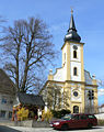
Panorama of the Old Town of Hollfeld
Wappen von Hollfeld.svg
Coat of arms
Location of Hollfeld within Bayreuth district
Hollfeld in BT.svg
Germany adm location map.svg
Red pog.svg
Hollfeld
Bavaria location map.svg
Red pog.svg
Hollfeld
Coordinates: 49°56′N11°18′E / 49.933°N 11.300°E / 49.933; 11.300 Coordinates: 49°56′N11°18′E / 49.933°N 11.300°E / 49.933; 11.300
Country Germany
State Bavaria
Admin. region Oberfranken
District Bayreuth
Government
   Mayor Hartmut Stern (Bürgerforum)
Area
  Total81 km2 (31 sq mi)
Elevation
403 m (1,322 ft)
Population
 (2019-12-31) [1]
  Total5,050
  Density62/km2 (160/sq mi)
Time zone CET/CEST (UTC+1/+2)
Postal codes
96142
Dialling codes 09274
Vehicle registration BT
Website www.hollfeld.de

Hollfeld is a town in the district of Bayreuth, in Bavaria, Germany.

Contents

It is situated 20 km west of Bayreuth, and 30 km east of Bamberg.

Sport

The towns association football club, ASV Hollfeld, experienced its greatest success in 2012 when it qualified for the new northern division of the expanded Bayernliga, the fifth tier of the German football league system, where it played for two seasons until 2014.

Villages

Drosendorf in Hollfeld.png Fernreuth in Hollfeld.png Freienfels in Hollfeld.png Gottelhof in Hollfeld.png Hainbach in Hollfeld.png Hoefen in Hollfeld.png Hollfeld in Hollfeld.png
DrosendorfFernreuthFreienfelsGottelhofHainbachHöfenHollfeld
Kainach in Hollfeld.png Kroegelstein in Hollfeld.png Loch in Hollfeld.png Moggendorf in Hollfeld.png Neidenstein in Hollfeld.png Pilgerndorf in Hollfeld.png Schoenfeld in Hollfeld.png
KainachKrögelsteinLochMoggendorfNeidensteinPilgerndorfSchönfeld
Stechendorf in Hollfeld.png Tiefenlesau in Hollfeld.png Treppendorf in Hollfeld.png Weiher in Hollfeld.png Welkendorf in Hollfeld.png Wiesentfels in Hollfeld.png Wohnsdorf in Hollfeld.png
StechendorfTiefenlesauTreppendorfWeiherWelkendorfWiesentfelsWohnsdorf

Related Research Articles

Bayreuth Town in Bavaria, Germany

Bayreuth is a medium-sized town in northern Bavaria, Germany, on the Red Main river in a valley between the Franconian Jura and the Fichtelgebirge Mountains. The town's roots date back to 1194. In the 21st century, it is the capital of Upper Franconia and has a population of 72,148 (2015). It is world-famous for its annual Bayreuth Festival, at which performances of operas by the 19th-century German composer Richard Wagner are presented.

Bayreuth is a Landkreis (district) in Bavaria, Germany. It surrounds, but does not include the city of Bayreuth. The district is bounded by the districts of Kulmbach, Hof, Wunsiedel, Tirschenreuth, Neustadt an der Waldnaab, Amberg-Sulzbach, Nürnberger Land, Forchheim and Bamberg.

Pegnitz (town) Place in Bavaria, Germany

Pegnitz is a town in the Bayreuth district in Upper Franconia, Bavaria, Germany, with a population of approximately 15,000 inhabitants. It is also the source of the river Pegnitz. The city Bayreuth is about 27 km to the north.

Waldsassen Place in Bavaria, Germany

Waldsassen is a town in the district of Tirschenreuth in the Upper Palatinate region of Bavaria.

Marktredwitz Place in Bavaria, Germany

Marktredwitz is a town in the district of Wunsiedel, in Bavaria, Germany, close to the Czech border. It is situated 22 km west of Cheb, 50 km east of Bayreuth and 50 km south of Hof/Saale.

Bad Berneck im Fichtelgebirge Place in Bavaria, Germany

Bad Berneck is a spa town in the district of Bayreuth, in Bavaria, Germany. It is situated on the White Main river, in the Fichtelgebirge mountains, 13 km northeast of Bayreuth. Its official title is Bad Berneck im Fichtelgebirge. It lies in the northern part of the Bavarian province of Upper Franconia. Since 1857 it has been a spa, initially based on its climate and whey products. In 1930 it became a Kneipp spa and, in 1950, a Kneipp health spa.

Betzenstein Place in Bavaria, Germany

Betzenstein is a town in the district of Bayreuth, in Bavaria, Germany. It is situated in the Franconian Switzerland, 35 km northeast of Nuremberg.

Creußen Place in Bavaria, Germany

Creußen is a town in the district of Bayreuth in Bavaria, Germany. It is situated on the Red Main river, 13 km southeast of Bayreuth.

Eschenbach in der Oberpfalz Place in Bavaria, Germany

Eschenbach in der Oberpfalz is a town in the district of Neustadt an der Waldnaab, in Bavaria, Germany. It is situated 25 km west of Neustadt an der Waldnaab, 30 km west of Weiden in der Oberpfalz, and 28 km southeast of Bayreuth. It is also about 1 km north of the large US military base in Grafenwöhr. The cathedral is the most popular site, the carving dedicated to the daughter-in-law of Charles XI of Sweden, Anna Svetl, who drowned in the Rhine in 1752, the carving reading, "Here Lies our Mother: Anna Svetl who died in the waters of the Rhine in the year seventeen hundred and fifty two. Even when the Death angel came for her, she said her final words, "A man shall perish but his memories shant for the rest of the Earth" Bless Her."

Gefrees Place in Bavaria, Germany

Gefrees is a town in the district of Bayreuth, in Bavaria, Germany. It is situated in the Fichtelgebirge, 21 km northeast of Bayreuth. It was the site of a battle during the Napoleonic Wars.

Goldkronach Place in Bavaria, Germany

Goldkronach is a town in the district of Bayreuth, in Bavaria, Germany. It is situated near the Fichtelgebirge, 12 km northeast of Bayreuth.

Scheßlitz Place in Bavaria, Germany

Scheßlitz is a town in the Upper Franconian district of Bamberg and lies on the rise to the Franconian Switzerland on the A 70 between Bamberg and Bayreuth, lying 14 km northeast of the former.

Waischenfeld Place in Bavaria, Germany

Waischenfeld is a town in the district of Bayreuth, in Bavaria, Germany. It is situated in Franconian Switzerland, 20 km southwest of Bayreuth.

Bindlach Place in Bavaria, Germany

Bindlach is a municipality in the district of Bayreuth in Upper Franconia in Bavaria, Germany. The town is adjacent immediately north of the town of Bayreuth. The population count of December 2006 was 7197 inhabitants.

Zell im Fichtelgebirge Place in Bavaria, Germany

Zell im Fichtelgebirge, formerly Zell is a market town in the district of Hof in Bavaria in Germany.

The Bamberg–Scheßlitz line, colloquially known as the Schääzer Bockerla refers to a 14 kilometre-long branch line from Bamberg to Scheßlitz in the province of Upper Franconia, in Bavaria, southern Germany. Route number: 5114

The Bayreuth–Hollfeld railway was a branch line in the Bavarian province of Upper Franconia. It ran from Bayreuth to Hollfeld in the northern part of Franconian Switzerland.

Bayreuth Altstadt–Kulmbach railway

The Bayreuth Altstadt–Kulmbach railway was a branch line in the Bavarian province of Upper Franconia in southern Germany. It was also known colloquially as the Thurnauer Bockela.

Mainkreis (Bavaria)

The Mainkreis was one of the 15 administrative districts of the Kingdom of Bavaria between 1806 and 1837 named after its main river Main. It was the predecessor of the Regierungsbezirk Oberfranken.

ASV Hollfeld

The ASV Hollfeld is a German association football club from the town of Hollfeld, Bavaria.

References

  1. "Tabellenblatt "Daten 2", Statistischer Bericht A1200C 202041 Einwohnerzahlen der Gemeinden, Kreise und Regierungsbezirke". Bayerisches Landesamt für Statistik und Datenverarbeitung (in German). July 2020.