Mistelgau

Last updated
Mistelgau
Schloss Truppach bei Mistelgau Oberfranken 16.09.07 (03).jpg
Truppach Castle
DEU Mistelgau COA.svg
Location of Mistelgau within Bayreuth district
Mistelgau in BT.svgPrüllWarmensteinacher Forst-NordWaidacher ForstWaidacher ForstNeubauer Forst-NordHeinersreuther ForstGlashüttener ForstForst Neustädtlein am ForstGemeindefreies Gebiet FichtelbergHaagMistelbachGlashüttenPegnitzFichtelbergBischofsgrüner ForstPottenstein
Germany adm location map.svg
Red pog.svg
Mistelgau
Bavaria location map.svg
Red pog.svg
Mistelgau
Coordinates: 49°55′N11°28′E / 49.917°N 11.467°E / 49.917; 11.467
Country Germany
State Bavaria
Admin. region Oberfranken
District Bayreuth
Municipal assoc. Mistelgau
Subdivisions42 Ortsteile
Government
   Mayor (202026) Karl Lappe [1]
Area
  Total42.52 km2 (16.42 sq mi)
Elevation
435 m (1,427 ft)
Population
 (2022-12-31) [2]
  Total3,921
  Density92/km2 (240/sq mi)
Time zone UTC+01:00 (CET)
  Summer (DST) UTC+02:00 (CEST)
Postal codes
95490
Dialling codes 09279
Vehicle registration BT
Website www.mistelgau.de

Mistelgau is a municipality in the district of Bayreuth in Bavaria in Germany. The eponymous village is the seat of both the municipality as well as the municipality association Mistelgau.

Contents

Name

The name "Mistelgau" is a compound of "Mistel" (German for mistletoe) and "Gau" (here: shire), possibly referring to the abundance of mistletoes in a nearby oak forest, which was cut down in 1780. [3]

Today, mistletoes are not quite as common in the area as the name would suggest.

Geography

Location

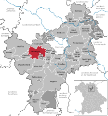
The main village Mistelgau is located 10 km to the west of Bayreuth. It is the centre of the so-called Hummelgau, the north-northeastern boundary of Franconian Switzerland and its transition into the Obermain foothills. The eastern part of the municipality is located on modestly hilly terrain used for agriculture, whereas the (south-)western parts are already part of the Franconian Switzerland with its steeper relief and wooded slopes. Roughly 5 km southwest of the main town, but still within the municipality, lies Neubürg, a table hill offering views of the surrounding area. To the east, the Red Main valley opens up, granting views of the Fichtel Mountains in the distance.

Neighbouring municipalities

Beginning in the north and continuing clockwise, Mistelgau shares borders with the following municipalities: Eckersdorf, Mistelbach, Hummeltal, Glashütten, Plankenfels, Hollfeld, and Thurnau.

Fossil pit

The Mistelgau fossil pit is considered one of the hundred most beautiful geotopes in Bavaria. Until 2005, the Mistelgau pit was used to mine clay for brick production.

It gained supraregional fame because of its impressive fossils. A “belemnite battlefield” and remains of dinosaurs make it one of the most important fossil sites in Europe. Some of the finds are exhibited at the Urwelt Museum Oberfranken in Bayreuthin.

The Bavarian State Office for the Environment has designated the pit as a valuable geotope (geotope number 472A016). [4]

Subdivisions

The municipality consists of the following 42 districts: Äußerer Graben, Außerleithen, Bärnreuth, Böhnershof, Braunersberg, Culm (obere), Culm (untere), Engelmeß, Eschenmühle, Frankenhaag, Friedrichsruh, Geislareuth, Gollenbach, Göritzen, Gries, Hardt, Harloh, Hundshof, Kammer, Klingenmühle, Kreckenmühle, Laimen, Lenz, Mengersdorf, Mistelgau, Moosing, Obernsees, Ochsenholz, Pensenleithen, Plösen, Schnackenwöhr, Schobertsberg, Schobertsreuth, Schöchleins, Seitenbach, Sorg, Streit, Striegelhof, Tennig, Truppach, Wohnsgehaig. [5]

History [3]

The area of the current municipality was first populated during the Stone Age: on top of the Neubürg, a fortified settlement existed between the Neolithic and the La Tène period. [6]

During the Frankish Empire, around the year 700, peasants (Hummelbauern) from the Moselle and Middle Rhine regions settled in the area. Also, tumuli from the times of the Carolingian dynasty have been found.

Mistelgau proper is one of the older villages in the western part of Bayreuth district. Its first documentary mention was in 1379. From 1386 onwards, a noble family resided within the village.

In 1422, the characteristic church St. Bartholomäus was first mentioned.

Most historic sources were destroyed in the course of the Hussite (1433), German Peasants' (1525), Second Margrave (1552–55), Thirty Years' and Seven Years' Wars.

In 1634, more than half of the population died of the plague.

In 1791, Mistelgau along with the remaining Principality of Bayreuth was ceded to Prussia.

During the Napoleonic Wars, a part of the municipality served as a staging area for French artillery in a battle against the Austrians (1806). After the Treaties of Tilsit, Mistelgau was briefly under French control until the Kingdom of Bavaria purchased it alongside the remainder of the former Principality of Bayreuth. Since then, Mistelgau has been part of Bavaria.

In 1904, a railroad line from Bayreuth to Hollfeld (see main article: Bayreuth–Hollfeld railway) with a stop in the village of Mistelgau was opened. The village was electrified and a couple of manufacturing plants constructed.

A public school was created in 1964.

In 1972, several other formerly independent municipalities (Seitenbach, Engelmeß, Truppach, Mengersdorf, Frankenhaag, Plösen, Gollenbach, Wohnsgehaig) were incorporated into Mistelgau.

The railroad connection to Bayreuth and Hollfeld was discontinued in 1974. In the time since then, the tracks have been dismantled and the former railroad route has been converted into a road (in the direction of Obernsees) and a bike path (in the direction of Bayreuth, linking Mistelgau to Hummeltal).

In 1978, the hitherto independent Obernsees was incorporated into the municipality.

In 1980, the Catholic church St. Peter and Paul was opened.

The thermal bath Therme Obernsees was inaugurated in 1998.

In 2003, the permanent exhibit NaturKunstRaum Neubürg on top of the hill Neubürg was opened.

References,

  1. Liste der ersten Bürgermeister/Oberbürgermeister in kreisangehörigen Gemeinden, Bayerisches Landesamt für Statistik, 15 July 2021.
  2. Genesis Online-Datenbank des Bayerischen Landesamtes für Statistik Tabelle 12411-003r Fortschreibung des Bevölkerungsstandes: Gemeinden, Stichtag (Einwohnerzahlen auf Grundlage des Zensus 2011)
  3. 1 2 "Gemeinde Mistelgau: Geschichte" [Municipality Mistelgau: History]. www.mistelgau.de. Retrieved 2021-09-10.
  4. "Tongrube Mistelgau" [Clay pit Mistelgau](PDF). UmweltAtlas Bayern (in German). Augsburg: Bayerisches Landesamt für Umwelt. Retrieved 10 September 2021.
  5. "Mistelgau" (in German). Bayerische Landesbibliothek Online. Retrieved 4 March 2018.
  6. "Die Neubürg – Neubürg" (in German). Retrieved 2021-09-10.

Related Research Articles

<span class="mw-page-title-main">Bergheim, Bavaria</span> Municipality in Bavaria, Germany

Bergheim is a municipality in the Neuburg-Schrobenhausen district of the state of Bavaria in Germany.

<span class="mw-page-title-main">Bischofsgrün</span> Municipality in Bavaria, Germany

Bischofsgrün is a municipality in the district of Bayreuth in Bavaria in Germany.

<span class="mw-page-title-main">Betzenstein</span> Town in Bavaria, Germany

Betzenstein is a town in the district of Bayreuth, in Bavaria, Germany. It is situated in the Franconian Switzerland, 35 km northeast of Nuremberg.

<span class="mw-page-title-main">Hollfeld</span> Town in Bavaria, Germany

Hollfeld is a town in the district of Bayreuth, in Bavaria, Germany.

<span class="mw-page-title-main">Wassertrüdingen</span> Town in Bavaria, Germany

Wassertrüdingen is a town in the district of Ansbach, Middle Franconia, Bavaria, Germany. It is between the Hesselberg, the only Franconian mountain with a view on the Alps, the wooded heights of the Oettinger Forest and the foothills of the Hahnenkamm. The Fränkisches Seenland recreation area is 15 kilometers away. Altentrüdingen, Fürnheim, Geilsheim, Obermögersheim, Reichenbach und Schobdach are part of Wassertrüdingen

<span class="mw-page-title-main">Waischenfeld</span> Town in Bavaria, Germany

Waischenfeld is a town in the district of Bayreuth, in Bavaria, Germany. It is situated in Franconian Switzerland, 20 km southwest of Bayreuth.

<span class="mw-page-title-main">Ergersheim, Middle Franconia</span> Municipality in Bavaria, Germany

Ergersheim is a municipality in Bavaria, Germany.

<span class="mw-page-title-main">Weidenbach, Bavaria</span> Municipality in Bavaria, Germany

Weidenbach is a municipality in the district of Ansbach in Bavaria in Germany.

<span class="mw-page-title-main">Stadelhofen</span> Municipality in Bavaria, Germany

Stadelhofen is a municipality in the Upper Franconian district of Bamberg and a member of the administrative community (Verwaltungsgemeinschaft) of Steinfeld.

<span class="mw-page-title-main">Aufseß</span> Municipality in Bavaria, Germany

Aufseß, also sometimes spelled Aufsess, is a municipality in the district of Bayreuth in Bavaria, Germany.

<span class="mw-page-title-main">Bindlach</span> Municipality in Bavaria, Germany

Bindlach is a municipality in the district of Bayreuth in Upper Franconia in Bavaria, Germany. The town is adjacent immediately north of the town of Bayreuth. The population count of December 2006 was 7197 inhabitants.

<span class="mw-page-title-main">Eckersdorf</span> Municipality in Bavaria, Germany

Eckersdorf is a municipality in the district of Bayreuth in Bavaria in Germany.

<span class="mw-page-title-main">Pollenfeld</span> Municipality in Bavaria, Germany

Pollenfeld is a municipality in the district of Eichstätt in Bavaria in Germany.

<span class="mw-page-title-main">Kalchreuth</span> Municipality in Bavaria, Germany

Kalchreuth is a municipality in the district of Erlangen-Höchstadt, in Bavaria, Germany. It is located 10 kilometers east of Erlangen and 15 kilometers north of Nuremberg and contains the villages of Kalchreuth, Käswasser and Röckenhof and also the hamlets of Stettenberg, Minderleinsmühle and Gabermühle.

<span class="mw-page-title-main">Trogen, Bavaria</span> Municipality in Bavaria, Germany

Trogen is a municipality in Upper Franconia in the district of Hof in Bavaria in Germany.

<span class="mw-page-title-main">Gachenbach</span> Municipality in Bavaria, Germany

Gachenbach is a municipality in the district of Neuburg-Schrobenhausen in Bavaria in Germany.

<span class="mw-page-title-main">Großeibstadt</span> Municipality in Bavaria, Germany

Großeibstadt is a municipality in the district of Rhön-Grabfeld in Bavaria in Germany. The river Franconian Saale flows through Kleineibstadt.

<span class="mw-page-title-main">Güntersleben</span> Municipality in Bavaria, Germany

Güntersleben is a municipality in the district of Würzburg in Bavaria in Germany.

<span class="mw-page-title-main">Eisenheim</span> Municipality in Bavaria, Germany

Eisenheim is a market town and municipality in the district of Würzburg in Bavaria, Germany. It lies on the river Main.

The Neubürg is a table hill in Mistelgau, Germany. It is part of the Franconian Jura and Franconian Switzerland.