Related Research Articles

Severn is a census-designated place (CDP) in Anne Arundel County, Maryland, United States. According to the 2020 U.S. census, the population of Severn is 57,118, a 22.6% increase from 44,231 in 2010. The zip code is 21144.

Millersville is an unincorporated community in Anne Arundel County, Maryland, United States. Population was 20,965 in 2015 based on American Community Survey data.
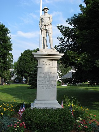
North Chelmsford is an unincorporated village in the town of Chelmsford, Massachusetts, United States. Although North Chelmsford has its own zip code (01863), library, post office, fire station, water district, and local calling area, it is otherwise run by the same local town government and shares a school district with Chelmsford.

Valley Lee is an unincorporated community in St. Mary's County, Maryland, United States. The St. George's Episcopal Church was listed on the National Register of Historic Places in 1973. Another landmark of Valley Lee is the 100-year-old Russells Store, a country store, barber/beautyshop, and local tavern. The ZIP Code for Valley Lee is 20692.
Scotland, in St. Mary's County, Maryland, United States, (Us) is a small settlement near the southernmost end of the state, on the western shore of the Chesapeake Bay. The ZIP Code for Scotland is 20687. There is a summer camp, operated by the Metropolitan Police Department and the Greater Washington Area Boys and Girls Club.
Barstow is a small, rural unincorporated community located at the crossroads of MD 231, German Chapel Road, and Barstow Road in Calvert County, Maryland, United States, immediately west of Prince Frederick. The community maintains its own zip code of 20610.

Dowell is a small, rural unincorporated community in Calvert County, Maryland, United States, located immediately north of Solomons. While many people consider Dowell to be a part of Solomons, it used to maintains its own zip code, 20629. This was recently changed to 20688 same as Solomons MD.

Lower Marlboro, is a small, waterfront unincorporated community located at the crossroads of MD 262 and Chaneyville Road in Calvert County, Maryland, United States, along the east bank of the Patuxent River.
Stoakley is an unincorporated community located in Calvert County, Maryland, United States. It is generally considered part of Prince Frederick and utilizes the Prince Frederick zip code.
Dayton is an unincorporated community located in Howard County, Maryland, United States.

Forest Hill is an unincorporated community in Harford County, Maryland, United States, located north of the county seat of Bel Air. The main part of town is located at the intersection of Maryland Route 24 and Jarrettsville Road. Until 1958, this community was served by the Maryland and Pennsylvania Railroad at milepost 30.3.
Conimicut is a community located in eastern Warwick, Rhode Island.
Coles Point is an unincorporated community in Westmoreland County, in the Commonwealth of Virginia. Coles Point is part of the Northern Neck of Virginia and lies on a peninsula which juts out into the Potomac River on its East side and as part of Westmoreland County waterfront, it follows the Potomac River northward. It is on the Virginia side of the Potomac, and faces St. Mary's County, Maryland. The ZIP Code for Coles Point is 22442.
Zacata is an unincorporated community in Westmoreland County, in the U. S. state of Virginia. The ZIP Code for Zacata is 22581.
Bushwood is an unincorporated community in what is familiarly called the "Seventh District" of St. Mary's County, Maryland, United States. Ocean Hall was listed on the National Register of Historic Places in 1973. The ZIP Code for Bushwood is 20618.

Coltons Point is an unincorporated community in what is popularly called the "Seventh District" of St. Mary's County, Maryland, United States. Here are located a small historical museum and a lighthouse. Seasonal boat service at times carries visitors the short distance to the shrinking, uninhabited St. Clement's Island, where in 1634 the first European settlers arriving in Maryland landed and celebrated the first Catholic Mass in English-speaking North America. It was listed on the National Register of Historic Places in 1972. The ZIP Code for Coltons Point is 20626.
Compton is an unincorporated community near Leonardtown in St. Mary's County, Maryland, United States. The St. Francis Xavier Church and Newtown Manor House Historic District where listed on the National Register of Historic Places in 1972. The ZIP Code for Compton is 20627.

Dameron is an unincorporated community in St. Mary's County, Maryland, United States. The Point No Point Light Station was listed on the National Register of Historic Places in 2002. The ZIP Code for Dameron is 20628.
Clements is an unincorporated community in St. Mary's County, Maryland, United States. Clements is located in northern St. Mary's County. ZIP Code 20624—Area Code 301—Time Zone Eastern—Population 1,282.
Morganza is an unincorporated community in St. Mary's County, Maryland, United States.
References
- ↑ U.S. Geological Survey Geographic Names Information System: Helen, Maryland
- ↑ "Helen ZIP Code". zipdatamaps.com. 2022. Retrieved November 11, 2022.
Municipalities and communities of St. Mary's County, Maryland, United States | ||
|---|---|---|
| Town |  | |
| CDPs | ||
| Other communities | ||
38°22′58″N76°43′18″W / 38.38278°N 76.72167°W