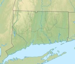
Fairfield County is a county in the southwestern corner of the U.S. state of Connecticut. It is the most populous county in the state and was also its fastest-growing from 2010 to 2020. As of the 2020 census, the county's population was 957,419, representing 26.6% of Connecticut's overall population. The closest to the center of the New York metropolitan area, the county contains four of the state's top 7 largest cities—Bridgeport (1st), Stamford (2nd), Norwalk (6th), and Danbury (7th)—whose combined population of 433,368 is nearly half the county's total population.

Fairfield is a town in Fairfield County, Connecticut, United States. It borders the city of Bridgeport and towns of Trumbull, Easton, Weston, and Westport along the Gold Coast of Connecticut. As of 2020, the town had a population of 61,512. The town is part of the Greater Bridgeport Planning Region.
Monroe is a town located in eastern Fairfield County, Connecticut, United States. The population was 18,825 at the 2020 census. The town is part of the Greater Bridgeport Planning Region.

Shelton is a city in Fairfield County, Connecticut, United States. The population was 40,869 at the 2020 United States Census. The city is part of the Naugatuck Valley Planning Region.

The Housatonic River is a river, approximately 149 miles (240 km) long, in western Massachusetts and western Connecticut in the United States. It flows south to southeast, and drains about 1,950 square miles (5,100 km2) of southwestern Connecticut into Long Island Sound. Its watershed is just to the west of the watershed of the lower Connecticut River.

The Saugatuck River is a 23.7-mile-long (38.1 km) river in southwestern Connecticut in the United States. It drains part of suburban and rural Fairfield County west of Bridgeport, emptying into Long Island Sound.

The Dale Hollow Reservoir is a reservoir situated on the Kentucky/Tennessee border. The lake is formed by the damming of the Obey River, 7.3 miles (12 km) above its juncture with the Cumberland River at river mile 380. Portions of the lake also cover the Wolf River. Dale Hollow is one of four major flood control reservoirs for the Cumberland; the others being Percy Priest Lake, Lake Cumberland, and Center Hill Lake. It is also the site of Dale Hollow Lake State Park on the north (Kentucky) side.

Route 58 is a primary state highway in the U.S. state of Connecticut connecting the towns of Fairfield and Bethel. Route 58 is 18.58 miles (29.90 km) long and is one of the primary routes to the downtown Danbury area via Routes 302 and 53.

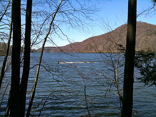
The Saugatuck Reservoir is a reservoir in Fairfield County, Connecticut, United States, that straddles the border between the towns of Redding, Weston, and Easton. Its completion is marked by the creation of the Samuel P. Senior dam of the Saugatuck River in January 1942, and provides water to several of the nearby towns. The reservoir is surrounded by the Centennial Watershed State Forest and a small section of the Trout Brook Valley State Park Reserve on the southeast end of the reservoir. The Saugatuck Reservoir utilizes an uncontrolled spillway adjacent to the Samuel P. Senior dam that effectively limits the maximum water level. There is also a concrete levee positioned on the southeastern side of the reservoir that prevents water from flooding Trout Brook Valley.

Bridgeport-Stamford-Norwalk is a metropolitan area in the U.S. state of Connecticut. The area is located in Southwestern Connecticut. In its most conservative form the area consists of the city of Bridgeport and five surrounding towns—Easton, Fairfield, Monroe, Stratford, and Trumbull. This definition of the Bridgeport area has a population of more than 305,000 and is within the Bridgeport-Stamford-Norwalk-Danbury metropolitan statistical area, which consists of all of Fairfield County, Connecticut. The estimated 2015 county population was 948,053. The area is numbered as part of the New York-Newark Combined Statistical Area NY-NJ-CT-PA by the United States Census Bureau.

Cedar Creek Reservoir is a reservoir located in Henderson and Kaufman Counties, Texas (USA), 50 miles (80 km) southeast of Dallas. It is built on Cedar Creek, which flows into the Trinity River. Floodwaters are discharged through a gated spillway into a discharge channel that connects to the Trinity River.
Ash Creek is a tidal creek and intertidal wetland in Fairfield County, Connecticut that serves as a border between the city of Bridgeport and the town of Fairfield. It is the last salt water estuary in the area, extending from Long Island Sound and up the Rooster River.

The Mill River is a 16.3-mile (26.2 km) river in the town of Fairfield, Connecticut. It flows into Long Island Sound at Southport harbor.
Bridgeport is the most populous city in the U.S. state of Connecticut and the fifth-most populous city in New England, with a population of 148,654 in 2020. Located in eastern Fairfield County at the mouth of the Pequonnock River on Long Island Sound, it is a port city 60 miles (97 km) from Manhattan and 40 miles (64 km) from The Bronx. It is bordered by the towns of Trumbull to the north, Fairfield to the west, and Stratford to the east. Bridgeport and other towns in Fairfield County make up the Greater Bridgeport Planning Region, as well as the Bridgeport–Stamford–Norwalk–Danbury metropolitan statistical area, the second largest metropolitan area in Connecticut. The Bridgeport–Stamford–Norwalk–Danbury metropolis forms part of the New York metropolitan area.

Bridgeport Reservoir is a lake at the lower end of Bridgeport Valley in Mono County, California. Its earth-filled dam was constructed in 1923 by the Walker River Irrigation District, along the East Walker River. The lake has a storage capacity of 42,455 acre-feet (52,367,000 m3) and is regulated by a Federal Watermaster supplying primarily agricultural irrigation and flood control for Lyon County, Nevada.

The Pequonnock River is a 16.7-mile-long (26.9 km) waterway in eastern Fairfield County, Connecticut. Its watershed is located in five communities, with the majority of it located within Monroe, Trumbull, and Bridgeport. The river has a penchant for flooding, particularly in spring since the removal of a retention dam in Trumbull in the 1950s. There seems to be a sharp difference of opinion among historians as to just what the Indian word Pequonnock signifies. Some insist it meant cleared field or open ground; others are sure it meant broken ground; while a third group is certain it meant place of slaughter or place of destruction.
The Aspetuck Reservoir is a large body of water in Fairfield County, Connecticut. It is formed on the Aspetuck River. All of the Aspetuck River Watershed in Redding, the easternmost quadrant of the Town, drains south to the Aspetuck Reservoir in Easton and Fairfield.

The Natchaug River is a 17.9-mile-long (28.8 km) river in Windham and Tolland Counties in northeastern Connecticut. The name Natchaug comes from the Nipmuc language and is believed to mean land between rivers.
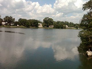
Success Lake is a reservoir in Bridgeport, Connecticut. The elevation of the reservoir is 46 feet. It is located in the 435 acre Lake Success Business Park, which was used to produce ammunition and explosives by the Remington Arms Company from 1905 through 1989 as it was then called "Remington Woods".