Hergensweiler

Last updated
Hergensweiler
Hergensweiler v SW 03.JPG
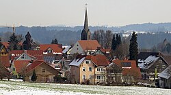
Hergensweiler seen from the southwest
Wappen von Hergensweiler.svg
Coat of arms
Location of Hergensweiler within Lindau district
Hergensweiler in LI.svg
Germany adm location map.svg
Red pog.svg
Hergensweiler
Bavaria location map.svg
Red pog.svg
Hergensweiler
Coordinates: 47°37′N9°46′E / 47.617°N 9.767°E / 47.617; 9.767 Coordinates: 47°37′N9°46′E / 47.617°N 9.767°E / 47.617; 9.767
Country Germany
State Bavaria
Admin. region Schwaben
District Lindau
Municipal assoc. Sigmarszell
Government
   Mayor (202026) Wolfgang Strohmaier [1]
Area
  Total12.06 km2 (4.66 sq mi)
Elevation
520 m (1,710 ft)
Population
 (2020-12-31) [2]
  Total1,888
  Density160/km2 (410/sq mi)
Time zone UTC+01:00 (CET)
  Summer (DST) UTC+02:00 (CEST)
Postal codes
88138
Dialling codes 08388
Vehicle registration LI
Website www.hergensweiler.de

Hergensweiler is a municipality in the district of Lindau in Bavaria in Germany. It is member of the municipal association of Sigmarszell.

Contents

Geography

Hergensweiler is located in the Allgäu region.

History

Hergensweiler was most likely founded about 800 AD by the Alemanni. It presumably owes its name to the Alemannic Hergen. Hergensweiler was an Amt of the free imperial city of Lindau and was assigned to the sovereigns of Bretzenheim by the Reichsdeputationshauptschluss (Principal Conclusion of the Extraordinary Imperial Delegation) in 1803 as part of the new formed principality of Lindau. They exchanged it to Austria in 1804, which had to assign it to Bavaria in 1805.

Population development

In 1970 1,098, in 1987 1,391 and in 2000 1,660 inhabitants were living in the municipality of Heimenkirch.

Politics

The mayor of Hergensweiler is Wolfgang Strohmaier, in office since 2014. [1]

The revenue from the municipal tax added up to 902,000 € in 1999, of which the net business tax amounted to 342,000 €.

Economy and infrastructure

Economy, agriculture and forestry

According to the official statistics, in 1998 there were 16 employees who were subject to social insurance contribution in the sector of agriculture and forestry, 310 in the industrial sector and 19 in the sector of trade and transport at place of work. In miscellaneous sectors there were 37 people employed at place of work. At pace of domicile there were 517 employees altogether. In the industrial sector there were none, in the main construction trade three businesses. Moreover, there were 40 agricultural businesses in 1999 with a total area of 640 ha.

Education

In 1999 the following institutions existed:

Related Research Articles

Geiselwind Place in Bavaria, Germany

Geiselwind is a market town in Lower Franconia (Bavaria) in the district of Kitzingen in Germany. It has a population of around 2,300.

Emmerting Place in Bavaria, Germany

Emmerting is a municipality in the district of Altötting in Bavaria in Germany and member of the administrative association of the same name.

Heinrichsthal Place in Bavaria, Germany

Heinrichsthal is a community in the Aschaffenburg district in the Regierungsbezirk of Lower Franconia (Unterfranken) in Bavaria, Germany, and a member of the Verwaltungsgemeinschaft of Heigenbrücken.

Bruck, Upper Bavaria Place in Bavaria, Germany

Bruck is a community in the Upper Bavarian district of Ebersberg. It is a member of the municipal association (Verwaltungsgemeinschaft) of Glonn.

Emmering, Ebersberg Place in Bavaria, Germany

Emmering is a community in the Upper Bavarian district of Ebersberg. It is a member of the administrative community (Verwaltungsgemeinschaft) of Aßling.

Röthenbach (Allgäu) Place in Bavaria, Germany

Röthenbach (Allgäu) is a municipality in the administrative region of Swabia Lindau district and seat of the municipal association Röthenbach.

Bodolz Place in Bavaria, Germany

Bodolz is a municipality in the district of Lindau in Bavaria in Germany.

Gestratz Place in Bavaria, Germany

Gestratz is a municipality in the district of Lindau in Bavaria in Germany.

Grünenbach Place in Bavaria, Germany

Grünenbach is a municipality in the district of Lindau in Bavaria in Germany.

Heimenkirch Place in Bavaria, Germany

Heimenkirch is a municipality in the district of Lindau in Bavaria in Germany.

Maierhöfen Place in Bavaria, Germany

Maierhöfen is a municipality in the district of Lindau in Bavaria in Germany.

Nonnenhorn Place in Bavaria, Germany

Nonnenhorn is one of the three Bavarian towns on Lake Constance in the Swabian district of Lindau. The air health resort and famous wine town is located between Wasserburg (Bodensee) and Kressbronn am Bodensee (Baden-Württemberg).

Oberreute Place in Bavaria, Germany

Oberreute is a municipality in the district of Lindau in Bavaria in Germany and member of the municipal association of Stiefenhofen. It is an acknowledged air health resort.

Opfenbach Place in Bavaria, Germany

Opfenbach is a municipality in the district of Lindau in Bavaria in Germany.

Stiefenhofen Place in Bavaria, Germany

Stiefenhofen is a municipality in the district of Lindau in Bavaria in Germany and the seat of the administrative community of Stiefenhofen.

Fellen Place in Bavaria, Germany

Fellen is a community in the Main-Spessart district in the Regierungsbezirk of Lower Franconia (Unterfranken) in Bavaria, Germany and a member of the Verwaltungsgemeinschaft of Burgsinn.

Karsbach Place in Bavaria, Germany

Karsbach is a municipality in the Main-Spessart district in the Regierungsbezirk of Lower Franconia (Unterfranken) in Bavaria, Germany and a member of the Verwaltungsgemeinschaft of Gemünden am Main.

Rüdenau Place in Bavaria, Germany

Rüdenau is a municipality in the Miltenberg district in the Regierungsbezirk of Lower Franconia (Unterfranken) in Bavaria, Germany and a member of the Verwaltungsgemeinschaft of Kleinheubach.

Mitterskirchen Place in Bavaria, Germany

Mitterskirchen is a municipality in the district of Rottal-Inn in Bavaria in Germany.

Zeilarn Place in Bavaria, Germany

Zeilarn is a municipality in the district of Rottal-Inn in Bavaria, Germany.

References

  1. 1 2 Liste der ersten Bürgermeister/Oberbürgermeister in kreisangehörigen Gemeinden, Bayerisches Landesamt für Statistik, 15 July 2021.
  2. "Tabellenblatt "Daten 2", Statistischer Bericht A1200C 202041 Einwohnerzahlen der Gemeinden, Kreise und Regierungsbezirke". Bayerisches Landesamt für Statistik und Datenverarbeitung (in German). June 2021.