
Lindau is a major town and island on the eastern side of Lake Constance in Bavaria, Germany. It is the capital of the county (Landkreis) of Lindau, Bavaria and is near the borders of the Austrian state of Vorarlberg, and the Swiss cantons of St. Gallen and Thurgau. The coat of arms of Lindau town is a linden tree, referring to the supposed origin of the town's name. The historic town of Lindau is located on the 0.68-square-kilometre (0.26 sq mi) island of the same name, which is connected with the mainland by a road bridge and a railway causeway leading to Lindau station.
Oberallgäu is a Landkreis (district) in Swabia, Bavaria, Germany. It is bounded by the districts of Unterallgäu and Ostallgäu, the Austrian states Tyrol and Vorarlberg, the district of Lindau, and the state of Baden-Württemberg. The city of Kempten is enclosed by but does not belong to the district.

Piding is an approved climatic spa in Bavaria near to the border of Austria close to Bad Reichenhall and Freilassing.

Zwiesel is a town in the lower-Bavarian district of Regen, and since 1972 is a Luftkurort with particularly good air. The name of the town was derived from the Bavarian word stem zwisl which refers to the form of a fork. The fork of the rivers Großer Regen and Kleiner Regen and the land that lies between these two rivers were called Zwiesel.

Ismaning is a municipality in Bavaria, Germany, located near Munich.
Mering is a municipality in the district Aichach-Friedberg, in Bavaria, Germany. It is located on the river Paar.

Argenbühl is a municipality in the district of Ravensburg, Baden-Württemberg, Germany.

Markt Indersdorf is a municipality in the district of Dachau in Bavaria in Germany.

Röthenbach (Allgäu) is a municipality in the administrative region of Swabia Lindau district and seat of the municipal association Röthenbach.

Weiler-Simmerberg is a market town in the Swabian Lindau district.
Krün is a municipality in the Upper Bavarian district of Garmisch-Partenkirchen. It belongs with Garmisch-Partenkirchen as district capital and cultural center as well as other municipalities to the region Werdenfelser Land. A few kilometers south runs the German-Austrian border.

Bodolz is a municipality in the district of Lindau in Bavaria in Germany.

Gestratz is a municipality in the district of Lindau in Bavaria in Germany.

Grünenbach is a municipality in the district of Lindau in Bavaria in Germany.

Maierhöfen is a municipality in the district of Lindau in Bavaria in Germany.

Oberreute is a municipality in the district of Lindau in Bavaria in Germany and member of the municipal association of Stiefenhofen. It is an acknowledged air health resort.

Opfenbach is a municipality in the district of Lindau in Bavaria in Germany.

Oberstaufen is a municipality in the district of Oberallgäu in Bavarian Swabia, Germany, situated on the B 308 road from Lindau to Immenstadt.

Weitnau is a municipality in the rural district Oberallgäu in Bavaria/Germany. Together with the neighboring municipality of Missen-Wilhams, Weitnau shares an administrative unit.

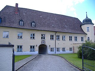
Hergatz station is the station of the Bavarian town of Hergatz. It has three platforms sidings and is classified by Deutsche Bahn as a category 5 station. The station is served by about 75 trains daily operated by Deutsche Bahn and Regentalbahn. Hergatz station is a separation station at the junction of the Buchloe–Lindau railway (Munich–Lindau) and the Kißlegg–Hergatz railway.


