Related Research Articles

Hertfordshire is a ceremonial county in the East of England and one of the home counties. It borders Bedfordshire to the north-west, Cambridgeshire to the north-east, Essex to the east, Greater London to the south and Buckinghamshire to the west. The largest settlement is Watford, and the county town is Hertford.

Bedfordshire is a ceremonial county in the East of England. It is bordered by Northamptonshire to the north, Cambridgeshire to the north-east, Hertfordshire to the south and the south-east, and Buckinghamshire to the west. The largest settlement is Luton (225,262), and Bedford is the county town.
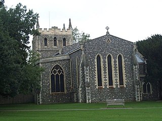
Royston is a town and civil parish in the District of North Hertfordshire and county of Hertfordshire in England.

The Icknield Way is an ancient trackway in southern and eastern England that runs from Norfolk to Wiltshire. It follows the chalk escarpment that includes the Berkshire Downs and Chiltern Hills.

Hitchin is a market town in the North Hertfordshire district of Hertfordshire, England. The town dates from at least the 7th century. It lies in the valley of the River Hiz at the north-eastern end of the Chiltern Hills. It is 16 miles (26 km) north-west of the county town of Hertford, and 35 miles (56 km) north of London. The population at the 2021 census was 35,220.

Hertford is the county town of Hertfordshire, England, and is also a civil parish in the East Hertfordshire district of the county. The parish had a population of 26,783 at the 2011 census.

Bishop's Stortford is a historic market town and civil parish in the East Hertfordshire district, in the county of Hertfordshire, England. It is in the London commuter belt, near the border with Essex, just west of the M11 motorway and Stansted Airport, 22 miles north-east of Central London and 34 minutes away by rail from Liverpool Street station. The town had an estimated population of 41,088 in 2020. The district of East Hertfordshire, where the town centre is located, was ranked as the best place to live in the UK by the Halifax Quality of Life annual survey in 2020.

Baldock is a historic market town in the North Hertfordshire district of Hertfordshire, England. The River Ivel rises from springs in the town. It lies 33 miles (53 km) north of London and 14 miles (23 km) north northwest of the county town of Hertford. Nearby towns include Royston to the northeast, Letchworth and Hitchin to the southwest and Stevenage to the south.
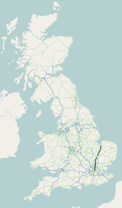
The A10 is a major road in England which runs between The City of London and King's Lynn in Norfolk.

St Margarets railway station is on the Hertford East branch line off the West Anglia Main Line in the east of England, serving the villages of Stanstead St Margarets and Stanstead Abbotts, Hertfordshire. It is 20 miles 25 chains (32.7 km) down the line from London Liverpool Street and is situated between Rye House and Ware. Its three-letter station code is SMT. It is in the civil parish of Great Amwell.

Walking is a popular recreational activity in London, despite traffic congestion. There are many streets that provide interesting walks, especially within historic central London. In addition there are attractive commons, parks, canals, and disused railway tracks that provide space for walks. This includes Wimbledon Common, Epping Forest, Hampstead Heath, and the eight Royal Parks: Hyde Park, Regent's Park, Richmond Park, etc. In recent years access to canals and rivers, including the Regent's Canal, and the River Thames has been greatly improved, and as well a number of long-distance walking routes have been created that link green spaces.
The Icknield Way Path or Icknield Way Trail is a long distance footpath and riding route in East Anglia, England. The ancient Icknield Way itself is unique among long-distance trails because it can claim to be ‘the oldest road in Britain’. It consists of prehistoric pathways, ancient when the Romans came; the route is dotted with archaeological remains. It survives today in splendid tracks and green lanes along the ‘chalk spine’ of southern England.

The Lea Valley Walk is a 50-mile (80 km) long-distance path located between Leagrave, the source of the River Lea near Luton, and the Thames, at Limehouse Basin, Limehouse, east London. From its source much of the walk is rural. At Hertford the path follows the towpath of the River Lee Navigation, and it becomes increasingly urbanised as it approaches London. The walk was opened in 1993 and is waymarked throughout using a swan logo.

Scouting in East of England is about Scouting in the official region of East of England. It is largely represented by The Scout Association of the United Kingdom and some Groups of traditional Scouting including the Baden-Powell Scouts' Association.

Hertingfordbury is a small village in Hertfordshire, England, close to the county town of Hertford. It was mentioned in the Domesday Book of 1086. Hertingfordbury is also the name of a neighbouring civil parish, which does not contain the village. Hertingfordbury village is within the Castle ward of Hertford Town Council. The population of the civil parish as of the 2021 census was 689.

The Hertfordshire Way is a circular walk around the county of Hertfordshire, England. The total length is 312 km (194 mi) which was originally fully waymarked in the anticlockwise direction but is now waymarked in both directions. One section has two optional routes reducing the possible length to 271 km (168 mi).

Turnford is a village in the Borough of Broxbourne, in Hertfordshire, England, in an area generally known as the Lee Valley. It is bounded by Wormley to the north, Cheshunt to the south and west, and its eastern boundary is formed largely by the Lee Navigation. Central London at Charing Cross is approximately 18 miles (29 km) south. At the 2001 census, together with Wormley, the village had a population of 8,146 in 3,399 households.

The Hundred Parishes is a cultural heritage initiative focused on an area in the East of England recognized for its high concentration of cultural and historical significance. Although without formal recognition or status, the concept has the blessing of county and district authorities. It encompasses around 450 square miles of northwest Essex, northeast Hertfordshire and southern Cambridgeshire. The area comprises just over 100 administrative parishes, hence its name. It contains over 6,000 listed buildings and many conservation areas, village greens, ancient hedgerows, protected features and a historical pattern of small rural settlements in close proximity to one another.

The Harcamlow Way is a waymarked walking route in England running in a figure-of-eight from Harlow to Cambridge and back again, hence its portmanteau name. On the way it runs through Essex, Hertfordshire and Cambridgeshire. The route is 141 miles (227 km) long.
Ashwell Rural District was a rural district in Hertfordshire, England from 1894 to 1935, covering an area in the north-east of the county.