The Shire of Macedon Ranges is a region in Central Victoria, Australia, best known for its expansive native forests, iconic geographical attraction Hanging Rock, and thriving artisan food and wine industries. The region covers an area of 1,748 square kilometres (675 sq mi). It is located in between the cities of Bendigo and Melbourne. In June 2018 the shire had a population of 49,388. It includes the towns of Gisborne, Kyneton, Lancefield, Macedon, Malmsbury, Mount Macedon, New Gisborne, Riddells Creek, Romsey and Woodend.
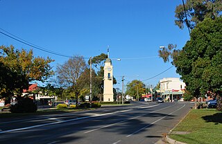
Woodend is a small town in Victoria, Australia. The town is in the Shire of Macedon Ranges local government area on Dja Dja Wurrung country and is bypassed to the east and north by the Calder Freeway (M79), located about halfway between Melbourne and Bendigo. At the 2011 census, Woodend had a population of 5,413.

Darraweit Guim is a Victorian town, situated on Deep Creek, on the edge of the Shire of Macedon Ranges near the shire's boundary with the Shire of Mitchell. In 1992 the town had an approximate population of 300 with approximately 120 homes and a local school overseeing 51 students. Next to the school are the three local tennis courts which are regularly used. Up the hill is the Town Hall, Churches and CFA which protects the area. Platypus can be spotted in the local creek, and wombats also have burrows in the river banks.

Romsey is a town in the local government area of the Shire of Macedon Ranges in the state of Victoria, Australia. The town is 61 kilometres (38 mi) north of Melbourne. At the 2011 census, Romsey had a population of 4,412.

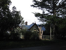
Newham is a small town in the Shire of Macedon Ranges in Victoria, Australia. It is situated between the towns of Kyneton, Woodend and Lancefield. At the 2006 census, Newham and the surrounding area had a population of 570. At the 2016 census, Newham and the surrounding area had a population of 506.
Clarkefield is a town in Victoria, Australia, 46 kilometres (29 mi) northwest of Melbourne's central business district. Its local government area is the City of Hume and Shire of Macedon Ranges. At the 2016 Census, Clarkefield had a population of 320.

Monegeetta is a town north of Melbourne, Australia between the major towns of Sunbury and Romsey in fertile agricultural land east of the Macedon Ranges. Its local government area is the Shire of Macedon Ranges.

The Shire of Gisborne was a now-defunct local government area northwest of Melbourne until its abolition in 1995, when the Shire of Macedon Ranges was created from the merging of the Shires of Gisborne, Newham and Woodend, Romsey, and parts of the Shire of Kyneton.

The Shire of Kyneton was a local government area about 85 kilometres (53 mi) northwest of Melbourne, the state capital of Victoria, Australia. The shire covered an area of 725.2 square kilometres (280.0 sq mi), and existed from 1859 until 1995.

The Shire of Newham and Woodend was a local government area about 70 kilometres (43 mi) northwest of Melbourne, the state capital of Victoria, Australia. The shire covered an area of 246.05 square kilometres (95.0 sq mi), and existed from 1861 until 1995.

The Shire of Romsey was a local government area about 65 kilometres (40 mi) north-north-west of Melbourne, the state capital of Victoria, Australia. The shire covered an area of 628 square kilometres (242.5 sq mi), and existed from 1862 until 1995.

Bullengarook is a locality in Victoria, Australia. The locality is centred on Bacchus Marsh Road, 14 kilometres (9 mi) west of Gisborne and 19 km north of Bacchus Marsh. Bullengarook is in the Shire of Macedon Ranges local government area. At the 2011 Census, Bullengarook and the surrounding area had a population of 603. Mount Bullengarook, the Lerderderg State Park and the headwaters of Coimadai Creek are found to the south of the township.
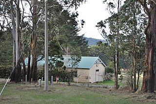
Kerrie is a small town in the Macedon Ranges region of Victoria, Australia, featuring a town hall (1934) and the closed Kerrie State School. The school was closed in 1991, but remains an important venue for community meetings and events. The buildings and grounds are heritage listed and underwent external restoration during 2009–2010. Near the hall are the former tennis courts, now overgrown and in a state of disrepair.

Rochford is a small settlement and locality in the Macedon Ranges Shire, in Victoria, Australia, on the Lancefield-Woodend Road.

Cherokee is a small town situated in the Macedon Ranges Shire, in Victoria, Australia 73 kilometres (45 mi) north of the state capital, Melbourne.

Bolinda is a small town and locality north of Melbourne, Australia on the Melbourne-Lancefield Road. It is 6 km. south of Romsey, within the Shire of Macedon Ranges.

Cobaw is a locality in the Macedon Ranges Shire, in Victoria, situated on Dry Creek. The Cobaw area formerly had its own Post Office and State school, now closed. Cobaw Post Office opened on 1 December 1887 and closed in 1952.The Cobaw Range is a section of the Great Dividing Range north of the settlement, running roughly east–west. The ranges are mainly granitic and reach a maximum height of 760m. Most of the western parts of this range are within the boundaries of the Cobaw State Forest. In the 2016 censes Cobaw had a population of 70.

Springfield is a locality in the Shire of Macedon Ranges local government area in central Victoria, Australia approximately 84 kilometres north of the state capital, Melbourne. It is within the catchment area of Deep Creek, a tributary of the Maribyrnong River.

Woodend North is a locality 4 km north of Woodend, Victoria in the Shire of Macedon Ranges in central Victoria, Australia. Formerly a distinct locality, Woodend North has effectively become the northern extension of the township of Woodend. The locality is now a mainly residential and agricultural area, with some light secondary industrial sites. At the 2006 census, Woodend North had a population of 313.
Pastoria East is a locality in Victoria, Australia, made up after the Shire of Kyneton merged with the Shires of Gisborne, Newham and Woodend, and Romsey to make up the Shire of Macedon Ranges.