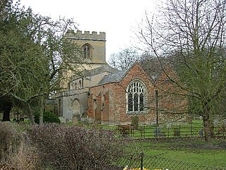
Hexton is a small village and civil parish in Hertfordshire, England, about 6 miles (10 km) west of Hitchin.

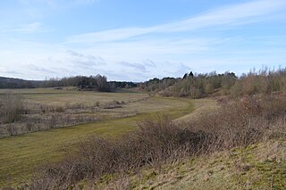
Barton Gravel Pit is a 1.1-hectare (2.7-acre) nature reserve east of Barton-le-Clay in Bedfordshire. It is managed by the Wildlife Trust for Bedfordshire, Cambridgeshire and Northamptonshire.

Totternhoe Knolls is a 13.1 hectare Site of Special Scientific Interest (SSSI) in Totternhoe in Bedfordshire. It is also a local nature reserve, and part of the Chilterns Area of Outstanding Natural Beauty. The site is owned by Central Bedfordshire Council and leased to the National Trust. Most of the site is maintained jointly by the National Trust and the Wildlife Trust for Bedfordshire, Cambridgeshire and Northamptonshire (WTBCN), and is part of the WTBCN Totternhoe nature reserve, which also includes Totternhoe Chalk Quarry and Totternhoe Stone Pit. The SSSI also includes Totternhoe Castle, the earthworks of a Norman motte-and-bailey castle which is a Scheduled monument.

Herts and Middlesex Wildlife Trust manages over 40 nature reserves covering nearly 810 hectares north of London, in Hertfordshire and the historic county of Middlesex, part of which is divided between the London boroughs of Barnet, Enfield, Harrow and Hillingdon. It has over 21,000 members, and is one of 46 Wildlife Trusts across the UK. It is a Registered Charity, with its Registered Office in St Albans, and had an income in the year to 31 March 2014 of over £1.5 million.

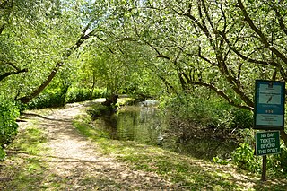
Stocker's Lake is an old flooded gravel pit of approx 90 acres (37.5ha) at Rickmansworth, Hertfordshire, England, within the Colne Valley Regional Park which is designated as a Local Nature Reserve.
Waterford Heath is a 35.2 hectare Local Nature Reserve in Waterford in Hertfordshire, England. It is owned by Lafarge Tarmac and managed by the Herts and Middlesex Wildlife Trust together with East Hertfordshire District Council and Lafarge.

Balls Wood is a 58.5-hectare (145-acre) nature reserve managed by the Herts and Middlesex Wildlife Trust in Hertford Heath in East Hertfordshire. The wood was purchased by the Trust from the Forestry Commission.

Hertford Heath nature reserve is a 28 hectare biological Site of Special Scientific Interest in Hertford Heath in Hertfordshire. It is managed by the Herts and Middlesex Wildlife Trust and the local planning authority is East Hertfordshire District Council.
Stanborough Reedmarsh is a 3.3 hectare Local Nature Reserve in Welwyn Garden City in Hertfordshire. It is owned by Welwyn Hatfield Borough Council and managed by the Herts and Middlesex Wildlife Trust.

Uxbridge Alderglade is a 2.9-hectare (7.2-acre) nature reserve in Uxbridge in the London Borough of Hillingdon. It is managed by the Herts and Middlesex Wildlife Trust.

Pryor's Wood is an 8.7-hectare (21-acre) nature reserve in Great Ashby, near Stevenage in Hertfordshire. It was formerly managed by the Herts and Middlesex Wildlife Trust (HMWT). In February 2016 HMWT announced that three sites, Barkway Chalk Pit, Hill End Pit and Pryor's Wood, which HMWT managed on behalf of their owner, North Hertfordshire District Council, were to return to Council management as the Trust was no longer able to meet the cost.
Hill End Pit is a 0.7-hectare (1.7-acre) nature reserve on the site of a former chalk pit, in St Paul's Walden in North Hertfordshire. It was formerly managed by the Herts and Middlesex Wildlife Trust (HMWT). In February 2016 HMWT announced that three sites, Barkway Chalk Pit, Hill End Pit and Pryor's Wood, which HMWT managed on behalf of their owner, North Hertfordshire District Council, were to return to Council management as the Trust was no longer able to meet the cost. It has the largest colony of Azeca goodalli snails in Hertfordshire. Plants include viper's bugloss, cowslip and marjoram, there are butterflies such as common blue and gatekeeper, and many birds including woodpeckers.

Purwell Ninesprings is a 6.4-hectare (16-acre) nature reserve managed by the Herts and Middlesex Wildlife Trust on the edge of Hitchin, Hertfordshire, England.

Stocking Springs Wood is a 1.1-hectare (2.7-acre) nature reserve between Ayot St Lawrence and Ayot St Peter in Welwyn Hatfield district in Hertfordshire. It is managed by the Herts and Middlesex Wildlife Trust.
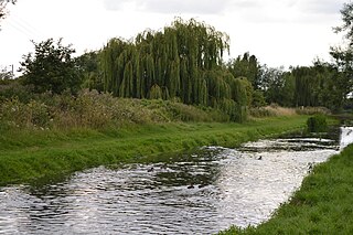
King's Meads is a nature reserve between the towns of Hertford and Ware in Hertfordshire. It is managed by the Herts and Middlesex Wildlife Trust, and with an area of 96 hectares it is the largest of the Trust's reserves. The site has been registered by the Trust as Common land, but the registration for some areas was disallowed due to objections.

Long Deans is a 15 hectare nature reserve managed by the Herts and Middlesex Wildlife Trust in Nash Mills, between Kings Langley and Hemel Hempstead in Hertfordshire. It is neutral and chalk grassland and woodland with beech, ash, oak and wild cherry. Birds include common linnet, common bullfinch and song thrush, and the site is home to bats.

Fir and Pond Woods is a 29 hectare nature reserve in Potters Bar in Hertfordshire. It is managed by the Herts and Middlesex Wildlife Trust. It is two separate woods, with Fir Wood connected by a short footpath to the large Pond Wood to the south.

Willowmead is a 1.5-hectare (3.7-acre) nature reserve in north Hertford. It is managed by the Herts and Middlesex Wildlife Trust.
Tewin Orchard and Hopkyns Wood is a 4.3-hectare (11-acre) nature reserve in Tewin in Hertfordshire. It is managed by the Herts and Middlesex Wildlife Trust.

Barkway Chalk Pit is a small nature reserve in Barkway in North Hertfordshire. It was managed by the Herts and Middlesex Wildlife Trust (HMWT). In February 2016 HMWT announced that three sites, Barkway Chalk Pit, Hill End Pit and Pryor's Wood, which HMWT managed on behalf of their owner, North Hertfordshire District Council, were to return to Council management as the Trust was no longer able to meet the cost.
