
Fulham is an ancient and historic settlement within the London Borough of Hammersmith & Fulham in West London, England, 3.6 miles (5.8 km) southwest of Charing Cross. It lies in a loop on the north bank of the River Thames, bordering Hammersmith, Kensington and Chelsea, with which it shares the area known as West Brompton. Over the Thames Fulham faces Wandsworth, Putney, the London Wetland Centre in Barnes in the London Borough of Richmond upon Thames.

The Regency era of British history is commonly understood as the years between c. 1795 and 1837, although the official regency for which it is named only spanned the years 1811 to 1820. King George III first suffered debilitating illness in the late 1780s, and relapsed into his final mental illness in 1810; by the Regency Act 1811, his eldest son George, Prince of Wales, was appointed prince regent to discharge royal functions. When George III died in 1820, the Prince Regent succeeded him as George IV. In terms of periodisation, the longer timespan is roughly the final third of the Georgian era (1714–1837), encompassing the last 25 years or so of George III's reign, including the official Regency, and the complete reigns of both George IV and his brother and successor William IV. It ends with the accession of Queen Victoria in June 1837 and is followed by the Victorian era (1837–1901).

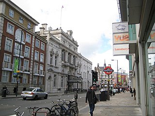
Hammersmith is a district of West London, England, 4.3 miles (6.9 km) southwest of Charing Cross. It is the administrative centre of the London Borough of Hammersmith and Fulham, and identified in the London Plan as one of 35 major centres in Greater London.

The Metropolitan Borough of Westminster was a metropolitan borough in the County of London, England, from 1900 to 1965.
The Metropolitan Borough of Fulham was a metropolitan borough in the County of London between 1900 and 1965, when it was merged with the Metropolitan Borough of Hammersmith to form the London Borough of Hammersmith and Fulham. It was a riverside borough, and comprised the many centuries-long definition of Fulham so included parts often considered of independent character today Walham Green, Parsons Green, Hurlingham, Sands End and that part of Chelsea Harbour west of Counter's Creek. The SW6 postal district approximately follows this as does the direct, though less empowered, predecessor Fulham civil parish.

Stamford Brook was a tributary of the Tideway stretch of the River Thames in west London supplied by three headwaters. Historically used as an irrigation ditch or dyke, the network of small watercourses had four lower courses and mouths.

Fulham Palace lies on the north bank of the River Thames in Fulham, London, previously in the former English county of Middlesex. It is the site of the Manor of Fulham dating back to Saxon times and in the continuous possession of the bishops of London since the 8th century as lords of the manor until the 20th century. The much reduced estate comprises a Grade I listed complex with medieval origins and was formerly the principal residence of the Bishop of London from the 11th century until 1973. Though still owned by the Church of England, the palace, managed by the Fulham Palace Trust, houses a number of restored historic rooms and a museum documenting its long history. The property abuts Bishops Park, once part of the estate, and contains a large botanic garden. The palace garden is ranked Grade II* on the Register of Historic Parks and Gardens.

The London Borough of Hammersmith & Fulham, an Inner London borough, has 231 hectares of parks and open spaces that are accessible to the general public, 159 hectares being within parks and 52.5 hectares within cemeteries and churchyards. Wormwood Scrubs and Scrubs Wood, located in the north of the Borough account for 42 hectares and Fulham Palace and Bishop's Park grounds contain another 14 hectares of open space. Private open space includes Hurlingham, Fulham and Queen's Club in West Kensington.

West Kensington, formerly North End, is an area in the ancient parish of Fulham, in the London Borough of Hammersmith and Fulham, England, 3.4 miles (5.5 km) west of Charing Cross. It covers most of the London postal area of W14, including the area around Barons Court tube station, and is defined as the area between Lillie Road and Hammersmith Road to the west, Fulham Palace Road to the south, Hammersmith to the north and West Brompton and Earl's Court to the east. The area is bisected by the major London artery the A4, locally known as the Talgarth Road. Its main local thoroughfare is the North End Road.
Chiswick Bridge is a reinforced concrete deck arch bridge over the River Thames in West London. It is one of three bridges opened in 1933 as part of an ambitious scheme to relieve traffic congestion west of London. The structure carries the A316 road between Chiswick on the north bank of the Thames and Mortlake on the south bank.

West Brompton is an area of west London, England, that straddles the boundary between the London Borough of Hammersmith and Fulham and Royal Borough of Kensington and Chelsea. The centuries-old boundary traced by Counter's Creek, probably marked the eastern edge of Fulham Manor since Saxon times and is now partly lost beneath the West London Line railway.

Sons of the Thames is a rowing club in Hammersmith, London, England. It was formed in Putney in 1886 with the aim, still enshrined in its constitution, to further the sport of rowing.
Hammersmith Creek was an outflow river of the Stamford Brook, and used to run through what is now King Street, into the River Thames at the present-day site of Furnivall Gardens in Hammersmith.
Events from the year 1795 in Ireland.
All Saints' Church is the ancient parish church of Fulham, in the County of Middlesex, pre-dating the Reformation. The parish was founded in the precinct of Fulham Manor, currently adjacent to it, which was in the possession of the Bishops of London, since the 8th century. Hence it began as the parish church of the bishops of London and several of them are buried there. It is now an Anglican church in Fulham, London, sited close to the River Thames, beside the northern approach to Putney Bridge. The church tower and interior nave and chancel are Grade II* listed.

St Peter's, Hammersmith, is a Church of England parish church. It is a Grade II* listed church, and the oldest church in Hammersmith.
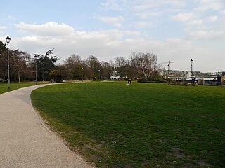
Furnivall Gardens is a park in Hammersmith alongside the river Thames.

Chiswick Mall is a waterfront street on the north bank of the river Thames in the oldest part of Chiswick in West London, with a row of large houses from the Georgian and Victorian eras overlooking the street on the north side, and their gardens on the other side of the street beside the river and Chiswick Eyot.

Old Chiswick is the area of the original village beside the river Thames for which the modern district of Chiswick is named. The village grew up around St Nicholas Church, founded c. 1181 and named for the patron saint of fishermen. The placename was first recorded c. 1000 as Ceswican. In the Middle Ages the villagers lived by fishing, boatbuilding, and handling river traffic. The surrounding area was rural until the late 19th century.

