
The London Borough of Hounslow is a London borough in west London, England, forming part of Outer London. It is governed by Hounslow London Borough Council.

The London Borough of Hammersmith and Fulham is a London borough in West London and which also forms part of Inner London. The borough was formed in 1965 as the London Borough of Hammersmith from the merger of the former Metropolitan Boroughs of Fulham and Hammersmith. The name was changed to Hammersmith and Fulham in 1979. The borough borders Brent to the north, the Royal Borough of Kensington and Chelsea to the east, Wandsworth to the south, Richmond upon Thames to the south west, and Hounslow and Ealing to the west.

Fulham is an area of the London Borough of Hammersmith & Fulham in West London, England, 3.6 miles (5.8 km) southwest of Charing Cross. It lies on the north bank of the River Thames, bordering Hammersmith, Kensington and Chelsea. The area faces Wandsworth, Putney, Barn Elms and the London Wetland Centre in Barnes. on the far side of the river.

Hammersmith is a district of West London, England, 4.3 miles (6.9 km) southwest of Charing Cross. It is the administrative centre of the London Borough of Hammersmith and Fulham, and identified in the London Plan as one of 35 major centres in Greater London.

Chelsea is an affluent area in West London, England, due south-west of Charing Cross by approximately 2.5 miles. It lies on the north bank of the River Thames and for postal purposes is part of the south-western postal area.

Hammersmith Bridge is a suspension bridge that crosses the River Thames in west London. It links the southern part of Hammersmith in the London Borough of Hammersmith and Fulham, on the north side of the river, with Barnes in the London Borough of Richmond upon Thames, on the south side of the river. The current bridge, which is Grade II* listed and was designed by civil engineer Sir Joseph Bazalgette, is the second permanent bridge on the site, and has been attacked three times by Irish republicans.

Putney Bridge is a Grade II listed bridge over the River Thames in west London, linking Putney on the south side with Fulham to the north. Before the first bridge was built in 1729, a ferry had shuttled between the two banks.

Stamford Brook was a tributary of the Tideway stretch of the River Thames in west London supplied by three headwaters. Historically used as an irrigation ditch or dyke, the network of small watercourses had four lower courses and mouths.
Furnivall Sculling Club is a rowing club based on the Tideway in Hammersmith, London. It was called Hammersmith Sculling Club until 1946. It was founded in 1896 by Frederick Furnivall, after whom the riverside Furnivall Gardens a few metres away are named. For its initial five years, in the reign of Queen Victoria, the club was for females only and is widely considered to have had the world's first female rowing team (crew). Furnivall has also admitted males since 1901. The club colours are a precise pallette: myrtle and old gold.

The London Borough of Hammersmith & Fulham, an Inner London borough, has 231 hectares of parks and open spaces that are accessible to the general public, 159 hectares being within parks and 52.5 hectares within cemeteries and churchyards. Wormwood Scrubs and Scrubs Wood, located in the north of the Borough account for 42 hectares and Fulham Palace and Bishop's Park grounds contain another 14 hectares of open space. Private open space includes Hurlingham, Fulham and Queen's Club in West Kensington.
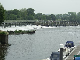
The Tideway is the part of the River Thames in England which is subject to tides. This stretch of water is downstream from Teddington Lock. The Tideway comprises the upper Thames Estuary including the Pool of London.

West Brompton is an area of west London, England, that straddles the boundary between the London Borough of Hammersmith and Fulham and Royal Borough of Kensington and Chelsea. The centuries-old boundary traced by Counter's Creek, probably marked the eastern edge of Fulham Manor since Saxon times and is now partly lost beneath the West London Line railway.

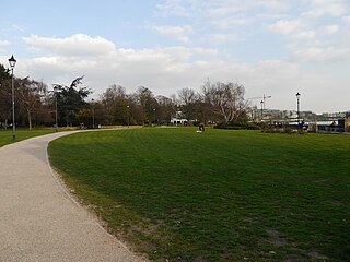
Ravenscourt Park or RCP is an 8.3 hectares public park and garden located in the London Borough of Hammersmith and Fulham, England. It is one of the Borough's flagship parks, having won a Green Flag Award. Stamford Brook and Ravenscourt Park tube stations are close by.

Walham Green is the historic name of an English village, now part of inner London, in the parish of Fulham in the County of Middlesex. It was located between the hamlet of North End to the north, and Parsons Green to the south. To the east it was bounded by Counter's Creek, the historical boundary with the parish of Chelsea, and to the south-east is Sands End.

St Peter's, Hammersmith, is a Church of England parish church. It is a Grade II* listed church, and the oldest church in Hammersmith.

King Street, Hammersmith is the main shopping street in Hammersmith, London. It runs west–east, and forms part of the A315, and is the eastern continuation of Chiswick High Road, where it meets Goldhawk Road, close to Stamford Brook tube station. At the eastern end it meets Hammersmith Broadway and continues east as Hammersmith Road where it forms a crossroads with the A219, the Shepherd's Bush Road running northwards, and the Fulham Palace Road running south.
Furnivall Gardens is a park in Hammersmith alongside the river Thames.
High Bridge was a footbridge that crossed Hammersmith Creek in Hammersmith, London. First referenced in 1541, the bridge was rebuilt several times, notably in 1712, 1751, 1820 and 1837. The bridge was destroyed in 1944 by a flying bomb.


