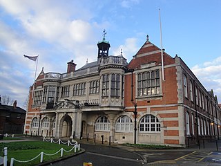
Hendon is an urban area in the London Borough of Barnet, northwest London 7 miles (11 km) northwest of Charing Cross. Hendon was an ancient manor and parish in the county of Middlesex and a former borough, the Municipal Borough of Hendon; it has been part of Greater London since 1965. Hendon falls almost entirely within the NW4 postcode, while the West Hendon part falls in NW9. Colindale to the northwest was once considered part of Hendon but is today separated by the M1 motorway.

Lancing is a large coastal village and civil parish in the Adur district of West Sussex, England, on the western edge of the Adur Valley. It occupies part of the narrow central section of the Sussex coastal plain between smaller Sompting to the west, larger Shoreham-by-Sea to the east, and the parish of Coombes to the north. Excluding definitive suburbs it may have the largest undivided village cluster in Britain. However, its economy is commonly analysed as integral to the Brighton/Worthing/Littlehampton conurbation. Its settled area beneath the South Downs National Park covers 3.65 square miles, the majority of its land.

Redhill is a town in the borough of Reigate and Banstead within the county of Surrey, England. The town, which adjoins the town of Reigate to the west, is due south of Croydon in Greater London, and is part of the London commuter belt. The town is also the post town, entertainment and commercial area of three adjoining communities : Merstham, Earlswood and Whitebushes, as well as of two small rural villages to the east in the Tandridge District, Bletchingley and Nutfield.

Worthing is a seaside town and borough in West Sussex, England, at the foot of the South Downs, 11 miles (18 km) west of Brighton, and 18 miles (29 km) east of Chichester. With a population of 113,094 and an area of 12.5 square miles (32.4 km2), the borough is the second largest component of the Brighton and Hove built-up area, the 15th most populous urban area in the United Kingdom. Northern parts of the borough, including the Worthing Downland Estate, form part of the South Downs National Park. In 2019, the Art Deco Worthing Pier was dubbed the best in Britain.

West Green is one of the 14 residential neighbourhoods in Crawley, a town and borough in West Sussex, England. Crawley was planned and laid out as a New Town after the Second World War, based on the principle of self-contained neighbourhoods surrounding a town centre of civic and commercial buildings. West Green was the first neighbourhood to be developed, and is one of the smallest and closest to the town centre.

Liverpool Road is a street in Islington, North London. It covers a distance of 1+1⁄4 miles (2.0 km) between Islington High Street and Holloway Road, running roughly parallel to Upper Street through the area of Barnsbury. It contains several attractive terraces of Georgian houses and Victorian villas, many of which are listed buildings. There are a number of pubs, small businesses and restaurants along its route, as well as some secluded garden squares. The vast majority of the street is residential, with a bustling shopping and business area at the southern, Angel, end.

Theale is a village and civil parish in West Berkshire, England. It is 5 miles (8 km) southwest of Reading and 10 miles (16 km) east of Thatcham. The compact parish is bounded to the south and south-east by the Kennet & Avon Canal, to the north by a golf course, to the east by the M4 motorway and to the west by the A340 road.
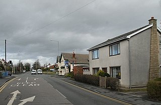
Euxton is a village and civil parish of the Borough of Chorley, in Lancashire, England. The population of the civil parish as taken at the 2011 census was 9,993, however, the population is now estimated to be around 14,000 due to the increase in housing developments in the village, including the Buckshaw development. The village is situated just to the west of Chorley, and to the south of Clayton-le-Woods.
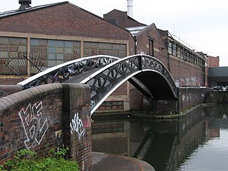
Bordesley is an area of Birmingham, England, 1.2 miles (2 km) south east of the city centre straddling the Watery Lane Middleway ring road. It should not be confused with nearby Bordesley Green. Commercial premises dominate to the west of the ring road, but much of this area is to be redeveloped. Blocks of residential apartments are planned and set for completion from the mid-2020s onwards. The largely residential area east of the ring road was renamed Bordesley Village following large scale clearance of back-to-back houses and redevelopment in the 1980s and 90s. Bordesley is the real life setting of the BBC series Peaky Blinders, and home to Birmingham City Football Club's ground, St Andrew's.

Hockley Heath is a village and civil parish within the Metropolitan Borough of Solihull, West Midlands, England. The village is to the south of the West Midlands conurbation, 12 miles (19 km) southeast of Birmingham 5.5 miles (8.9 km) from Solihull town centre and 13 miles (21 km) north of Stratford-upon-Avon. Hockley Heath is in the Arden area and borders Warwickshire and the District of Stratford-on-Avon to the south, with some parts of the village on either side of the border. It incorporates the hamlet of Nuthurst, and has a history dating back to the year 705 AD as a wood owned by Worcester Cathedral. The 2011 Census gives the population of Hockley Heath civil parish as 2,038.

Charing Cross is a major road junction and area within the centre of Glasgow, Scotland. It is situated north of the River Clyde at the intersection of Sauchiehall Street, St George's Road, Woodlands Road, North Street and Newton Street, as well as being at a major interchange of the M8 motorway. Charing Cross marks the notional boundary between the City Centre and the West End of the city.
The A3036 is an A road in London, England, running from Waterloo to Wandsworth.

Great Junction Street is a street in Leith, on the northern outskirts of Edinburgh, Scotland. It runs southeast to northwest following approximately the southwestmost line of the old town walls around Leith.
West Worthing is a neighbourhood of Worthing in West Sussex, England that was developed within Heene and later expanded beyond Heene's boundaries. Intended as an exclusive resort, the township of West Worthing was developed from around 1864 and merged with the formerly separate township of Worthing in 1890, when Worthing gained borough status.

Worthing is a large seaside town in Sussex, England in the United Kingdom. The history of the area begins in Prehistoric times and the present importance of the town dates from the 19th century.
Worthing, a seaside town in the English county of West Sussex which has had borough status since 1890, has a wide range of public services funded by national government, West Sussex County Council, Worthing Borough Council and other public-sector bodies. Revenue to fund these services comes principally from Council Tax.
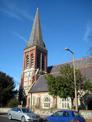
St George's Church is an Anglican church in the East Worthing area of the borough of Worthing, one of seven local government districts in the English county of West Sussex. Built in 1867–68 to serve new residential development in the southeast of the town, the Decorated Gothic-style structure was extended later in the 19th century, and expanded its reach further by founding three mission halls elsewhere in Worthing. English Heritage has listed it at Grade C for its architectural and historical importance.
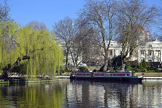
Little Venice is an affluent residential district in West London, England, around the junction of the Paddington Arm of the Grand Union Canal, the Regent's Canal, and the entrance to Paddington Basin. The junction, also known as Little Venice and Browning's Pool, forms a triangular shape basin designed to allow long canal boats to turn around. Many of the buildings in the vicinity are Regency white painted stucco terraced town houses and taller blocks (mansions) in the same style. The area is 2.5 miles (4.0 km) west-north-west of Charing Cross and immediately north-west of Paddington.

Warwick Road is located in the Earl's Court district of the Royal Borough of Kensington & Chelsea in London. The road began to be laid out around 1822 and was gradually extended south to Old Brompton Road over a number of decades. It is a major north–south traffic route in west London.

The following is a timeline of the history of the borough of Worthing, West Sussex, England.


