Worthing exploits its seaside location for tourism—for which Worthing Pier has always been important—but the sea and coast have also been used for farming, fishing and trade.
Worthing, a seaside resort on the English Channel coast of West Sussex, southeast England, has a long maritime history predating its late 18th-century emergence as a fashionable holiday and residential town. Fishing was a major economic activity for centuries, and still retains a small presence on Worthing's shingle shoreline. Smuggling, usually by sea, also contributed to the growing town's economy. The formerly sandy beach has changed over time, partly because of sea defence work carried out to alleviate concerns over flooding, which has affected the town several times. Large seaweed deposits, driven up from the sea bed, have caused occasional problems, while undersea rock formations off the coast have national importance as a wildlife habitat. There have been many shipwrecks and groundings in the area, and lifeboats were stationed in the town for many years.
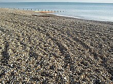
19th-century timber groynes caused coarse shingle to accumulate on Worthing's previously sandy beach.This capstan is one of three on Worthing beach; it survives from the 19th century.
Worthing is situated on a small ridge next to the English Channel coast. The geology and physical geography of the coastline encourage erosion and longshore drift, which have had major effects on the hinterland.[1] The coastline is almost entirely built up, but there are some gaps such as Goring Gap and the grounds of Beach House.[2]
Worthing developed in the pre-medieval era as a small southern outpost of the parish and larger village of Broadwater, based on farming and fishing. Teville Stream and its estuary, upon which a harbour was situated by the 14th century,[3] separated the hamlet from Broadwater. The early farmers reclaimed land from the sea, but it was lost again to flooding during the Middle Ages. Soon after this, a bar of shingle began to form in the sea, affecting the current and also the tidal flow of the stream. This protected the coastline and allowed salt marshes to form.[1] Usually called the "saltgreen", "Worthing Common" or, most often, the "saltgrass",[1][4][5] this fertile soil contained large amounts of salt—the most important preservative agent of the pre-refrigeration era. Salt and other minerals were extracted, and the land was used for farming.[5] Instead of being enclosed, as much land was at the time, it was left as common land; Worthing's inhabitants were granted leases to graze their animals on it.[6] Some buildings also stood there: an early courthouse, and some buildings called "shops" which were likely to be fishing-related.[4][7] The first of these was documented in the early 17th century, and several others were known about later that century.[8]
Storms in the 17th century and in 1703 started to damage this exposed land, and it was completely undermined in the 18th century. An inn on the saltgrass was destroyed by the sea in 1772: its remains were washed on to the beach during a winter storm.[9] The 50 acres (20ha) of saltgrass remaining in the middle of the 18th century had disappeared by the early 19th century, and a beach of fine golden sand appeared in its place.[1][4][7][10] The shingle bar, which wind and wave action had gradually moved towards the shore, had also contributed to these changes, and its undesirable effect on the flow of water around the estuary resulted in the town commissioners breaking it up at the start of the 19th century.[1][11] At the same time, groynes were constructed to attempt to save the land on which the growing town was built from erosion. This was only partly successful—floods affected the town centre several times during the 19th century, particularly on New Year's Day 1877[12] when water reached a long way inland—and accumulations of stones and shingle started to affect the quality of the beach.[1][11] Storms in 1866 forced the esplanade (originally built in 1819) to be repaired.[11] By the 20th century, the beach was composed entirely of large, coarse stones called Coombe Rock.[13] The esplanade was extended to the east and west during the 1930s,[11] and sea defences were improved further from 1990 onwards when blocks of stone were built into the beach at three points.[14] Long-term trends suggest that shingle will continue to accumulate on the beach and make it shelve more steeply, and the land will continue to erode (especially if sea levels rise) and be carried off to the east on sea currents.[15]
There are three capstans on Worthing beach. All survive from the 19th century, when they were used by boat crews.[16]
Worthing Lumps and seaweed
The Worthing Lumps are a range of underwater chalk cliffs about 5 miles (8km) off the Worthing coast.[17] They face north, rise as high as 10 feet (3m) and have areas of small rocks and sand at their base.[18] They have been designated a Marine Site of Nature Conservation Interest (SNCI),[15][17] and are an important breeding and visiting ground for sea creatures such as lesser spotted dogfish, tompot blenny, gobies, triggerfish and piddocks, and for birds such as the red-breasted merganser.[18][19][20] There are few undersea chalk cliffs in the waters around Britain: Sussex has several, and the Lumps have been described as the best example.[18]
A large "seaweed zone" also exists on the seabed off Worthing.[14]Seaweed has been washed up on Worthing beach throughout the town's history, but it began to cause problems at the start of the 19th century when the town was growing and trying to present itself as a fashionable seaside resort. The decaying matter was unsightly, smelt offensive and attracted flies, especially when sewage from the town's primitive drainage system mixed with it.[14][21][22] When Worthing was an agricultural and fishing village, farmers took the seaweed away and used it as fertiliser;[1][21] the town commissioners allowed this at first, but later discouraged it. By the mid-20th century, the Borough Council demanded payment from people wishing to remove seaweed from the beach; when it piled up, it was mechanically pushed out to sea, but this damaged the beach.[23] Confirmation that the source was local came in 1956, when a specialist team analysed the West Sussex seabed; this disproved a longstanding theory that rocks on the seabed at Bognor Regis were to blame.[14]
Fishing and boatbuilding industry
Fishing was important to Worthing's economy from the 16th century or earlier, when it was a modest village, until the early 20th century, but the numbers of boats and men employed were small.[24][25] Early fishermen supplemented their income by working the land for part of the year as well, and some inhabitants who farmed for most of the year also fished occasionally.[26] Fishing tended to run in families for many generations.[27] As well as being sold locally, fish was being exported to towns in Sussex and Surrey by the late 18th century. The main catches were mackerel and herring, supplemented by various crustaceans.[24][25] A large oyster bed was found in 1823,[24] and it yielded 50 million oysters within the first year; but overfishing led to its exhaustion within a decade.[27]
In the 1830s, Worthing's fishermen were affected by economic decline, overfishing and competition from unlicensed French fishermen (English laws required fishermen to hold licences). French boats would sail into English territory, sabotage nets and take as many fish as they could. Worthing's fishermen united in 1838 to present a petition to the House of Commons of the United Kingdom demanding action, and the intervention of Sir George Richard Brooke-Pechell, 4th Baronet (MP for Brighton and the owner of Castle Goring) resulted in the French and British governments signing a trade agreement which improved fishing rights for the English.[28]
The industry was most successful in the second half of the 19th century. The local fishing fleet trebled in size to 110 boats between 1855 and 1887, and the 1892 season's yield was valued at a record £2,526.[25] Decline in yield, boats used and men employed set in quickly after that: about ten fishermen were still active in 1950 and five by the 1990s.[24][25]
Boatbuilding was less important in Worthing than in nearby towns such as Shoreham-by-Sea and Littlehampton, but a small industry existed for about 60 years from the mid-19th century: a fishing boat built in 1856 was the town's first,[29] and boats were sold outside the town.[24] J. Belton's building firm, active from the 1880s until 1916, was the most prominent company in the area.[29]
Smuggling
The former Coastguard House dates from the 1820s.
When Worthing first developed as a fashionable resort, it was often reported in newspapers, guidebooks and other media that the town's new-found high-class status was in contrast to its corrupt history as a "den of smugglers". This was an exaggeration, but there was significant smuggling activity during the 1740s: battles between soldiers and smugglers culminated in the defeat of a major gang in 1749, which subdued illegal operations for several decades.[30]
Activity resumed in the 1820s because of economic depression which had caused Worthing's economy to stagnate. High taxes on goods were also a factor.[31] A customs ship stationed off Worthing as part of the Coastal Blockade for the Prevention of Smuggling—a response to the events of the Napoleonic Wars, which attempted to defend the Kent and Sussex coasts—seized many shipments of contraband goods during the 1820s, and there were several battles in which smugglers and troops suffered injuries.[31][32] In February 1832, 200 smugglers broke through the defences and reached the High Street with their contraband; they were intercepted, and during the subsequent fighting the gang leader was shot dead as he tried to defend the gang while they crossed Teville Stream.[31][33] After this, dragoons were stationed in Worthing specifically to prevent smuggling.[32] The gang leader, William Cowerson, was well respected in the town; his funeral was attended by many people, and his grave in Steyning church yard is marked by an ornate headstone.[34][35] He is said to have stored contraband in various hiding places, including tombs at St Andrew's Church, West Tarring.[36]
Another incident in 1838, when smugglers were caught running contraband through the grounds of Beach House, resulted in another major battle.[32] Thereafter, smuggling became less attractive because taxes on imported goods were reduced and free trade became easier. The last reported incidents were in the 1870s.[28]
Coastguards, lifeboats and shipwrecks
The former lifeboat station retains its conical lookout tower.
Worthing's first coastguard house, a wooden structure on the seafront, was built in about 1809,[1][37] and a sea mark had helped navigation since its installation in 1795. Another coastguard station was built in the 1820s;[1] a passageway next to it marks the ancient boundary between Worthing and Heene.[35] Short-lived stations were recorded in East Worthing during the mid-19th century.[1][37] Others existed between 1886 and 1934 (in central Worthing) and between 1886 and 1903 (at Goring-by-Sea). The 1820s station closed in 1931, but the building survives.[37]
The coastguards regularly battled with smugglers during the 1820s and 1830s, and killed the town's smuggling ringleader in 1832.[38] They also kept order among Worthing's fishermen during a period of discord with their French rivals during the 1830s.[28] In 1836, three coastguard crew died in an accident at sea off Goring-by-Sea.[39]
After 11 fishermen died when attempting to rescue the crew of the foundering Lalla Rookh (which was afterwards escorted safely to London)[40]) in 1850, funding was provided for a permanent lifeboat for Worthing.[41] A Littlehampton-based firm provided the first boat in 1852[1] or 1853, and it stood outside the coastguard house.[42] A lifeboat station was provided later: it opened at 107 Marine Parade, near the coastguard house, in 1874[1][42] and survives, much altered (although its original lookout turret remains) and in private residential ownership.[42][43][44] In March 1865, the Royal National Lifeboat Institution took control of lifeboat operations in Worthing, and a new boat was provided. It served (under two names) until 1887, when another replacement was built; this was in turn replaced in 1901.[42] Another boat was also used later.[44]
A lifeboat station was opened at Shoreham-by-Sea in 1929, and it served Worthing from the following year, at which point the town's station was shut down.[42] The last boat was put on display in the town until 1950.[44] Research suggests that 58 people were saved by the Worthing lifeboat during its years of operation.[1] Since the late 20th century, Worthing Borough Council have owned and operated some modern inflatable craft on Worthing seafront.[45]
Difficult currents and sudden changes in the level of the seabed, with many shallow areas, have made the Worthing coast—in common with other parts of Sussex—an area where shipwrecks and similar incidents are common.[46] Wrecks and groundings have been documented since the 17th century, and two caused multiple deaths; the Lalla Rookh disaster killed 11 local men and led to the provision of lifeboats in the town.[47] The sinking of the Indiana resulted in large numbers of oranges and lemons washing ashore, which attracted thousands of residents eager to retrieve them despite coastguards trying to stop them.[46][48][49][50]
When this barque was seen in distress in stormy waters 3.5 miles (5.6km) off Worthing during a November storm, eleven local fishermen sailed out to help. As hundreds of people watched from the shore, the fishing boat suddenly capsized just before it reached the Lalla Rookh. All 11 crew were lost, and another team of fishermen rescued the barque's crew.
This schooner was wrecked on the shore in the centre of Worthing after running aground. The same storm was responsible for this wreck and the Capella incident.
This 490-ton steamship was carrying coal to London when the crew of 11 were forced to abandon ship off the coast of Worthing. Their lifeboat sank and all on board died. The bodies were recovered and were buried at St Mary's Church, Broadwater. Worthing's lifeboat was not launched, but after an inquiry no blame was attached to the crew or coastguard.
This 2,225-ton steamer crashed into another ship, the City of Washington, at East Worthing. It was wrecked, and sank; the City of Washington rescued the crew. The Indiana was carrying a large cargo of fruit, which was washed ashore for several days afterwards.
The rescue of this ship, which encountered difficulties off Worthing and was wrecked, was commemorated in a painting which is held at Worthing Museum and Art Gallery.
This schooner sent out a distress signal in stormy seas, and was eventually wrecked at Goring-by-Sea. Worthing lifeboat was launched, but it capsized during the rescue, killing a crewmember.
The Lalla Rookh has been described as Worthing's greatest tragedy,[47] and the disaster continues to be commemorated: for example, in 2004 a collection of poetry inspired by the events and the poem which gave the ship its name was exhibited at Worthing library.[57] Most of the men who died were married fathers, and they were performing the role of rescuers voluntarily in the absence of a town lifeboat service.[47] Residents and civic leaders raised more than £5,000 for the families of the men killed, and there is a memorial at St Mary's Church in Broadwater.[51]
Worthing Borough Council has also commemorated other shipwrecks. A road in East Worthing was named Ophir Road in reference to the wreck of the Ophir nearby.[48] In 1989, the naming of a new block of flats on the seafront in West Worthing was intended to honour the Capella, which came ashore there nearly a century earlier—but the name was accidentally misspelt and the building became "Capelia House".[48]
Since 2005, the sinking of the Indiana has been commemorated by an annual charity event. Residents gather on the beach to throw oranges and lemons, in reference to the washed-up cargo, and prizes are given for the longest throws.[49]
Related Research Articles
Littlehampton is a town, seaside resort and civil parish in the Arun District of West Sussex, England. It lies on the English Channel on the eastern bank of the mouth of the River Arun. It is 52 miles (84 km) south south-west of London, 19 miles (31 km) west of Brighton and 10 miles (16 km) east of the county town of Chichester.
Worthing is a seaside town and borough in West Sussex, England, at the foot of the South Downs, 11 miles (18 km) west of Brighton, and 18 miles (29 km) east of Chichester. With a population of 113,094 and an area of 12.5 square miles (32.4 km2), the borough is the second largest component of the Brighton and Hove built-up area, the 15th most populous urban area in the United Kingdom. Northern parts of the borough, including the Worthing Downland Estate, form part of the South Downs National Park. In 2019, the Art Deco Worthing Pier was dubbed the best in Britain.
Kingsdown is a village on the English Channel coast of Kent. Parts of the village are built on or behind the shingle beach that runs north to Deal and beyond, while other parts are on the cliffs and hills inland. The village church of St John the Evangelist was built by local landowner William Curling in 1848. Curling's former residence, Kingsdown House, was acquired by the Brightstone Holiday Centre in 1934 and a holiday camp, now known as Kingsdown Holiday Park, has operated in the grounds up to the present day. It is in the civil parish of Ringwould with Kingsdown. In 2019 it had an estimated population of 1764.
Rye Harbour is a village located on the East Sussex coast in southeast England, near the estuary of the River Rother: it is part of the civil parish of Icklesham and the Rother district. Rye Harbour is located some two miles (3.2 km) downstream of the town of Rye.
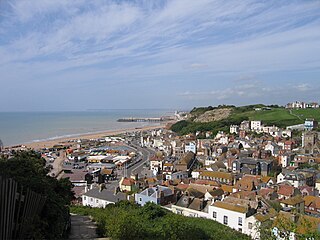
Hastings Old Town is an area in Hastings, England, roughly corresponding to the extent of the town prior to the nineteenth century. It lies mainly within the easternmost valley of the current town. The shingle beach known as The Stade is home to the biggest beach-launched fishing fleet in Britain.
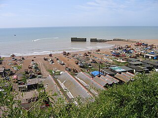
The Stade is a shingle beach in Hastings Old Town, Hastings, East Sussex, England. It has been used for beaching boats for more than a thousand years. It is now home to Europe's largest fleet of beach-launched fishing boats.
Mudeford is a harbourside and beachside parish based on a former fishing village in the east of Christchurch, Dorset, England, fronting water on two sides: Christchurch Harbour and the sands of Avon Beach.
Worthing is a large seaside town in Sussex, England in the United Kingdom. The history of the area begins in Prehistoric times and the present importance of the town dates from the 19th century.
St Andrew's Church is the Church of England parish church of Tarring, West Sussex, England. Founded in the 11th century in a then rural parish which had earlier been granted to the Archbishop of Canterbury, the church remained a peculier of Canterbury for many centuries thereafter. It served nearby parishes when their churches fell into disrepair, John Selden was baptised here, and the church became a base for smuggling. The present building is mostly 13th-century, and its tall spire is a landmark in the area. The church is a Grade II* Listed Building.
Worthing, a seaside town with borough status in the United Kingdom, is connected to the rest of the country by a network of major roads, a mainline railway, frequent bus and coach services and a nearby airport. Its 19th-century growth was encouraged by the development of turnpikes and stagecoach routes to London and nearby towns. By the middle of that century railway services improved journey times and conditions significantly. Suburbanisation in the 20th century was assisted by a network of bus routes.
Worthing, a town with borough status in the English county of West Sussex, has 212 buildings with listed status. The Borough of Worthing covers an area of 8,030 acres (3,250 ha) on the south coast of England, facing the English Channel. The town's development in the early 19th century coincided with nearby Brighton's rise as a famous, fashionable resort, and Worthing became a quiet seaside town with a large stock of Victorian buildings. Residential growth in the 20th century absorbed nearby villages, and older houses, churches and mansions became part of the borough. The Town and Country Planning Act 1947, an act of Parliament effective from 1948, introduced the concept of "listing" buildings of architectural and historical interest, and Worthing Borough Council nominated 90 buildings at that time. More have since been added, but others have been demolished. As of 2009, Worthing has three buildings of Grade I status, 11 listed at Grade II*, 196 of Grade II status and three at the equivalent Grade C.
St Andrew the Apostle is an Anglican church in Worthing, West Sussex, England. Built between 1885 and 1886 in the Early English Gothic style by Sir Arthur Blomfield, "one of the last great Gothic revivalists", the church was embroiled in controversy as soon as it was founded. During a period of religious unrest in the town, theological tensions within Anglicanism between High church Anglo-Catholics and Low church Anglicans were inflamed by what the latter group saw as the church's "idolatrous" Roman Catholic-style fittings—in particular, a statue of the Virgin Mary which was seized upon by opponents as an example of a reversion to Catholic-style worship in the Church of England. The "Worthing Madonna" dispute delayed the consecration of the church by several years. English Heritage has listed the building at Grade C for its architectural and historical importance, and the adjacent vestry and vicarage are listed separately at Grade II.
St Botolph's Church is an Anglican church in the Heene area of the borough of Worthing, one of seven local government districts in the English county of West Sussex. It had 11th-century origins as a chapelry within the parish of West Tarring, but declined and fell into disuse by the 18th century. Neighbouring Worthing's rapid development as a seaside resort in the 19th century encouraged residential growth around the ancient village of Heene, and a new church with the same dedication was built to serve both Heene and the high-class planned estate of West Worthing. Edmund Scott's Early English Gothic-style church stands next to the fragmentary ruins of the old church, which are listed separately at Grade II.
Hastings Fishermen's Museum is a museum dedicated to the fishing industry and maritime history of Hastings, a seaside town in East Sussex, England. It is housed in a former church, officially known as St Nicholas' Church and locally as The Fishermen's Church, which served the town's fishing community for nearly 100 years from 1854. After wartime damage, occupation by the military and subsequent disuse, the building was leased from the local council by a preservation society, which modified it and established a museum in it. It opened in 1956 and is now one of the most popular tourist attractions in the town and borough of Hastings. The building, a simple Gothic Revival-style stone chapel, has been listed at Grade II by English Heritage for its architectural and historical importance.
The Brighton Fishing Museum is a registered independent museum established in co-operation with the local fishing community in 1994. This museum is dedicated to Brighton's fishing and seaside history. It is located a short distance to the west of Brighton Pier within an area known as the Fishing Quarter, occupying two of the arches on the Kings' Road, which runs along Brighton's beachfront. Admission is free and donations appreciated.
Littlehampton Lifeboat Station is located in the town of Littlehampton, in West Sussex, on the south coast of England.The station is on the harbour side on the eastern bank of the River Arun, a quarter mile from the harbour entrance and the pier. The current lifeboat house on Fisherman's Quay was built in 2002.
Worthing Lifeboat Station was located on Marine Parade, in the town of Worthing, in West Sussex.
This page is based on this Wikipedia article Text is available under the CC BY-SA 4.0 license; additional terms may apply. Images, videos and audio are available under their respective licenses.