
The Black Forest is a large forested mountain range in the state of Baden-Württemberg in southwest Germany, bounded by the Rhine Valley to the west and south and close to the borders with France and Switzerland. It is the source of the Danube and Neckar rivers.

Spessart is a Mittelgebirge, a range of low wooded mountains, in the States of Bavaria and Hesse in Germany. It is bordered by the Vogelsberg, Rhön and Odenwald. The highest elevation is the Geiersberg at 586 metres above sea level.

The Rhön Mountains are a group of low mountains in central Germany, located around the border area where the states of Hesse, Bavaria and Thuringia come together. These mountains, which are at the extreme southeast end of the East Hesse Highlands, are partly a result of ancient volcanic activity. They are separated from the Vogelsberg Mountains by the river Fulda and its valley. The highest mountain in the Rhön is the Wasserkuppe, which is in Hesse. The Rhön Mountains are a popular tourist destination and walking area.

The Kaufungen Forest is a range of steep, wooded hills straddling the border between the states of Hesse and Lower Saxony in central Germany. It takes its name from the town Kaufungen.

Lautertal is a municipality in the Vogelsbergkreis in Hesse, Germany.

The Fläming Nature Park is a nature park with 824 km2 in Saxony-Anhalt, Germany, opened in 2005. It is one of six nature parks in the state Saxony-Anhalt.

Schönbuch is an almost completely wooded area south west of Stuttgart and part of the Southern German Escarpment Landscape. In 1972 the centre zone of Schönbuch became the first nature park in Baden-Württemberg.

The Bavarian Rhön Nature Park straddles the junction of the German states of Bavaria, Hesse and Thuringia. 70 km2 of the total 125 km2 area of the nature park has been recognised by UNESCO as part of the Rhön Biosphere Reserve.
The organisation for the promotion of the Bavarian Rhön Nature Park was founded in 1967. On 26 November 1982 the regulation for the Naturpark Bayerische Rhön was issued and, in 1997, the Zweckverband became the Society for the Bavarian Rhön Nature Park and Biosphere Reserve.

The West Hesse Highlands, also known as the West Hessian Lowlands and Highlands, are a heavily forested region of the Central Uplands in Germany. These highlands lie mainly within the state of Hesse, between that part of the Rhenish Massif right of the Rhine in the west, the Weser Uplands to the north, the Hessian Central Uplands to the east and the Wetterau to the south.
The East Hesse Highlands describes a heavily wooded range of hills lying mainly in the German state of Hesse, but also extending a little way into Lower Saxony to the north, Thuringia to the east and Bavaria to the southeast. The region is sandwiched between the West Hesse Depression to the west, the Weser Uplands to the north, the Thuringian Basin to the northeast, the northwestern edge of the Thuringian Forest to the east, the Spessart to the south and the Wetterau to the southwest.

The Saalhausen Hills are a range of hills up to 687.7 m above sea level (NN) high in the Sauerland region within the districts of Olpe and Hochsauerlandkreis in the German state of North Rhine-Westphalia. They are part of the Rhine Massif and lie within the Süder Uplands.

The TERRA.vita Nature Park is located in the German states of Lower Saxony and North Rhine-Westphalia and is divided into northern and southern areas. The park is also known as the Osnabrück Land Nature Park and sometimes by its old name of North Teutoburg Forest-Wiehen Hills Nature Park.
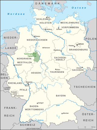
The Teutoburg Forest / Egge Hills Nature Park is a nature park founded in 1965 in the northeast of the German state of North Rhine-Westphalia. After being expanded in 2008, the nature park is now the largest in Germany, covering an area of 2,700 square kilometres (1,000 sq mi). The park comprise the southern Teutoburg Forest and Egge Hills.

The Southern Black Forest Nature Park is located in Baden-Württemberg in Germany and covers an area of 394,000 hectares. As of 2018, it is Germany's largest nature park.

The Upper Hessian Ridge or Upper Hesse Ridge is a hill chain in the West Hesse Highlands in North and Middle Hesse, which lies on the Rhine-Weser watershed and links the montane Central Upland ranges of the Kellerwald and the Vogelsberg in a north-south direction. The swell is divided into the Gilserberg Heights in the north, the central Neustadt Saddle and the Northern Vogelsberg Foreland in the south.

The German-Luxembourg Nature Park is a cross-border nature park, which was established on 17 April 1964 by state treaty between the German state of Rhineland-Palatinate and the Grand Duchy of Luxembourg. It thus became the first cross-border nature park in Western Europe. On the German side Naturpark Südeifel is providing services for visitors.

The is a large volcanic mountain range in the German Central Uplands in the state of Hesse, separated from the Rhön Mountains by the Fulda river valley. Emerging approximately 19 million years ago, the Vogelsberg is Central Europe's largest basalt formation, consisting of a multitude of layers that descend from their peak in ring-shaped terraces to the base.
The Taunus Nature Park is a nature park in Central Germany with an area of 134,775 hectares (1347.75 km2) in the Central Upland range of the Taunus. It is one of two Hessian nature parks in the Taunus and the second largest nature park in Hesse.

The Rhine-Westerwald Nature Park is a nature park in Germany that covers an area of around 470 km2 to the east of the River Rhine and in the north of the state of Rhineland-Palatinate between Neuwied and Unkel. It extends from the Rhine over its eastern bank terraces up to the first hill ridge of the Lower Westerwald. The Rhine-Westerwald Nature Park is over 60 years old, making it one of the oldest in Germany. It was founded in 1962 and celebrated its 50th anniversary in 2012. Its legal owner is the society of Naturpark Rhein-Westerwald.

The Nagelfluhkette is a mountain range located in Bavaria, Germany and Vorarlberg, Austria, bordering on the northern edge of the Allgäu Alps. It has a maximum altitude of 1,834 m above sea level. Its name derives from the rock type Nagelfluh. In older and geological literature, as well as in the local vernacular language, one also finds the term Hochgratkette.

