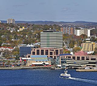
Dartmouth is a built-up community of Halifax Regional Municipality, Nova Scotia, Canada. Located on the eastern shore of Halifax Harbour, Dartmouth has 72,139 residents as of 2021.

Lower Sackville is a suburban community of the Halifax Regional Municipality, Nova Scotia, Canada.

Highway 111 is a 13-kilometre (8 mi) controlled-access highway in Halifax Regional Municipality, Nova Scotia, Canada.

Highway 107 in Nova Scotia runs through the eastern suburbs of the Halifax Regional Municipality, from the Burnside Industrial Park in Dartmouth to an intersection with Trunk 7 in Musquodoboit Harbour. It is 43.2 km (26.8 mi) long, and is mostly two lane, controlled access highway.

Highway 118 is a divided highway connecting Dartmouth with Highway 102 at Fall River, 14 kilometres (8.7 mi) to the north in the Canadian province of Nova Scotia.
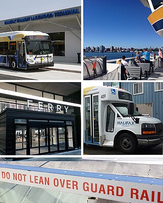
Halifax Transit is a Canadian public transport service operating buses and ferries in Halifax, Nova Scotia. Founded as Metro Transit in March 1981, the agency runs two ferry routes, 66 conventional bus routes, three regional express routes, and three rural routes. Halifax Transit also operates Access-a-Bus, a door-to-door paratransit service for senior and disabled citizens.
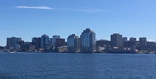
Downtown Halifax is the primary central business district of the Municipality of Halifax. Located on the central-eastern portion of the Halifax Peninsula, on Halifax Harbour. Along with Downtown Dartmouth, and other de facto central business districts within the Municipality, Downtown Halifax serves as the business, entertainment, and tourism hub of the region.
Rockingham is a community located within the urban area of the Municipality of Halifax, in Nova Scotia, Canada.
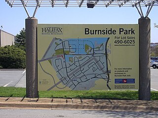
Burnside is a Canadian urban neighbourhood located along the northeast shore of Bedford Basin of the Halifax Regional Municipality in Dartmouth, Nova Scotia.
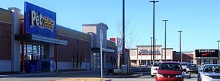
Dartmouth Crossing is a commercial real estate development in Dartmouth, a part of Halifax Regional Municipality, Nova Scotia, Canada.
Albro Lake is a neighbourhood in the North End of the community of Dartmouth in Nova Scotia's Halifax Regional Municipality.
Shannon Park is an urban neighbourhood and former national defence site in the north end of Dartmouth on the eastern shore of Halifax Harbour in the Halifax Regional Municipality (HRM) in Nova Scotia, Canada. It is immediately south of the A. Murray MacKay Bridge in the community of Dartmouth. It straddles Highway 111, a CN Rail freight line, and Halifax Harbour. It is bordered on the south by Tuft's Cove.

Wallis Heights is a Canadian urban neighbourhood in Nova Scotia's Halifax Regional Municipality.
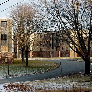
Crystal Heights is a neighborhood in the north end of the Dartmouth area in Nova Scotia's Halifax Regional Municipality.

Halifax Regional Municipality has a multi-modal transportation network.
Naval Radio Station Albro Lake was a naval radio station operated by the Royal Canadian Navy (RCN).
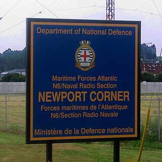
Naval Radio Section Newport Corner is a Canadian Forces naval radio station located in Brooklyn, Nova Scotia. Founded in 1942, it is still in operation today but remotely controlled from CFB Halifax.
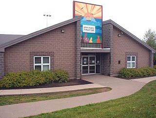
Dartmouth North Community Centre is a Community centre in Albro Lake a neighbourhood in the north end of the community of Dartmouth in Nova Scotia's Halifax Regional Municipality. Albro Lake is also known as District 9.
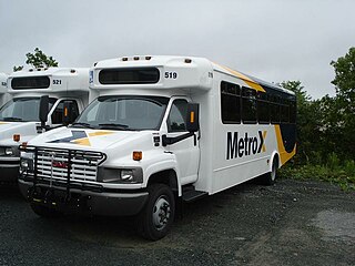
MetroX is a rural express bus service operating in the Canadian province of Nova Scotia. Operated by Halifax Transit, MetroX service is available on three limited-stop fully accessible express routes within the Halifax Regional Municipality. All routes link to downtown Halifax, with one from Upper Tantallon, one from Fall River and Halifax Stanfield International Airport, and one from Porters Lake.
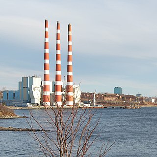
Tufts Cove is an urban neighbourhood in the community of Dartmouth, Nova Scotia, Canada. It is situated on the eastern shore of Halifax Harbour in the North End of Dartmouth. The neighbourhood boundaries of Tufts Cove are approximately from Albro Lake Road in the south to Highway 111 in the north, and from Victoria Road in the east with the harbour to the west.
