
Dartmouth is an urban community and former city located in the Halifax Regional Municipality of Nova Scotia, Canada. Dartmouth is located on the eastern shore of Halifax Harbour. Dartmouth has been nicknamed the City of Lakes, after the large number of lakes located within its boundaries.

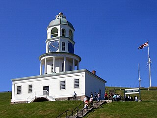
Halifax is the capital and largest municipality in the Canadian province of Nova Scotia, and the largest municipality in Atlantic Canada. As of the 2021 Census, the municipal population was 439,819, with 348,634 people in its urban area. The regional municipality consists of four former municipalities that were amalgamated in 1996: Halifax, Dartmouth, Bedford, and Halifax County.

The Zatzman Sportsplex is an indoor sports and community centre in Dartmouth, Nova Scotia, opened 1982 and known as the Dartmouth Sportsplex until 2019. It houses an arena, a gymnasium, two swimming pools, and other fitness, leisure and events facilities. It is managed by the Dartmouth Sportsplex Community Association, a non-profit organization which runs the facility on behalf of the Halifax Regional Council.

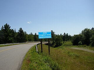
Cole Harbour is a former village and current community located in Nova Scotia, Canada that is part of the Halifax Regional Municipality
Crichton Park is a residential neighbourhood in the Dartmouth area of the Halifax Regional Municipality, Nova Scotia. It is located in the north end of Dartmouth close to the Macdonald and MacKay bridges, Brightwood Golf and Country Club, Mic Mac Mall and Lake Banook. Crichton Park is home to Crichton Park Elementary school.
Halifax, Nova Scotia, was originally inhabited by the Miꞌkmaq. The first European settlers to arrive in the future Halifax region were French, in the early 1600s, establishing the colony of Acadia. The British settled Halifax in 1749, which sparked Father Le Loutre's War. To guard against Miꞌkmaw, Acadian, and French attacks on the new Protestant settlements, British fortifications were erected in Halifax (1749), Bedford (1749), Dartmouth (1750), and Lawrencetown (1754). St. Margaret's Bay was first settled by French-speaking Foreign Protestants at French Village, Nova Scotia, who migrated from Lunenburg, Nova Scotia, during the American Revolution. All of these regions were amalgamated into the Halifax Regional Municipality (HRM) in 1996. While all of the regions of HRM developed separately over the last 250 years, their histories have also been intertwined.
Portland Estates is a suburban neighbourhood in Woodlawn, an area of eastern Dartmouth in the Halifax Regional Municipality, Nova Scotia. It reaches from Eisener Blvd. in the west, all the way to Portland Hills in the east, and is located to the south of Portland Street.
Portland Hills is a subdivision in Dartmouth Nova Scotia that is part of the Halifax Regional Municipality. It is located east of Morris Lake and Portland Estates. It formed in 2001-2008 as an extension of the community of Portland Estates along Portland Street. The neighbourhood is home to the Portland Hills Centre, which includes Irish themed pub, Finbars. Running through Portland Hills is Birches Park, which includes the Portland Hills Greenway 2.2 kilometre trail.
Woodlawn is an area of eastern Dartmouth, Nova Scotia in the Halifax Regional Municipality, Nova Scotia that is mainly residential and retail. It is situated within an area with Highway 111 on the west, Portland Street on the east and Main Street on the North side. The first three digits of the postal code are B2W.
Commodore Park is a mostly residential neighbourhood in the Dartmouth community of the Halifax Regional Municipality, Nova Scotia. It is located in the east end of Dartmouth in the Woodlawn area. Prince Andrew High School is located within this area.

Halifax Public Libraries (HPL) is a Canadian public library system serving residents of Halifax, Nova Scotia. It is the largest public library system in Nova Scotia, with over 2.8 million visits to library branches and 172,520 active registered borrowers or 44% of the municipality's population. With roots that trace back to the establishment of the Citizens' Free Library in 1864, the current library system was created in 1996 during municipal amalgamation, and now consists of 14 branches and a collection of almost 1 million items.
The Halifax Regional Municipality (HRM) in the Canadian province of Nova Scotia is composed of more than 200 communities and neighbourhoods. As of the 2016 Census, the municipality has a landmass of 549,035 hectares and is home to 403,131 people.
Dartmouth founded in 1750, is a Metropolitan Area and former city in the Canadian province of Nova Scotia.
Grahams Corner is a mostly residential neighbourhood in located on the eastern shore of Lake Banook in Dartmouth area of Halifax Regional Municipality, Nova Scotia.
Russell Lake West is a planned residential subdivision and commercial development in the eastern part of the community of Dartmouth in the Halifax Regional Municipality, Nova Scotia. The area began construction in 2006 with the creation of Exit 8 on Highway 111, providing access from the southwest to the area via Mount Hope Avenue, which as of October 2011, Exit 8 also provides direct access into the Woodside Industrial Park. Russell Lake West is located next to the community of Woodside and a park and walking trails provide direct access to and from Woodside. The subdivision covers 251 ha, and houses approximately 3,200 people. and houses approximately 3,200 people.
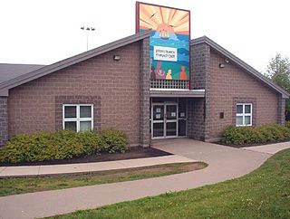
Dartmouth North Community Centre is a Community centre in Albro Lake a neighbourhood in the north end of the community of Dartmouth in Nova Scotia's Halifax Regional Municipality. Albro Lake is also known as District 9.
The Battle at St. Croix was fought during Father Le Loutre's War between Gorham's Rangers and Mi'kmaq at Battle Hill in the community of St. Croix, Nova Scotia. The battle lasted from March 20–23, 1750.

The Raid on Dartmouth occurred during Father Le Loutre's War on May 13, 1751, when a Miꞌkmaq and Acadian militia from Chignecto, under the command of Acadian Joseph Broussard, raided Dartmouth, Nova Scotia, destroying the town and killing twenty British villagers and wounding British regulars. The town was protected by a blockhouse on Blockhouse Hill with William Clapham's Rangers and British regulars from the 45th Regiment of Foot. This raid was one of seven the Natives and Acadians would conduct against the town during the war.

Fort Clarence was a British coastal fort built in 1754 at the beginning of the French and Indian War in Dartmouth, Nova Scotia, Canada. The battery was built on the grant of Capt. John Rous. Initially it had 8 guns mounted. In the spring of 1759, a Mi'kmaq attack on the Eastern Battery killed five soldiers.
Tam O'Shanter Ridge is a mostly residential neighbourhood in the Dartmouth area of Halifax Regional Municipality, Nova Scotia. It is located in the east end of Dartmouth on the outer fringe of Westphal, north of Commodore Park.

