Highland Council wards 1999 to 2007

Last updated

ScotlandHighlands.png
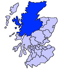
Highland council area
Shown as one of the council areas of Scotland
1995 to 1999 wards
1999 to 2007 wards
2007 to 2017 wards
2017 wards

The second set of Highland Council wards, 80 in number, became effective for election purposes in 1999, for the second general election of the Highland Council, [1] and were used also for the third general election in 2003. These wards replaced 72 older wards, and were themselves replaced by a set of 22 wards for the fourth general election in 2007.

Contents

The Highland Council (Comhairle na Gaidhealtachd in Gaelic) had become a local government authority in 1996, when the two-tier system of regions and districts was abolished and the Highland region became a unitary council area, under the Local Government etc (Scotland) Act 1994. The first Highland Council election, however, was one year earlier, in 1995. Until 1996 councillors shadowed the regional and district councils and planned for the transfer of powers and responsibilities. Elections to the council are normally on a four-year cycle, all wards being contestable at each election.

For the periods 1995 to 1999 and 1999 to 2007, each ward elected one councillor by the first past the post system. In 2007, this arrangement was replaced with one of multi-member wards, each electing three or four councillors by the single transferable vote system, to produce a form of proportional representation.

The wards used from 1995 to 1999 had been subdivisions of eight council management areas, with councillors elected from each area forming an area committee. The wards created in 1999, however, were not exactly subdivisions of the management areas, management area boundaries were not adjusted to take account of new ward boundaries and, therefore, area committees ceased to be exactly representative of areas for which they were named and for which they took decisions.

In 2007, the management areas were replaced with three new corporate management areas, each consisting of a whole number of the new multi-member wards.

Lists of wards, 1999 to 2007

Wards are listed by management area to which linked for area committee purposes.

Badenoch and Strathspey wards

There were five wards related to the Badenoch and Strathspey management area:

WardDescription
Badenoch EastIncluded parts of the villages of Aviemore and Kingussie
Badenoch WestIncluded the village of Newtonmore and part of the village of Kingussie
Grantown on SpeyIncluded the town of Grantown on Spey
Strathspey North EastA rural area around the town of Grantown on Spey
Strathspey SouthIncluded part of the village of Aviemore

Caithness wards

There were 10 wards related to the Caithness management area:

WardDescription
Caithness CentralIncluded the village of Halkirk
Caithness North EastIncluded the villages of Dunnet and John o' Groats
Caithness North WestIncluded the village of Castletown
Caithness South EastIncluded the village of Lybster
PultneytownIncluded the Pultneytown area of the town of Wick
Thurso CentralPart of the town of Thurso
Thurso EastPart of the town of Thurso
Thurso WestPart of the town of Thurso
WickIncluded part of the town of Wick and a more rural area to the north
Wick WestIncluded part of the town of Wick

Inverness wards

The management area included Loch Ness, Strathglass and the former royal burgh of Inverness.

Inverness was granted city status in 2001 and the Highland Council then used the 'city' title in reference to the Inverness management area. Letters patent refer, however, to the 'Town of Inverness' and, although there is a former 'royal burgh' which had defined boundaries, there is no 'town' with such boundaries.

'Urban Inverness', below, refers to the area centred on the former royal burgh and generally urban in character during the 1999 to 2007 period.

There were 23 wards related to the management area:

WardDescription
Ardersier, Croy and PettyA rural area to the east of urban Inverness
Included Fort George, Inverness Airport, and the village of Ardersier.
BallifearyThe Ballifeary and Bught areas of western urban Inverness.
BallochThe Balloch and southern Culloden areas to the east of urban Inverness.
Beauly and StrathglassA rural area to the far west of the management area.
Included Strathglass and Glen Affric, and the villages of Beauly and Cannich.
CanalThe Dalneigh and Muirtown areas of western urban Inverness.
CulduthelThe Culduthel and Castle Heather areas in southern urban Inverness, and the rural Slackbuie area further south.
CullodenThe Seafield and northern Culloden area to the east of urban Inverness.
CrownThe Crown area in central urban Inverness.
DrumossieThe urban Cradlehall area east of Inverness, and the rural Drumossie district to its south.
Included the villages of Daviot, Moy, and Tomatin.
HiltonThe New Hilton area in southern urban Inverness.
InshesThe Culcabock and Drakies areas in eastern urban Inverness, and the Inshes and Milton of Leys areas to their south.
Inverness CentralThe City Centre, Haugh, and Longman areas of central and northern urban Inverness.
Inverness WestThe Kinmylies, Leachkin, and Torvean areas of western urban Inverness, and the rural area to the south-west.
Included the villages of Dochgarroch and Lochend.
KirkhillThe Clachnaharry area in north-western urban Inverness and the rural Aird district to the west.
Included the villages of Kirkhill and Kiltarlity.
LochardilThe Drummond and Lochardil areas in southern urban Inverness.
Loch Ness EastA rural area to the east of Loch Ness.
Included the villages of Dores and Foyers.
Loch Ness WestA rural Glen Urquhart and Glen Moriston areas to the west of Loch Ness.
Included the villages of Drumnadrochit and Fort Augustus.
MerkinchThe South Kessock and northern Merkinch areas in north-western urban Inverness.
MiltonThe Milton and Old Hilton areas of southern urban Inverness.
MuirtownThe Carse and southern Merkinch areas of western urban Inverness.
RaigmoreThe Raigmore area in eastern urban Inverness.
ScorguieThe Scorguie area in the western urban Inverness.
Westhill and SmithtonThe Westhill and Smithton areas east of urban Inverness.

Lochaber wards

There were eight wards related the Lochaber management area:

WardDescription
Ardnamurchan and MorvernIncluded the Ardnamurchan and Morvern peninsulas and the village of Acharacle
Caol Caol area of Fort William
Claggan and Glen SpeanIncluded the village of Spean Bridge
Fort William NorthPart of Fort William
Fort William SouthPart of Fort William and a more rural area to the south
GlencoeIncluded the village of Kinlochleven
Kilmallie and InvergaryIncluded Loch Lochy
Mallaig and Small IslesIncluded the town of Mallaig and the Small Isles

Nairn wards

The Nairn management area was mostly rural.
Ward boundaries radiated from the town of Nairn (a former burgh), dividing the town between all four wards:

WardDescription
Nairn AlltanThe north-western part of the town and an area further west
Nairn AuldearnThe south-eastern part of the town, and the rural southern area of the management area
Included the villages of Auldearn and Piperhill
Nairn CawdorThe Tradespark area in the south-west of the town, and the rural area further south-west
Included the village of Cawdor
Nairn NinianThe central Fishertown and Town Centre areas of the town, and a rural area to the east

Ross and Cromarty wards

There were 18 wards related to the Ross and Cromarty management area:

WardDescription
Alness and ArdrossIncluded the town of Alness and the village of Ardross
Avoch and FortrosePart of the Black Isle, with coastline along the Moray Firth
Includes the villages of Avoch and Fortrose
Black Isle NorthPart of the Black Isle, with coastline along the Cromarty Firth
Includes the village of Cromarty
Conon and MaryburghIncluded the village of Conon Bridge
Dingwall NorthIncludes part of the town of Dingwall
Dingwall SouthIncluded part of the town of Dingwall
FerindonaldHad coastline on the north side of the Cromarty Firth, between Dingwall and Alness
GairlochIncluded the village of Gairloch
InvergordonIncludes the town of Invergordon
Knockbain and KillearnanPart of the Black Isle, with coastline along the Beauly Firth and the Moray Firth
Included the village of Munlochy and North Kessock
LochbroomIncluded the town of Ullapool
LochcarronIncluded the village of Lochcarron
Muir of OrdIncluded the village of Muir of Ord
Rosskeen and SaltburnHad coastline on the north side of the Cromarty Firth, east of Alness
SeaboardIncluded the Seaboard Villages
Strathpeffer and StrathcononIncluded the village of Strathpeffer and upper Strathconon
Tain EastIncluded part of the town of Tain
Tain WestIncluded part of the town of Tain

Skye and Lochalsh wards

The Skye and Lochalsh management area included the islands of Skye, Raasay and Scalpay, the village of Kyle of Lochalsh on the mainland, and a rural area to the east of Kyle of Lochalsh. There were six wards related to the Skye and Lochalsh area:

WardDescription
KinlochshielA mainland area, east of the village of Kyle of Lochalsh
Kyle and SleatIncluded the villages of Kyle of Lochalsh, on the mainland, and Kyleakin, on the Isle of Skye, and the Sleat peninsular of the Isle of Skye
PortreeIncluded the town of Portree, on the Isle of Skye
Skye CentralIncluded the town of Broadford, one the Isle of Skye, and the islands of Raasay and Scalpay
Skye WestIncluded the village of Dunvegan, on the Isle of Skye
Snizort and Trotternish Trotternish peninsular, north of Portree, on the Isle of Skye
Included the village of Uig

Sutherland wards

There were six wards related to the Sutherland management area:

WardTowns and villages
BroraIncluded the town of Brora
Dornoch FirthAreas both sides of the Dornoch Firth
Included the town of Dornoch
Golspie and RogartIncluded the villages of Golspie and Rogart
Sutherland CentralIncluded the villages of Lairg and Bonar Bridge
Sutherland North WestIncluded the villages of Durness and Lochinver
Tongue and FarrIncluded the villages of Tongue, Farr, Bettyhill and Reay

See also

Notes and references

  1. Highland Council website, accessed 29 February 2008

Related Research Articles

<span class="mw-page-title-main">Highland (council area)</span> Council area of Scotland

Highland is a council area in the Scottish Highlands and is the largest local government area in the United Kingdom. It was the 7th most populous council area in Scotland at the 2011 census. It shares borders with the council areas of Aberdeenshire, Argyll and Bute, Moray and Perth and Kinross. Their councils, and those of Angus and Stirling, also have areas of the Scottish Highlands within their administrative boundaries.

<span class="mw-page-title-main">Lochaber</span> Ward management area of the Highland Council

Lochaber is a name applied to a part of the Scottish Highlands. Historically, it was a provincial lordship consisting of the parishes of Kilmallie and Kilmonivaig, as they were before being reduced in extent by the creation of Quoad Sacra parishes in the 19th century. Lochaber once extended from the Northern shore of Loch Leven, a district called Nether Lochaber, to beyond Spean Bridge and Roybridge, which area is known as Brae Lochaber or Braigh Loch Abar in Gaelic. Lochaber is now also used to refer to a much wider area, one of the 16 ward management areas of the Highland Council of Scotland and one of eight former local government districts of the two-tier Highland region. The main town of Lochaber is Fort William.

<span class="mw-page-title-main">Ross and Cromarty</span> Area in the Highlands and Islands of Scotland

Ross and Cromarty, sometimes referred to as Ross-shire and Cromartyshire, is a variously defined area in the Highlands and Islands of Scotland. There is a registration county and a lieutenancy area in current use, the latter of which is 8,019 square kilometres in extent. Historically there has also been a constituency of the Parliament of the United Kingdom, a local government county, a district of the Highland local government region and a management area of the Highland Council. The local government county is now divided between two local government areas: the Highland area and Na h-Eileanan Siar. Ross and Cromarty border Sutherland to the north and Inverness-shire to the south.

<span class="mw-page-title-main">County of Nairn</span> Historic county in Scotland

The County of Nairn is a historic county, registration county and lieutenancy area of Scotland. The county was used for local administration until the county council, based at the county town of Nairn, was abolished in 1975 under the Local Government (Scotland) Act 1973, the area becoming one of the eight districts of the two-tier Highland region. This arrangement ended in 1996 when the Highland council area was made a unitary authority.

<span class="mw-page-title-main">Badenoch and Strathspey</span> Local government ward in Scotland

Badenoch and Strathspey is a former district of Highland region, Scotland.

<span class="mw-page-title-main">Skye and Lochalsh</span> A government district of the former Highland Region of Scotland

Skye and Lochalsh is one of eight former local government districts of the two-tier Highland region of Scotland. The main offices of the Skye and Lochalsh district council were in Portree, on the Isle of Skye.

<span class="mw-page-title-main">Inverness, Nairn, Badenoch and Strathspey (UK Parliament constituency)</span> Parliamentary constituency in the United Kingdom, 2005 onwards

Inverness, Nairn, Badenoch and Strathspey is a constituency of the House of Commons of the UK Parliament. As with all seats since 1955 it elects one Member of Parliament (MP) by the first past the post system of election.

<span class="mw-page-title-main">Ross, Skye and Lochaber (UK Parliament constituency)</span> Parliamentary constituency in the United Kingdom, 2005 onwards

Ross, Skye and Lochaber is a constituency of the House of Commons of the Parliament of the United Kingdom (Westminster). It elects one Member of Parliament (MP) by the first past the post system of election.

<span class="mw-page-title-main">Caithness, Sutherland and Easter Ross (Scottish Parliament constituency)</span> Region or constituency of the Scottish Parliament

Caithness, Sutherland and Easter Ross was a constituency of the Scottish Parliament (Holyrood), in use between 1999 and 2011. It elected one Member of the Scottish Parliament (MSP) by the first past the post method of election. Also, however, it was one of eight constituencies in the Highlands and Islands electoral region, which elects seven additional members, in addition to eight constituency MSPs, to produce a form of proportional representation for the region as a whole.

<span class="mw-page-title-main">Ross, Skye and Inverness West (Scottish Parliament constituency)</span>

Ross, Skye and Inverness West was a constituency of the Scottish Parliament (Holyrood). It elected one Member of the Scottish Parliament (MSP) by the first past the post method of election. Also, however, it is one of eight constituencies in the Highlands and Islands electoral region, which elects seven additional members, in addition to eight constituency MSPs, to produce a form of proportional representation for the region as a whole.

<span class="mw-page-title-main">Highland Council wards and councillors 2003 to 2007</span>

The second general election to the Highland Council was held in May 2003, using 80 wards created for the first election, in 1999. In 1999 and 2003 each ward elected one councillor by the first past the post system of election. Elections are held on a four-year cycle: therefore the next general election is scheduled for 2007.

<span class="mw-page-title-main">Inverness East, Nairn and Lochaber (Scottish Parliament constituency)</span> Region or constituency of the Scottish Parliament

Inverness East, Nairn and Lochaber was a constituency of the Scottish Parliament (Holyrood). It elected one Member of the Scottish Parliament (MSP) by the first past the post method of election. It was one of eight constituencies in the Highlands and Islands electoral region, which elects seven additional members, in addition to constituency MSPs, to produce a form of proportional representation for the region as a whole.

<span class="mw-page-title-main">Politics of the Highland council area</span>

The politics of the Highland council area in Scotland are evident in the deliberations and decisions of the Highland Council, in elections to the council, and in elections to the House of Commons of the Parliament of the United Kingdom (Westminster) and the Scottish Parliament (Holyrood). In the European Parliament the area was within the Scotland constituency, which covers all of the 32 council areas of Scotland.

<span class="mw-page-title-main">Highland Council wards and councillors 1999 to 2003</span>

The first general election to the Highland Council was held in May 1999, using 80 wards created for that election, and which remain in use today. Each ward elects one councillor by the first past the post system of election. Elections are held on a four-year cycle: therefore the next general election was in 2003.

<span class="mw-page-title-main">Highland Council wards created in 2007</span>

The third set of Highland Council wards, 22 in number, became effective for election purposes in 2007, for the fourth general election of the Highland Council. The new wards were created under the Local Governance (Scotland) Act 2004, and are as defined in recommendations of the Local Government Boundary Commission for Scotland.

<span class="mw-page-title-main">Highland Council wards 1995 to 1999</span>


The first set of Highland Council wards was first used for Highland Council election purposes in 1995, for the first general election of the council. They were replaced with 80 new wards for the second general election in 1999.

<span class="mw-page-title-main">The Highland Council</span> Scottish unitary authority council in Highland, Scotland, UK

The Highland Council, the political body covering the Highland local authority created in 1995, comprises 21 wards, each electing three or four councillors by the single transferable vote system, which creates a form of proportional representation. The total number of councillors is 74, and the main meeting place and main offices are in Glenurquhart Road, Inverness.

<span class="mw-page-title-main">Inverness-shire</span> Historic county in Scotland

Inverness-shire is a historic county, registration county and lieutenancy area of Scotland. Covering much of the Highlands and Outer Hebrides, it is Scotland's largest county, though one of the smallest in population, with 67,733 people or 1.34% of the Scottish population.

<span class="mw-page-title-main">Skye, Lochaber and Badenoch (Scottish Parliament constituency)</span> Constituency of the Scottish Parliament

Skye, Lochaber and Badenoch is a constituency of the Scottish Parliament (Holyrood) covering part of the Highland council area. It elects one Member of the Scottish Parliament (MSP) by the first past the post method of election. It is also one of eight constituencies in the Highlands and Islands electoral region, which elects seven additional members, as well as eight constituency MSPs, to produce a form of proportional representation for the region as a whole.

<span class="mw-page-title-main">Highland Council Wards in 2017</span> Administrative regions of Scotland

The fifth set of Highland Council wards, 21 in number, became effective for election purposes in 2017, for the fifth general election of the Highland Council. The new wards were created under the Local Governance (Scotland) Act 2004, and are as defined in recommendations of the Local Government Boundary Commission for Scotland. The commission's report includes maps of the new wards
Generally, descriptions above are inferred from the maps.