Highway 302 (Thailand)

Last updated
Thai Highway-302.svg
National Highway 302
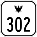
ทางหลวงแผ่นดินหมายเลข 302
Route information
Length17.808 km [1]  (11.065 mi)
Existed1985–present
Major junctions
West end Bang Yai, Nonthaburi
Major intersections Ratchaphruek Road
Tiwanon Road
Si Rat Expressway
Vibhavadi Rangsit Road
Phahonyothin Road
East end Chatuchak, Bangkok
Location
Country Thailand
Major cities Bang Bua Thong, Mueang Nonthaburi, Lak Si
Highway system

Highway 302 is a national highway in greater Bangkok, Thailand. It includes two connecting roads: Rattanathibet Road and Ngam Wong Wan Road.

Contents

Route 302 is 17.808 kilometres (11.065 mi) long, of which 15.12 kilometres (9.40 mi) is in Nonthaburi, and 2.688 kilometres (1.670 mi) is in Bangkok. [1]

Rattanathibet Road

Rattanathibet Road (Thai : ถนนรัตนาธิเบศร์) starts at Kanchanaphisek Road (Motorway Route 9) in Sao Thong Hin subdistrict, Bang Yai District, Nonthaburi, and runs east through Bang Bua Thong District, passes Bang Kruai - Sai Noi Road (Route 3215) at Bang Phlu intersection (Thai : ถนนบางกรวย - ไทรน้อย) and Mueang Nonthaburi district, passes Ratchaphruek Road (Thai : ถนนราชพฤกษ์) at Bang Rak Noi intersection and crosses the Chao Phraya River on the Phra Nang Klao Bridge and Phra Nang Klao Parallel Bridge, passes Nonthaburi 1 Road (Thai : ถนนนนทบุรี 1) (Route 3110) and passes Liang Mueang Nonthaburi Road and continues east until it ends at Khae Rai intersection, where it intersects with Tiwanon Road (Route 306) and the route continues as Ngam Wong Wan Road.

Ngam Wong Wan Road

Ngam Wong Wan Road (Thai : ถนนงามวงศ์วาน) continues east from Rattanathibet Road at Khae Rai intersection in Nonthaburi, crossing into Bangkok at Lak Si District, then passing through Chatuchak District, ending at Kaset intersection, where it intersects with Phahonyothin Road. Via a bypass tunnel beneath Kasetsart, the road continues as Prasoet Manukit Road (Thailand Route 351).

Ngam Wong Wan Road is named for Damrong Ngamwongwan (Thai : ดำรง งามวงศ์วาน), a Department of Highways engineer who oversaw construction of the road. It was a policy of the Plaek Phibunsongkhram government that new roads be named for their chief engineers.

Related Research Articles

<span class="mw-page-title-main">Nonthaburi province</span> Province of Thailand

Nonthaburi is one of the central provinces (changwat) of Thailand, established by the Act Establishing Changwat Samut Prakan, Changwat Nonthaburi, Changwat Samut Sakhon and Changwat Nakhon Nayok, Buddhist Era 2489 (1946), which came into force on 9 May 1946 (Thursday).

<span class="mw-page-title-main">Bang Kruai district</span> District in Nonthaburi, Thailand

Bang Kruai is a district (amphoe) in the southern part of Nonthaburi province, central Thailand.

<span class="mw-page-title-main">Bang Yai district</span> District in Nonthaburi, Thailand

Bang Yai is a district (amphoe) in the western part of Nonthaburi province, central Thailand.

<span class="mw-page-title-main">Pathum Wan district</span> District in Bangkok, Thailand

Pathum Wan is one of the fifty districts (khet) of Bangkok, Thailand. It lies just beyond the old city boundary of Khlong Phadung Krung Kasem, and was a rural area on the eastern outskirts of the city when royal villas were built there in the late nineteenth century. The district was officially established in 1915, and covers an area of 8.37 square kilometres (3.23 sq mi). A large part of the district area is taken up by the campus of Chulalongkorn University and the green expanses of Lumphini Park and the Royal Bangkok Sports Club. By the turn of the 20th–21st centuries, the district had become known as the modern-day city centre, home to the prominent shopping areas of Siam and Ratchaprasong.

<span class="mw-page-title-main">Phasi Charoen district</span> Khet in Bangkok, Thailand

Phasi Charoen is one of the 50 districts (Khet) of Bangkok, Thailand. The district is bounded by other Bangkok districts : Taling Chan, Bangkok Noi, Bangkok Yai, Thon Buri, Chom Thong, Bang Bon, and Bang Khae.

<span class="mw-page-title-main">Thai highway network</span>

The Thai highway network follows the left-hand traffic rule of the road. The network is the twin responsibility of the Department of Highways, and the Department of Rural Roads, under the oversight of the Transportation ministry of Thailand. Public highways are also called public roads, especially when part of urban streets. The network spans over 70,000 kilometers across all regions of Thailand. Most are single carriageways. Dual carriageways have frequent u-turn lanes and intersections slowing down traffic. Coupled with the increase in the number of vehicles and the demand for a limited-access motorway, the Thai Government issued a Cabinet resolution in 1997 detailing the motorway construction master plan. Some upgraded sections of highway are being turned into a "motorway", while other motorways are not being built from highway sections.

The MRT Brown Line is a 22.1 km rapid transit line in Bangkok, Thailand proposed monorail mass transit line from Nonthaburi Civic Centre, Nonthaburi Province to Lam Sali intersection, Bang Kapi District. 20 stations are proposed for the line and the expected cost for the project is 48 billion baht. The line has been integrated for 7.2km with the N2 expressway project and a feasibility study has been completed. The MRT Brown line will interchange with 7 other mass transit lines.

Pak Kret is a city in Nonthaburi province, Thailand. It lies in the Central Thai plains on the east bank of the lower Chao Phraya River, bordering Bangkok to the east, Mueang Nonthaburi district of Nonthaburi province to the south, and Pathum Thani province to the north. It is part of the Bangkok Metropolitan Region megalopolis. With a registered population of 190,272, Pak Kret is the third most populous city municipality in Thailand.

<span class="mw-page-title-main">Nonthaburi Civic Center MRT station</span>

Nonthaburi Civic Center station is a Bangkok MRT station on the Purple Line. The station is located on the Rattanathibet road in Nonthaburi Province.

<span class="mw-page-title-main">Charan Sanit Wong Road</span>

Charan Sanit Wong Road is a main road in Bangkok's Thonburi side, it is named in honour of Luang Charan Sanit Wong, the former Permanent Secretary, Ministry of Transport. Its name has been misspelled as จรัลสนิทวงศ์ in Thai according to the 1999 Royal Institute Dictionary.

<span class="mw-page-title-main">Phra Nang Klao Bridge MRT station</span>

Phra Nang Klao Bridge station is a Bangkok MRT station on the Purple Line. The station opened on 6 August 2016 and is located on Rattanathibet road on the eastern end of Phra Nang Klao Bridge crossing the Chao Phraya River in Nonthaburi Province. The station has three entrances.

<span class="mw-page-title-main">Phra Nang Klao Hospital</span> Hospital in Nonthaburi , Thailand

Phra Nang Klao Hospital is the main public hospital of Nonthaburi Province, Thailand and is classified under the Ministry of Public Health as a regional hospital. It is capable of initial tertiary-level care. Its closest rapid transit station is Phra Nang Klao Bridge MRT station on the MRT Purple Line. It is the main teaching hospital of the School of Medicine, Siam University and an affiliated teaching hospital of the Faculty of Medicine Siriraj Hospital, Mahidol University.

<span class="mw-page-title-main">Wong Sawang</span> Khwaeng in Thailand

Wong Sawang is a khwaeng (subdistrict) of two subdistricts of Bang Sue District, Bangkok, apart from Bang Sue Subdistrict. It is also the name of the surrounding area.

Tha It is a tambon (sub-district) in Pak Kret district, Nonthaburi province, outskirts Bangkok.

<span class="mw-page-title-main">Phra Nang Klao Bridge</span> Bridge in Thailand

Phra Nang Klao Bridge is a 4-lane bridge over Chao Phraya River in the area of Mueang Nonthaburi District, Nonthaburi Province.

<span class="mw-page-title-main">Arun Amarin Road</span> Road in Bangkok, Thailand

Arun Amarin Road is a road in Thunburi side of Bangkok.

Khae Rai is the name of a major road intersection and its surrounding neighborhood in downtown Nonthaburi, a northern suburb city of Bangkok and the administrative seat of Nonthaburi province. Formed by the crossing of Ngam Wong Wan/Rattanathibet and Tiwanon roads, it lies within Bang Kraso subdistrict of Mueang Nonthaburi district, and is home to government offices of both the city and the province as well as commercial and residential developments. It will serve as a mass transit interchange between the MRT Purple Line and the under-construction Pink Line, as well as the planned Brown Line.

References

  1. 1 2 Highway information database Archived 2009-04-26 at the Wayback Machine , Department of Highways (in Thai). Retrieved on August 7, 2009.