| List of controlled-access highway in Thailand |
| Shield | Official name | Other name(s) | From | To | Length | Opened | Owner | Operator | Status |
 Expressway Expressway |
|---|
 | Chaloem Maha Nakhon Expressway | First Stage Expressway System | Tha Ruea Interchange | Din Daeng Toll Plaza | 8.9 km (5.5 mi) | 29 October 1981;43 years ago (1981-10-29) | Expressway Authority of Thailand | Expressway Authority of Thailand & Bangkok Expressway and Metro
60:40 revenue share | Operational |
| Bang Na Interchange | 7.9 km (4.9 mi) | 17 January 1983;42 years ago (1983-01-17) |
| Dao Khanong Interchange | 10.3 km (6.4 mi) | 5 December 1987;37 years ago (1987-12-05) |
| | Si Rat Expressway | Second Stage Expressway System | Section A | Pracha Chuen Toll Plaza | Asok Interchange | 12.4 km (7.7 mi) | 2 September 1993;31 years ago (1993-09-02) |
| Section B | Phaya Thai Interchange | Bang Khlo Interchange | 9.4 km (5.8 mi) | 6 October 1996;28 years ago (1996-10-06) |
| Section C | Pracha Chuen Toll Plaza | Chaeng Watthana Interchange | 8 km (5.0 mi) | 2 September 1993;31 years ago (1993-09-02) | Bangkok Expressway and Metro |
| Section D | Asok Interchange | Srinagarindra Interchange | 8.7 km (5.4 mi) | 2 December 1998;26 years ago (1998-12-02) |
| Double-Decker Expressway [1] | Pracha Chuen Toll Plaza | Asok Interchange | 17.0 km (10.6 mi) | TBA | TBA | Under Planning |
|---|
| | Chalong Rat Expressway | Kanchanapisek–Ramindra–At Narong Expressway | Section 1 | Watcharaphol Interchange | At Narong Interchange | 18.7 km (11.6 mi) | 6 October 1996;28 years ago (1996-10-06) | Expressway Authority of Thailand | Operational |
| Section 2 | Chatuchot Interchange | 9.5 km (5.9 mi) | 23 March 2009;15 years ago (2009-03-23) |
| Chatuchot-Lam Luk Ka Expressway | Section 3 | Chatuchot Interchange | Lam Luk Ka Road | 16.2 km (10.1 mi) | 2027;2 years' time (2027) | Under construction [2] |
| | Burapha Withi Expressway | Bang Na –Chonburi Expressway | Bang Na Interchange | Chon Buri Toll Plaza | 55 km (34 mi) | 9 April 1998;26 years ago (1998-04-09) | Operational |
| Burapha Withi Expressway Extension [3] | Chon Buri Toll Plaza | Nong Mai Daeng Interchange | 4.5 km (2.8 mi) | TBA | - | Under Planning |
|---|
| | S1 Expressway | • Third Stage Expressway System, S1 section
• At Narong–Bang Na Expressway | Bang Na Interchange | At Narong Interchange | 4.1 km (2.5 mi) | 15 June 2005;19 years ago (2005-06-15) | Expressway Authority of Thailand | Operational |
 | Kanchanaphisek Expressway (Southern part of Kanchanaphisek Road) | • Bang Phli–Suk Sawat Expressway
• South Kanchanapisek Road | Wat Salut Interchange | Bang Kru Interchange | 22.1 km (13.7 mi) | 15 November 2007;17 years ago (2007-11-15) |
| | Udon Ratthaya Expressway | Bang Pa-in–Pak Kret Expressway | Phase 1 | Chaeng Watthana Interchange | Chiang Rak Interchange | 22.0 km (13.7 mi) | 2 December 1998;26 years ago (1998-12-02) | Bangkok Expressway and Metro |
| Phase 2 | Chiang Rak Interchange | Kanchanaphisek Interchange (Bang Pa In Toll Plaza) | 10.0 km (6.2 mi) | 1 November 1999;25 years ago (1999-11-01) |
| | Prachim Ratthaya Expressway | Si Rat–Outer Ring Road Expressway | Si Rat Interchange | Chim Phli Toll Plaza | 16.7 km (10.4 mi) | 22 August 2016;8 years ago (2016-08-22) |
 | Don Mueang Tollway | Uttaraphimuk Elevated Tollway | Din Daeng - The National Memorial Section | Din Daeng Toll Plaza | The National Memorial Toll Plaza (abolished) | 20.9 km (13.0 mi) | 14 December 1994;30 years ago (1994-12-14) | Department of Highway | Don Mueang Tollway Public Company |
 [4] [4] | The National Memorial - Rangsit Section | The National Memorial Toll Plaza (abolished) | Rangsit Toll Plaza (abolished) | 7.33 km (4.55 mi) | 3 December 1998;26 years ago (1998-12-03) | Department of Highway | Toll abolished since 2004 [5] |
| | Rama 3 - Dao Khanong - Western Outer Ring Road | Bang Khlo Interchange | Bang Khun Thian Interchange | 18.7 km (11.6 mi) | 2025;0 years ago (2025) | Expressway Authority of Thailand | Expressway Authority of Thailand | Under construction |
| | Si Rat - Sukhontasawat Underground Expressway | Ngam Wong Wan Interchange | Sukhontasawat Junction | 10.32 km (6.41 mi) | TBA | TBA | Under Planning |
|---|
| | Chalong Rat - Kanchanaphisek Road Expressway | Sukhontasawat Junction | Lat Bua Khao Interchange | 6.77 km (4.21 mi) |
| | Kathu - Patong Expressway | Phra Phuket Kaeo Road | Phra Mettha Road | 3.98 km (2.47 mi) | Project Approved |
| Intercity Motorway |
|---|
 | Intercity Motorway No.5 | Northern Route Motorway | Rangsit - Bang Pa In Section [6] | Rangsit Toll Plaza (abolished) | Bang Pa In Interchange 1 | 22 km (14 mi) | TBA | Department of Highway | TBA | Project Approved |
|---|
| Bang Pa In - Nakhon Sawan Section | Bang Pa In Interchange 1 | Highway No.117 | 175 km (109 mi) | Under Planning |
| Nakhon Sawan - Phitsanulok Section | TBA | 142 km (88 mi) |
|---|
| Phitsanulok - Lampang Section | 182 km (113 mi) |
| Lampang - Lamphun Section | 60 km (37 mi) |
| Lamphun - Chiang Mai Section | 39 km (24 mi) |
| Chiang Mai - Chiang Khong Section | 292 km (181 mi) |
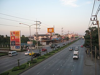
 | Intercity Motorway No.6 | Bang Pa In - Nakhon Ratchasima Section | Kanchanaphisek Road | Nakhon Ratchasima Interchange | 195.8 km (121.7 mi) | December 27, 2023;13 months ago (2023-12-27)(Pak Chong - Nakhon Ratchasima; 80 km) [7]
2025;0 years ago (2025)(Full route) | BTS Group & Gulf Energy | Partially Operational |
| Nakhon Ratchasima - Khon Khaen Section | Kham Thale So Interchange (future) | Khon Khaen Interhchange | 203.33 km (126.34 mi) | TBA | - | Under Planning |
|---|
| Khon Khaen - Nong Khai Section | Kosum Phisai Interchange (future) | N/A | 160 km (99 mi) |
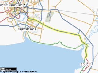
   | Intercity Motorway No.7 | Bangkok - Chon Buri New Road | Section 1 | Srinagarindra Interchange | Khiri Nakhon Interchange | 78.8 km (49.0 mi) | December 1, 1998;26 years ago (1998-12-01) | Department of Highway | Operational |
| Chon Buri - Pattaya Road | Section 2 | Khiri Nakhon Interchange | Sukhumvit-Motorway Junction | 47.165 km (29.307 mi) | March 28, 2010;14 years ago (2010-03-28) |
| Pattaya - Map Ta Put Road | Section 3 | Map Prachan Interchange | U-Tapao Interchange | 32 km (20 mi) | March 1, 2021;3 years ago (2021-03-01) [8] |
| Srinagarindra - Suvarnabhumi Airport Elevated Road | Srinagarindra Interchange | Suvarnabhumi Airport Toll Plaza (future) | 18.5 km (11.5 mi) | TBA | TBA | Project Approved |
|---|
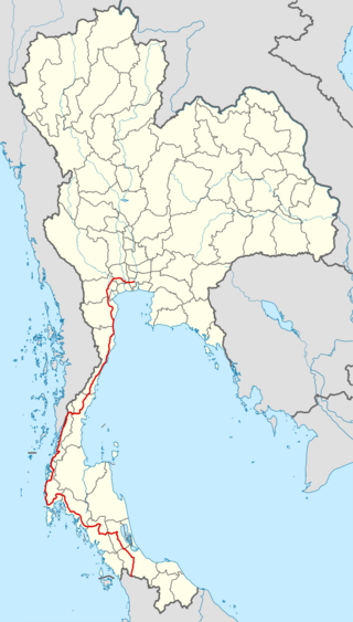
 | Intercity Motorway No.8 | Southern Route Motorway | Nakhon Pathom - Pak Tho Section | Laem Ko Bua Interchange | Pak Tho Interchange | 70.25 km (43.65 mi) |
| Pak Tho - Cha Am Section | Pak Tho Interchange | Tha Yang Interchange | 46.19 km (28.70 mi) |
| Cha Am - Chumphon Section | Tha Yang Interchange | TBA | 266 km (165 mi) | Under Planning |
|---|
| Chumphon - Ban Na San Section | TBA | 200 km (120 mi) |
|---|
| Ban Na San - Phatthalung Section | 168 km (104 mi) |
| Phatthalung - Hat Yai Section | 80 km (50 mi) |
| Hat Yai - Su-ngai Kolok section | 215 km (134 mi) |
 | Intercity Motorway No.9 | • Kanchanaphisek Road • Bangkok's 2nd Ring Road | Eastern Section | Bang Pa In 2 Interchange | Wat Salut Interchange | 64 km (40 mi) | 1998;27 years ago (1998) | Department of Highways | Operational |
 | Western Section (Ground Level) | Bang Kru Interchange | Bang Pa In Interchange 1 | 84.127 km (52.274 mi) | 1978;47 years ago (1978)
(as a part of  Highway No.340) Highway No.340)
1995;30 years ago (1995)(renumbered to  Highway No.37) Highway No.37)
1996;29 years ago (1996)(renumbered to  Motorway No.9) Motorway No.9) |
| | Bang Khun Thian - Bang Bua Thong Section [9] | Bang Khun Thian Interchange | Bang Bua Thong Interchange | 38 km (24 mi) | TBA | TBA | Project Approved |
|---|
| Bang Bua Thong - Sam Khok Section | Bang Bua Thong Interchange | Bang Pa In Toll Plaza (future) | 23.5 km (14.6 mi) |
| Sam Khok - Bang Pa In Section | Bang Pa In Toll Plaza (future) | New Bang Pa In Interchange (future) | 16.5 km (10.3 mi) |
 | Intercity Motorway No.51 | Udon Ratthaya - Suphan Buri Motorway | Kanchanaphisek Interchange (Bang Pa In Toll Plaza) | TBA | 57 km (35 mi) | Under Planning |
|---|
 | Intercity Motorway No.52 | Lampang - Phayao Motorway | TBA | 191 km (119 mi) |
|---|
 | Intercity Motorway No.53 | Chiang Rai - Chiang Khong Motorway | 77 km (48 mi) |
 | Intercity Motorway No.54 | Mae Sod - Phitsanulok Motorway | 205 km (127 mi) |
 | Intercity Motorway No.61 | Laem Chabang Port - Prachinburi Motorway [10] [11] | Laem Chabang Port - Highway No.331 Section | Laem Chabang Port | Highway No.331 | 20.942 km (13.013 mi) |
| Highway No.331 - Prachinburi Section | Highway No.331 | Highway No.3340 | 44.5 km (27.7 mi) |
 | Intercity Motorway No.62 | Nakhon Sawan - Chong Mek Border Checkpoint Motorway | TBA | 594 km (369 mi) |
|---|
 | Intercity Motorway No.63 | Phitsanulok - Nakhon Phanom Motorway | 667 km (414 mi) |
 | Intercity Motorway No.64 | Bueng Kan - Chong Chom Border Checkpoint/Chong Sa-ngam Border Checkpoint Motorway | 481 km (299 mi) |
 | Intercity Motorway No.65 | Ubon Ratchathani - Na Tan Motorway | 109 km (68 mi) |
 | Intercity Motorway No.71 | Eastern Outer Ring Road - Chachoengsao - Sa Kaeo - Aranyaprathet Border Checkpoint Motorway | Lat Bua Khao Interchange | TBA | 204 km (127 mi) |
|---|
 | Intercity Motorway No.72 | Chonburi - Rayong - Trat Motorway | TBA | 271 km (168 mi) |
|---|
 | Intercity Motorway No.81 | Bang Yai - Ban Pong - Kanchanaburi - Ban Phu Namron Border Checkpoint Motorway | Bang Yai - Kanchanaburi Section | Bang Yai Interchange | Kanchanaburi Interchange | 96.41 km (59.91 mi) | April 19, 2024;9 months ago (2024-04-19)(์Nakhon Pathom - Kanchanaburi; 51 km) [12]
2025;0 years ago (2025)(Full route) | BTS Group & Gulf Energy | Partially Operational |
| Kanchanaburi - Ban Phu Namron Border Checkpoint Section | TBA | 82 km (51 mi) | TBA | TBA | Project Approved |
|---|
 | Intercity Motorway No.82 | Bang Khun Thai - Pak Tho Motorway | Bang Khun Thian - Ban Phaeo Section | Bang Khun Thian Interchange | Ban Phaeo Toll Plaza (under construction) | 24.6 km (15.3 mi) | 2025;0 years ago (2025)(Partially) 2026;1 year's time (2026)(Full route) | Under construction |
| Ban Phaeo - Pak Tho Section | Ban Phaeo Toll Plaza (under construction) | Pak Tho Interchange | 47 km (29 mi) | TBA | Project Approved |
|---|
 | Intercity Motorway No.83 | Chumphon - Ranong Motorway | TBA | 94 km (58 mi) | Under Planning |
|---|
 | Intercity Motorway No.84 | Hat Yai - Sadao Border Checkpoint | Phetkasem Road | Sadao Border Chekcpoint | 62.5 km (38.8 mi) | Project Approved [13] |
 | Intercity Motorway No.85 | Surat Thani - Phang Nga - Phuket Motorway | TBA | 236 km (147 mi) | Under Planning |
|---|
 | Intercity Motorway No.91 | Bangkok's 3rd Ring Road | Northern Section | Highway No.32 | Rangsit - Nakhon Nayok Road | 34 km (21 mi) |
| Eastern Section | Rangsit - Nakhon Nayok Road | Bang Na - Trat Road | 97 km (60 mi) |
| Southern Section | Bang Na - Trat Road | Highway No.35 | 77 km (48 mi) |
| Western Section | Highway No.35 | Highway No.32 | 101 km (63 mi) |
 | Intercity Motorway No.92 | Bangkok's 4th Ring Road | TBA |
|---|
| Total (Operational) | 634.022 km (393.963 mi) | |
|---|
| Total (Under construction) | 220.71 km (137.14 mi) |
|---|
| Total (Project approved) | 430.42 km (267.45 mi) |
|---|
| Total (Planned) | 5,545.362 km (3,445.728 mi) |
|---|

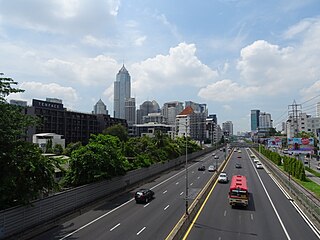
 Din Daeng - Tha Ruea section of the Chaloem Maha Nakhon Expressway, the first expressway in Thailand.
 Rama IX Bridge is the part of Tha Ruea - Dao Khanong section of the


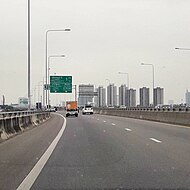


 Intercity Motorway No.6 and Lam Takhong Reservoir.
 Western part of