Highwood, Hamden

Last updated

Highwood
neighborhood
Highwood Square.jpg
Highwood Square mixed-use development
Coordinates: 41°20′35″N72°56′10″W / 41.343°N 72.936°W / 41.343; -72.936
Country United States
State Connecticut
County New Haven
Town Hamden
Population
4,959

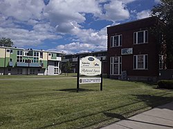
Highwood is a neighborhood in the south-central portion of the town of Hamden, Connecticut. It is primarily residential, with a mixture of small apartment buildings and single-family, two- and three-family homes. Commercial development is concentrated on its principal street, Dixwell Avenue. [1] Immigrants from Germany were the first to settle the area extensively in the 1860s, followed by others from Ireland, Italy, and Eastern Europe later in the nineteenth century. [2] Today it is predominantly African American. [3]

Contents

There are no officially established boundaries for the neighborhood. One map has it bounded on the north by Helen Street and Putnam Avenue, on the east by Newhall Street, on the south by the New Haven city line, and on the west by Fitch Street and Fairview Avenue. [4] The census tract with GEOID 09009165500, corresponding closely to these boundaries, had a population of 4,959, as of the 2010 census.

Several other names have been given to the neighborhood. The German immigrants named it Hamburg after the city in their homeland. It was given the Highwood name in 1888 by its first postmaster, Daniel Visel, while looking at tall trees through the window. [5] It is also known as South Hamden, [6] and its eastern portion has also been called Newhall; [7] however, it should not be confused with the adjoining Newhallville neighborhood in New Haven.

History

Enough German immigrants had settled in Hamburg by 1870 for a horsecar line to connect it to downtown New Haven [8] and the town of Hamden to establish a public school there. [9] By the 1880 census it had the largest population of five villages listed in town, 477. [10] A post office with the Highwood name was established in 1888, [11] and a volunteer fire department in 1896. [12] Immigration from Ireland and Italy led to the first Catholic church in 1890, [13] and a second in 1910. A railroad along the former route of the Farmington Canal led to establishment of a manufacturing area. [14] An airport briefly operated north of Morse Street for a few years around 1930, then that area was used as a circus grounds. [15] The area is now an industrial park. [16]

On July 10, 1989, a tornado rated F4 on the Fujita scale caused extensive damage to Highwood. It was one of the most serious in a tornado outbreak across the northeastern United States. [17]

Throughout the late nineteenth and early twentieth century, the Winchester Repeating Arms Company buried toxic waste in a portion of the neighborhood where homes were later built. In the largest residential cleanup program ever in Connecticut, thousands of tons of contaminated soil were removed from the area in 2010. The project was paid for by Olin Corporation, which had acquired the Winchester brand, and state bonding. [18]

Historic site

The Farmington Canal-New Haven and Northampton Canal, running through the neighborhood, is on the National Register of Historic Places. Its route has been converted to the Farmington Canal Heritage Trail, which is a portion of the East Coast Greenway.

Government

The Town of Hamden provides all municipal services for the neighborhood. It is located in Connecticut's 3rd congressional district. The neighborhood is in the 17th state senate district and the 94th state house district. [19] The portion of Highwood west of the Farmington Canal Heritage Trail is in the 3rd district of the town legislative council with the remainder in the 5th. [20] The western portion is served by the Hamden post office with ZIP code 06514 and the eastern by the Whitneyville post office, 06517.

Transportation

Most of Dixwell Avenue in Highwood is part of Connecticut Route 10. The state highway, southbound, turns west off Dixwell onto Arch Street, then southwest onto Fitch Street into New Haven.

The principal bus route in the neighborhood is CT Transit route 238 along Dixwell Avenue. Routes 234 and 237 operate on several other neighborhood streets. [21]

The Farmington Canal Heritage Trail has many access points in the neighborhood.

Education

There are no public schools in the neighborhood. Students attend public elementary schools elsewhere in Hamden, followed by Hamden Middle School and Hamden High School. [22] The former Newhall Street School is now the Borough496 business incubator. [23] There is also the Eli Whitney Technical High School, part of a state system. [24]

Recreation

John L. Carusone Field, formerly known as St. Ann's Park, has a playground and fields for various sports. [25] [26] Keefe Community Center provides a variety of services. [27]

Related Research Articles

<span class="mw-page-title-main">New Haven, Connecticut</span> City in Connecticut, United States

New Haven is a city in New Haven County, Connecticut, United States. It is located on New Haven Harbor on the northern shore of Long Island Sound and is part of the New York City metropolitan area. With a population of 135,081 as determined by the 2020 U.S. census, New Haven is the third largest city in Connecticut after Bridgeport and Stamford, the largest city in the South Central Connecticut Planning Region, and the principal municipality of Greater New Haven, which had a total population of 864,835 in 2020. Prior to 1960, it was the county seat of New Haven County until the county governments were abolished that year.

<span class="mw-page-title-main">Hamden, Connecticut</span> Town in Connecticut, United States

Hamden is a town in New Haven County, Connecticut, United States. The town's nickname is "The Land of the Sleeping Giant". The town is part of the South Central Connecticut Planning Region. The population was 61,169 at the 2020 census.

Newhall may refer to:

<span class="mw-page-title-main">East Rock, New Haven</span> Neighborhood of New Haven in Connecticut, United States

East Rock is a neighborhood in the city of New Haven, Connecticut, named for nearby East Rock, a prominent trap rock ridge. The area is home to a large group of Yale students, staff, and faculty, as well as many young professionals and families. Writing in the Times Literary Supplement, Hirsh Sawhney describes East Rock as a "yuppie enclave", which is "increasingly composed of wealthy professionals and graduate students, most of whom are affiliated with Yale University, whose lavish campus lies just over a mile away" East Rock is also a popular destination for cyclists, as a city bike lane runs along Orange Street, the neighborhood's spine. East Rock is the safest neighborhood in New Haven County. East Rock is home to East Rock Park, which is frequently visited by families and tourists.

<span class="mw-page-title-main">Connecticut Route 40</span> State highway in New Haven County, Connecticut, US

Route 40, also known as the Mount Carmel Connector, is a 3.08-mile (4.96 km) spur route from Interstate 91 in North Haven, Connecticut connecting I-91 and Bailey Road in North Haven to Route 10 in the Mount Carmel neighborhood of Hamden. Route 40 is a four-lane freeway with one intermediate exit leading to/from U.S. Route 5 in North Haven. It crosses over Route 15 but does not have an interchange with it. This is the only place in the state where two freeways cross without an interchange.

<span class="mw-page-title-main">Connecticut Route 22</span> State highway in New Haven County, Connecticut, US

Route 22 is a 14.07-mile-long (22.64 km) secondary state route within the U.S. state of Connecticut. Route 22 is an L-shaped road that is signed east–west from Hamden to the western junction of Route 80 in North Branford, and north–south to its eastern terminus in Guilford. It was designated in 1951 as a bypass of New Haven, connecting the Wilbur Cross Parkway and Route 80.

<span class="mw-page-title-main">Connecticut Route 10</span> State highway in Connecticut, US

Connecticut Route 10 is a state highway that runs between New Haven and the state line near Granby. It continues north of the state line as Massachusetts Route 10, which in turn continues directly to New Hampshire Route 10.

<span class="mw-page-title-main">Whitneyville, Connecticut</span> Neighborhood in New Haven, Connecticut, United States

Whitneyville is a neighborhood in the southeastern portion of the town of Hamden, Connecticut. It started in the early nineteenth century as a factory town for workers in Eli Whitney's gun factory. Around the turn of the twentieth century, it evolved into a trolley suburb of New Haven. Today it is primarily residential, with a mixture of single-family homes and small apartment and condominium buildings. There is some commercial development centered around the intersection of Whitney and Putnam avenues.

Newhallville is a neighborhood in the city of New Haven, Connecticut, named for industrialist George Newhall.

<span class="mw-page-title-main">Farmington Canal Heritage Trail</span>

The Farmington Canal Heritage Trail is an 81.2-mile (130.7 km) multi-use rail trail located in Connecticut and Massachusetts.

<span class="mw-page-title-main">Prospect Hill, New Haven</span> Historic district in Connecticut, United States

Prospect Hill is a neighborhood of the city of New Haven, Connecticut located in the north central portion of the city, directly north of Downtown New Haven. The neighborhood contains residences, institutional buildings of Albertus Magnus University and a portion of the main campus of Yale University, including the Science Hill area, the Hillhouse Avenue area and the Yale Peabody Museum. The City of New Haven defines the neighborhood to be the region bounded by the town of Hamden in the north, Winchester Avenue in the west, Munson Street/Hillside Place/Prospect Street in the southwest, Trumbull Street in the south, and Whitney Avenue in the east. Prospect Street is the main thoroughfare through the neighborhood.

<span class="mw-page-title-main">Prospect Hill Historic District (New Haven, Connecticut)</span> Historic district in Connecticut, United States

The Prospect Hill Historic District is an irregularly-shaped 185-acre (75 ha) historic district in New Haven, Connecticut. The district encompasses most of the residential portion of the Prospect Hill neighborhood.

<span class="mw-page-title-main">Winchester Repeating Arms Company Historic District</span> Historic district in Connecticut, United States

The Winchester Repeating Arms Company Historic District is a historic district in New Haven, Connecticut that was listed on the National Register of Historic Places in 1988. It includes 867 properties, which "include 858 major structures and 131 notable outbuildings." Of these structures, 876 are buildings deemed to contribute to the historical and/or architectural significance of the area, and most of these are residential. However the center of the district is "dominated" by the 75-acre (30 ha) tract of the former Winchester Repeating Arms Company, which contains industrial buildings.

The city of New Haven, Connecticut has many distinct neighborhoods. In addition to Downtown, centered on the central business district and the Green, are the following neighborhoods: the west central neighborhoods of Dixwell and Dwight; the southern neighborhoods of The Hill, historic water-front City Point, and the harborside district of Long Wharf; the western neighborhoods of Edgewood, West River, Westville, Amity, and West Rock; East Rock, Cedar Hill, Prospect Hill, and Newhallville in the northern side of town; the east central neighborhoods of Mill River and Wooster Square, an Italian-American neighborhood; Fair Haven, an immigrant community located between the Mill and Quinnipiac rivers; Quinnipiac Meadows and Fair Haven Heights across the Quinnipiac River; and facing the eastern side of the harbor, The Annex and East Shore.

Whitney Avenue is a principal arterial connecting Downtown New Haven with the town center of Hamden in the U.S. state of Connecticut. Most of the road within the city of New Haven is included in the Whitney Avenue Historic District, which is listed on the National Register of Historic Places. The designation begins at Grove Street in the northern part of Downtown New Haven and extends through the town of Hamden up to the Cheshire town line. North of Dixwell Avenue in Hamden Center, the road is a state highway and designated as part of Route 10. From the New Haven town line to Dixwell Avenue, the road is state-maintained with an unsigned designation of State Road 707. Within New Haven, Whitney Avenue is a town road. The J route of Connecticut Transit New Haven, which connects New Haven to Waterbury, runs along Whitney Avenue.

<span class="mw-page-title-main">Farmington Canal State Park Trail</span> Connecticut Nature Trail

Farmington Canal State Park Trail is a Connecticut state park forming a portion of the Farmington Canal Heritage Trail in the towns of Cheshire and Hamden. The developed section of the trail within state park boundaries runs over 17.0 miles (27.4 km) from Lazy Lane in Southington to Todd Street in Hamden and includes the historic Farmington Canal's restored Lock 12, located south of Brooksvale Road in Cheshire. The paved, multiple-use trail is used for hiking, biking, jogging, in-line skating and cross-country skiing.

<span class="mw-page-title-main">Mount Carmel, Hamden</span> Neighborhood in New Haven, Connecticut, United States

Mount Carmel is a neighborhood in the northeastern portion of the town of Hamden, Connecticut. It was the site of the first meeting house in what is now Hamden. Its founders named the area due to the resemblance of a range of hills nearby to the Mount Carmel mentioned in the Bible. The hills are better known today as the Sleeping Giant, site of a large state park known for its system of hiking trails. The neighborhood also contains the principal campus of Quinnipiac University. It is primarily residential with single-family homes. Commercial development is mostly along its principal street, Whitney Avenue.

<span class="mw-page-title-main">Centerville, Hamden</span> Neighborhood in New Haven, Connecticut, United States

Centerville, originally spelled Centreville, is a neighborhood in the east-central portion of the town of Hamden, Connecticut. It is the location of Hamden Town Hall and other major town government buildings. It derived its name from being at the intersection of the town's two principal thoroughfares, Whitney and Dixwell avenues, both with commercial development. The rest of the neighborhood is residential, with single-family houses, condominiums, and apartments.

<span class="mw-page-title-main">Spring Glen, Hamden</span> Neighborhood in New Haven, Connecticut, United States

Spring Glen is a neighborhood in the southeastern portion of the town of Hamden, Connecticut. It is primarily residential, mostly single-family homes with a few two-family. Commercial development is entirely on its principal street, Whitney Avenue. It was developed throughout the first half of the twentieth century as a trolley suburb of New Haven. It was named for the Spring Glen dairy farm established by James J. Webb in 1858 in what would become part of the neighborhood.

References

  1. "Neighborhood Scout overview of Morse St/Dixwell Ave".
  2. Becker, Martha May (1986). Hamden: Our Architectural Heritage. Whitney Press. p. 55.
  3. "2010 SCS 5-Year Estimates, Race, Census Tract 1655, New Haven County, Connecticut".
  4. Hartley, Rachel M. (1959). The History of Hamden, Connecticut, 1786-1959. Shoe String Press. Map in frontispiece.
  5. Hartley. History. p. 343.
  6. "South Hamden residents up in arms over rundown state of neighborhoods".
  7. "Some problems persist, but Newhall neighborhood in Hamden rebounds from industrial contamination".
  8. New Map of the City of New Haven (Map). Price, Lee & Co. 1870.
  9. Hartley. History. p. 315.
  10. Hartley. History. p. 331.
  11. Hartley. History. p. 343.
  12. Hartley. History. p. 396.
  13. Hill, Everett G. (1918). A Modern History of New Haven and Eastern New Haven County, Volume I. S.J. Clarke. p. 347.
  14. Hill. Modern History. p. 343.
  15. Becker, Martha May (1986). Hamden: Our Architectural Heritage. Whitney Press. p. 55.
  16. "Manufacturing Cluster".
  17. "F4 Tornado Slams into Southern Hamden".
  18. "Work Begins On Toxic Dig In Hamden".
  19. "Hamden State district map".
  20. "Legislative Council district map".
  21. "CT Transit New Haven local system map" (PDF).
  22. "Hamden Public Schools".
  23. "Bourough496".
  24. "Eli Whitney Technical High School".
  25. "John L. Carusone Field".
  26. "Coming upgrades designed to make Carusone Park in Hamden more kid-friendly".
  27. "Community Services".