
Mount Brandon or Brandon, at 952 metres (3,123 ft), is one of the ten highest peaks in Ireland, being the 8th–highest peak in Ireland on the Arderin list, and the 9th–highest on the Vandeleur-Lynam list. Brandon is the highest Irish mountain outside the MacGillycuddy's Reeks range and has the greatest prominence of any Irish peak except Carrauntoohil, Ireland's highest mountain.

The Essex County Ground (ECG) is a cricket venue in Chelmsford, Essex, England. It has been used by Essex County Cricket Club for first-class cricket since 1925 and List A matches since 1969, and has been the county's official home ground since 1967. The ground has a capacity of 6,500, mostly in single-tier seating with a single double-tiered stand. Its pavilion was completed in the 1970s.
Patriot Parliament is the name commonly used for the Irish Parliament session called by King James II during the Williamite War in Ireland which lasted from 1688 to 1691. The first since 1666, it held only one session, which lasted from 7 May 1689 to 20 July 1689.
Goose Hollow is a neighborhood in southwest Portland, Oregon, United States. It acquired its distinctive name through early residents' practice of letting their geese run free in Tanner Creek Gulch and near the wooded ravine in the Tualatin Mountains known as the Tanner Creek Canyon. Tanner Creek Gulch was a 20-block-long, 50-foot-deep (15 m) gulch that started around SW 17th and Jefferson and carried the waters of Tanner Creek into Couch Lake. Over a century ago, Tanner Creek was buried 50 feet (15 m) underground, and the Tanner Creek Gulch was infilled. Thus, the only remaining part of the hollow is the ravine carved out by Tanner Creek through which The Sunset Highway carrying US-26 passes and which the Vista Bridge spans.

Montana is one of the eight Mountain States, located in the north of the region known as the Western United States. It borders North Dakota and South Dakota to the east. Wyoming is to the south, Idaho is to the west and southwest, and the Canadian provinces of British Columbia, Alberta, and Saskatchewan are to the north, making it the only state to border three Canadian provinces.
The U.S. state of Tennessee is geographically diverse, with varying terrains and several distinct physiographic regions. Its landforms range from the Blue Ridge Mountains in the eastern part of the state to flat and fertile plains along the Mississippi River. The state is geographically, legally, culturally, and economically divided into three Grand Divisions: East Tennessee, Middle Tennessee, and West Tennessee.

Tourism in Belize has grown considerably recently, and it is now the second largest industry in the nation. Belizean Prime Minister Dean Barrow has stated his intention to use tourism to combat poverty throughout the country. The growth in tourism has positively affected the agricultural, commercial, and finance industries, as well as the construction industry. The results for Belize's tourism-driven economy have been significant, with the nation welcoming almost one million tourists in a calendar year for the first time in its history in 2012.

Itter Castle is a 19th-century castle in Itter, a village in Tyrol, Austria. In 1943, during World War II, it was turned into a Nazi prison for French VIPs. The castle was the site of an extraordinary instance of the U.S. Army, German Wehrmacht, Austrian Resistance, and the prisoners themselves fighting side-by-side against the Waffen-SS in the battle for Castle Itter in early May 1945 before the end of the war in Europe.

A roddon, also written as rodham, roddam or rodden, is the dried raised bed of a watercourse such as a river or tidal-creek, especially in The Fens in eastern England. Such raised silt and clay-filled beds are ideal for settlement in the less firm peat of The Fens. Many writers have followed the archaeologist Major Gordon Fowler's preference for the word roddon to define such structures though modern researchers suggest the word rodham is the more correct local word.

The Rumpi Hills are an undulating mountain range with its highest peak, Mount Rata about 1,800 m (5,900 ft) located between the villages of Dikome Balue and Mofako Balue, Ndian division in the Southwest region of Cameroon. The hills are situated at 4°50’N 9°07’E, cutting across four local councils, with the eastern slopes in Dikome Balue, southern slopes in Ekondo Titi, western slopes in Mundemba, and northern slopes in Toko local councils respectively. These hills are located about 80 km (50 mi) north of Mount Cameroon; about 50 km (31 mi) west of the Bakossi Mountains and some 15 km (9.3 mi) southeast of the Korup National Park.

Rio Culebra is a river or creek in Costilla County, Colorado. The Rio Culebra rises in the Sangre de Cristo Mountains and is 48 km (30 mi) long. It empties into the Rio Grande west of the town of San Luis. The region around San Luis features extensive agriculture made possible by irrigation water from the river. Sometimes called the "Culebra Basin" this area is known for the extensive irrigation canals called acequias built by its Hispanic settlers in the 19th century and still in use in the 21st century
The Slieve Felim Mountains are a mountain range in Munster, Ireland. They cover parts of County Limerick and County Tipperary. Historically, the name "Slieve Felim" meant the whole mountainous area between Murroe, Silvermines, Borrisoleigh and Dundrum, including the Silvermine Mountains and Mauherslieve. However, today the name usually only applies to the southwestern part, made up of Slieve Felim, Cullaun, Knockastanna and Gortnageragh.
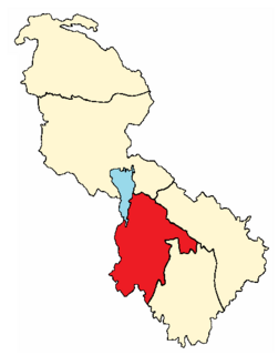
The barony of Mohill is an ancient barony in County Leitrim, Republic of Ireland.
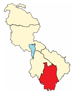
The barony of Leitrim is a barony in County Leitrim, Republic of Ireland.

Glencar Lough, locally known as Glencar Lake, is a freshwater lake in the northwest of Ireland. It covers an area of 1.15 square kilometres and lies mostly in County Leitrim with a smaller part in County Sligo. Glencar Waterfall is located near the lake's north shore on the Leitrim side.
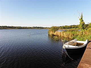
Lough Scur is a freshwater lake in south County Leitrim, northwest Ireland. It is part of the Shannon–Erne Waterway. There have been Human settlements here since the New Stone Age. Modern features include quays and moorings. Protected features are Castle John, three Crannogs, and the causeway into Rusheen Island, though "Jail Island" is not protected. The ecology of Lough Scur, and indeed all county Leitrim lakes, is threatened by pollution and invasive species such as curly waterweed, zebra mussel, and freshwater clam.
Drumaleague Lough is a very small freshwater in northwest Ireland. The ecology of Drumaleague Lough, and other Leitrim waterways, remain threatened by zebra mussel and other invasive species.
Cow Mountain Ridge is a ridge in Lake County, California and Mendocino County, California It joins Cow Mountain from the south.
