
Marmolada is a mountain in northeastern Italy and the highest mountain of the Dolomites. It lies between the borders of Trentino and Veneto. The Marmolada is an ultra-prominent peak (Ultra).

Piz Badile is a mountain of the Bregaglia range in the Swiss canton of Graubünden and the Italian region of Lombardy. The border between the two countries runs along the summit ridge. Its north-east face, overlooking the Swiss Val Bregaglia near Soglio, is considered one of the six great north faces of the Alps.

Tête Blanche is a mountain of the Pennine Alps on the Swiss-Italian border. Its summit is the tripoint between the valleys of Hérens, Mattertal and Valpelline, thus forming the linguistic tri-point between French, German, and Italian-speaking areas.

The Schwarzberghorn is a mountain of the Pennine Alps, located on the border between Switzerland and Italy. Its summit is the tripoint between the valleys Mattertal, Saastal and Valle Anzasca and the southernmost point of the Mischabel-Strahlhorn chain, and northern end of the Weissgrat.
The Latelhorn is a mountain of the Pennine Alps, located on the border between Switzerland and Italy. It lies between the valleys of Saas (Valais) and Antrona (Piedmont), just north of the Antrona Pass.

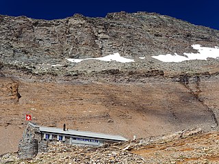
The Portjengrat is a mountain of the Pennine Alps, located on the border between Switzerland and Italy. It lies south of the Weissmies and the Zwischbergen Pass, where the international border diverges away from the main Alpine watershed. The summit of the Portjengrat has an elevation of 3,654 metres above sea level and is the tripoint between the valleys of Saas, Divedro and Antrona. It is the culminating point of the Antrona valley.
The Wasenhorn is a mountain of the Lepontine Alps, located on the border between Switzerland and Italy. It lies halfway between Brig and Varzo, just north of Monte Leone, in the Simplon Pass area. Politically the Wasenhorn is split between the municipalities of Ried-Brig and Varzo.

The Ofenhorn is a mountain of the Lepontine Alps on the Swiss-Italian border. It is located between the valleys of Binn and Formazza.
The Kastelhorn is a mountain of the Lepontine Alps, located on the border between Switzerland and Italy. It lies north of the Basòdino.
The Pointe Allobrogia is a mountain of the Mont Blanc massif, overlooking the Col Ferret on the border between Italy and Switzerland. It lies at the southern end of the range south-east of Mont Dolent.

The Surettahorn is a mountain in the Oberhalbstein Range of the Alps located on the border between Italy and Switzerland. It overlooks the Splügen Pass on its west side.
Piz Cotschen, also named Rötlspitz or Punta Rosa, is a mountain of the Ortler Alps, overlooking both the Umbrail and Stelvio Pass. Its summit is located within the Swiss canton of Graubünden, near the border with Italy.
The Punta Valgrande is a mountain of the Lepontine Alps, located on the border between Switzerland and Italy. The west side belongs to the Swiss canton of Valais and the east side belongs to the Italian region of Piedmont.
The Schwarzhorn is a mountain of the Lepontine Alps, located on the Swiss-Italian border, between the Binntal (Valais) and the Valle Dèvero (Piedmont). It lies north of the Scherbadung.
The Gross Schinhorn is a 2,939-metre-high (9,642 ft) mountain of the Lepontine Alps, located on the Swiss-Italian border.

The Marmontana is a mountain of the Lepontine Alps, located on the Swiss-Italian border.

La Spedla is a minor summit south of Piz Bernina on the border between Italy and Switzerland. With a height of 4,020 metres above sea level, it is the highest summit on the Italian side of the Bernina Range and the highest summit in Lombardy. Because of its small prominence it was included only in the enlarged list of alpine four-thousanders.

Monte Resegone or Resegone di Lecco, also known as Monte Serrada, is a mountain of the Bergamasque Prealps in Lombardy, northern Italy. It has an elevation of 1,875 m and is located on the border between the provinces of Bergamo and Lecco.

The Vincent Pyramid is a mountain of the Pennine Alps, located on the border between the Italian regions of Aosta Valley and Piedmont. The Vincent Pyramid makes up a large buttress of the huge multi-summited Monte Rosa. It lies south of the Ludwigshöhe on the border with Switzerland, between the Lysgletscher and the Piode Glacier. A seconday summit of the Vincent Pyramid, the Punta Giordani/Giordanispétz, lies to the southeast. Both Vincent Pyramid and Punta Giordani are on the official UIAA list of Alpine four-thousanders.

Pizzo Bianco is a mountain of the Pennine Alps, overlooking Macugnaga in the Italian region of Piedmont. It lies on the range north of the Punta Grober, between the Belvedere Glacier and the valley of Quarazza.

