
Bourbon whiskey is a type of American whiskey, a barrel-aged distilled spirit made primarily from corn. The name ultimately derives from the French Bourbon dynasty, although the precise inspiration for the whiskey's name is uncertain; contenders include Bourbon County in Kentucky and Bourbon Street in New Orleans, both of which are named after the dynasty. Bourbon has been distilled since the 18th century. The use of the term "bourbon" for the whiskey has been traced to the 1820s, with consistent use beginning in Kentucky in the 1870s. Although bourbon may be made anywhere in the United States, it is strongly associated with the American South and with Kentucky in particular. As of 2014, distillers' wholesale market revenue for bourbon sold within the U.S. was about $2.7 billion, and bourbon made up about two-thirds of the $1.6 billion of U.S. exports of distilled spirits.

Fleming County is a county located in the U.S. state of Kentucky. As of the 2010 census, the population was 14,348. Its county seat is Flemingsburg. The county was formed in 1798 and named for Colonel John Fleming, an Indian fighter and early settler. It is a moist county.

Westwood is a census-designated place (CDP) in Boyd County, Kentucky, United States. The population was 4,746 at the 2010 census. It serves as a suburb of the city of Ashland. Westwood is closely affiliated with Ashland, as it shares its ZIP code and bus system with the city. Westwood is located on a flat to hilly elevation just west of the Ohio River. The flat hilltop is unusual to eastern Kentucky and was created by the preglacial Teays River which existed in ancient times and flowed in the opposite direction of the Ohio River.

Greenville is a home rule-class city in Muhlenberg County, Kentucky, in the United States. It is the seat of its county. The population was 4,312 at the 2010 census.

Below are tables of congressional delegations from Kentucky to the United States House of Representatives and the United States Senate.

The Louisville metropolitan area or Kentuckiana, also known as the Louisville–Jefferson County, Kentucky–Indiana, metropolitan statistical area, is the 45th largest metropolitan statistical area (MSA) in the United States. The principal city is Louisville, Kentucky.
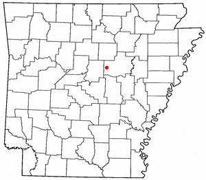
Romance is an unincorporated community in west-central White County, Arkansas, United States. The community is located approximately halfway between the town of Rose Bud to the north, and the unincorporated community of El Paso to the south. Alternately, the community is about 16 miles (26 km) northwest of Beebe, and less than 5 miles (8.0 km) east of Mount Vernon.
Hoosier Hill is the highest natural point in the state of Indiana at 1,257 feet (383 m) above sea level. It is in the rural area of Franklin Township, Wayne County to the northwest of Bethel. The nearest intersection to the high point is Elliot Road and County Line Road. The nearest major landmark is Interstate 70 and Richmond 11 miles (17.5 km) to the south.
Hooper Battery was a hilltop earthworks fortification, built for the Defense of Cincinnati during the American Civil War in Northern Kentucky by the Union Army to turn back invading Confederate troops. It was constructed to protect Cincinnati and the Ohio River valley. The battery overlooks the Licking River valley in an advantageous position.
Hager Hill is an unincorporated community in Johnson County, Kentucky, United States. Hager Hill is located approximately four miles south of Paintsville, the county seat of Johnson County.

Hilltop Manor is an unincorporated community in New Castle County, Delaware, United States. Hilltop Manor is located southeast of U.S. Route 13 Business between Bellefonte and Claymont.
Hilltop is an unincorporated community in Logan County, Kentucky, United States.

Hilltop is a census-designated place (CDP) in Fayette County, West Virginia, United States. Hilltop is located on West Virginia Route 16 and West Virginia Route 61 2 miles (3.2 km) south of Oak Hill. Hilltop has a post office with ZIP code 25855. As of the 2010 census, its population was 624.
Hilltop is an unincorporated community in Grayson County, Kentucky, United States. Hilltop is located on Kentucky Route 1214, 11.8 miles (19.0 km) east-southeast of Leitchfield.

Hilltop is a populated place situated in Cochise County, Arizona. It has an estimated elevation of 5,702 feet (1,738 m) above sea level.
Hilltop is a census-designated place (CDP) in Starr County, Texas, United States. It is a new CDP formed from part of the La Rosita CDP prior to the 2010 census with a population of 77.


