Hinton Parva

Last updated

Hinton Parva
Hinton Parva - geograph.org.uk - 322757.jpg
Hinton Parva
Dorset UK location map.svg
Red pog.svg
Hinton Parva
Location within Dorset
Population56 (2001 Census)
OS grid reference ST998044
Civil parish
District
Shire county
Region
Country England
Sovereign state United Kingdom
Post town WIMBORNE
Postcode district BH21
Dialling code 01202
Police Dorset
Fire Dorset and Wiltshire
Ambulance South Western
UK Parliament
Website valeofallen-pc.gov.uk
List of places
UK
England
Dorset
50°50′20″N2°00′11″W / 50.839°N 2.003°W / 50.839; -2.003

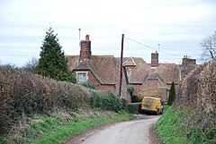
Hinton Parva is a hamlet and former civil parish, now in the civil parish of Hinton, in east Dorset, England, three miles north of Wimborne Minster. The parish had a population of 56 in 2001 [1] and included the nearby hamlet of Stanbridge. The civil parish was abolished on 1 April 2015 and merged with Hinton Martell to form Hinton parish. [2]

The first tier of local government is Vale of Allen Parish Council, which covers four neighbouring parishes as well as Hinton. [3]

Related Research Articles

<span class="mw-page-title-main">East Dorset</span> Former non-metropolitan district in England

East Dorset was a local government district in Dorset, England. Its council met in Wimborne Minster between 2016 and 2019.

<span class="mw-page-title-main">North Dorset</span> Former non-metropolitan district in England

North Dorset was a local government district in Dorset, England, between 1974 and 2019. Its area was largely rural, but included the towns of Blandford Forum, Gillingham, Shaftesbury, Stalbridge and Sturminster Newton. Much of North Dorset was in the River Stour valley, known as the Blackmore Vale. The economy of North Dorset was largely based on dairy agriculture.

<span class="mw-page-title-main">West Orchard</span> Human settlement in England

West Orchard is a small village and civil parish in the county of Dorset in southern England. It is situated in the Blackmore Vale in the North Dorset administrative district, approximately halfway between the towns of Shaftesbury and Sturminster Newton. It is separated from the adjacent settlement of East Orchard by a stream. In 2013 the civil parish had an estimated population of 50. For local government purposes the parish is grouped with the parishes of East Orchard and Margaret Marsh, to form a Group Parish Council.

<span class="mw-page-title-main">East Orchard</span> Human settlement in England

East Orchard is a small village and parish in the county of Dorset in southern England. It lies in the Blackmore Vale within the North Dorset administrative district. It is situated roughly midway between the hilltop town of Shaftesbury and the riverside town of Sturminster Newton. It is separated from the neighbouring village of West Orchard by a small stream. In 2013 the estimated population of the civil parish was 100. For local government purposes the parish is grouped with the parishes of West Orchard and Margaret Marsh, to form a Group Parish Council.

<span class="mw-page-title-main">Hinton St Mary</span> Village in Dorset, England

Hinton St Mary is a village and civil parish in Dorset, southern England. It is sited on a low Corallian limestone ridge beside the River Stour, one mile north of the market town Sturminster Newton. In 2001 the parish had 97 households and a population of 221. In 2013 the estimated population of the parish was 260.

<span class="mw-page-title-main">Caundle Marsh</span> Village in Dorset, England

Caundle Marsh is a village and civil parish in northwest Dorset, England, situated in the Blackmore Vale, 4 miles (6.4 km) southeast of Sherborne. The parish includes the hamlet of Tut Hill and the Dorset County Council estimate that in 2013 the population of the parish was 70.

<span class="mw-page-title-main">Coombe Keynes</span> Hamlet in Dorset, England

Coombe Keynes is a hamlet, civil parish and depopulated village in the Purbeck district of Dorset, England. The village is about 2 miles (3 km) south of Wool and about 5 miles (8 km) west-south-west of Wareham.

<span class="mw-page-title-main">Fifehead Neville</span> Human settlement in England

Fifehead Neville is a village and civil parish in the county of Dorset in southern England, situated in the Blackmore Vale about two miles southwest of the town of Sturminster Newton. In the 2011 census the population of the parish was 147.

<span class="mw-page-title-main">Folke</span> Parish in Dorset, England

Folke is a parish in the county of Dorset in southern England, situated in the Blackmore Vale, approximately 3.5 miles (5.6 km) south-east of Sherborne. The parish has an area of 2,120 acres (8.6 km2) and is made of the villages of Folke and Alweston, and the hamlet of Bishops Down. Dorset County Council's 2013 estimate of the population of Folke parish is 270. In the 2011 census figures have been published for the population of Folke parish combined with the small parish of North Wootton to the north; this was 339.

<span class="mw-page-title-main">Fontmell Magna</span> Human settlement in England

Fontmell Magna is a village and civil parish in Dorset, England. It is situated in the Blackmore Vale, close to the chalk hills of Cranborne Chase, on the A350 road five miles south of Shaftesbury and eight miles north of Blandford Forum. In the 2011 census the parish had a population of 734.

<span class="mw-page-title-main">Hinton Martell</span> Village in Dorset, England

Hinton Martell is a village and former civil parish, now in the civil parish of Hinton, in the county of Dorset in southern England. It lies within the East Dorset administrative district of the county, three miles north of the town of Wimborne Minster. In the 2001 Census the parish had a population of 368. The civil parish was abolished on 1 April 2015 and merged with Hinton Parva to form Hinton.

<span class="mw-page-title-main">Lydlinch</span> Human settlement in England

Lydlinch is a village and civil parish in the Blackmore Vale in north Dorset, England, about three miles west of Sturminster Newton. The village is sited on Oxford clay close to the small River Lydden. The parish – which includes the village of King's Stag to the south and the hamlet of Stock Gaylard to the west – is bounded by the Lydden to the east and its tributary, the Caundle Brook, to the north.

<span class="mw-page-title-main">Tarrant Hinton</span> Human settlement in England

Tarrant Hinton is a village and civil parish in the county of Dorset in southern England. It is situated in the Tarrant Valley, approximately five miles northeast of Blandford Forum. In 2013 the estimated population of the civil parish was 160.

<span class="mw-page-title-main">Hazelbury Bryan</span> Village in Dorset, England

Hazelbury Bryan is a village and civil parish in the county of Dorset in southern England. It is situated in the Blackmore Vale, approximately five miles southwest of the small town of Sturminster Newton. The parish includes the hamlets of Droop, Kingston, Parkgate, Pidney, Pleck, Wonston and Woodrow. In the 2011 census the parish had 480 dwellings, 454 households and a population of 1,059.

<span class="mw-page-title-main">Bishopstone, Swindon</span> Human settlement in England

Bishopstone is a village and civil parish in the Swindon unitary authority of Wiltshire, England, about 6 miles (10 km) east of Swindon, and on the county border with Oxfordshire. Since 1934 the parish has included the village of Hinton Parva.

<span class="mw-page-title-main">Margaret Marsh</span> Hamlet in Dorset, England

Margaret Marsh is a hamlet and civil parish in north Dorset, England. It is situated in the Blackmore Vale, halfway between the towns of Shaftesbury and Sturminster Newton. It is sited on Kimmeridge Clay close to a small tributary stream of the River Stour. In the 2001 census the parish had a population of 60. In 2013 the estimated population of the parish was 40. The parish church has a 15th-century tower and 13th-century font, but the rest of the building was rebuilt in 1873. For local government purposes the parish is grouped with the parishes of East Orchard and West Orchard, to form a Group Parish Council.

<span class="mw-page-title-main">Hamfallow</span> Human settlement in England

Hamfallow is a civil parish in the district of Stroud, Gloucestershire. There is no village centre, the parish consists of farms and hamlets such as Abwell, Breadstone, Halmore, Mobley and Wanswell.

<span class="mw-page-title-main">Dalton, South Yorkshire</span> Civil parish in South Yorkshire, England

Dalton is a civil parish in the Metropolitan Borough of Rotherham in South Yorkshire, England. Dalton is situated 162 miles (260.7 km) north from London and is 2 miles (3.2 km) north-east from the centre of Rotherham town centre. The population of the parish as taken at the 2011 Census was 10,292. The parish includes the communities of Brecks, Dalton Brook, Dalton Foljambe, Dalton Magna, Dalton Parva, Flanderwell, Sunnyside and Woodlaithes.

<span class="mw-page-title-main">Stoke Wake</span> Human settlement in England

Stoke Wake is a hamlet and civil parish, formerly part of the Whiteway hundred in north Dorset, England. It is situated under Bulbarrow Hill on the edge of the Blackmore Vale, west of Blandford Forum. Dorset County Council's 2013 mid-year estimate of the parish population is 60.

<span class="mw-page-title-main">Hinton Parva, Wiltshire</span> Human settlement in England

Hinton Parva, also known as Little Hinton, is a village in the Borough of Swindon in Wiltshire, England. It lies about 2 miles (3.2 km) from the eastern edge of the Swindon built-up area, and is separated from the town by farmland and the village of Wanborough. Hinton Parva was a separate civil parish until 1934, and is now in the parish of Bishopstone.

References

  1. "2001 Census Data: Hinton Parva". Dorset Data Online. Dorset County Council. Archived from the original on 19 May 2006 via Internet Archive.
  2. "The East Dorset (Reorganisation of Community Governance) Order 2015" (PDF). LGBCE. Archived from the original (PDF) on 15 October 2017. Retrieved 9 March 2018.
  3. "Vale of Allen Group Parish Council" . Retrieved 27 July 2023.