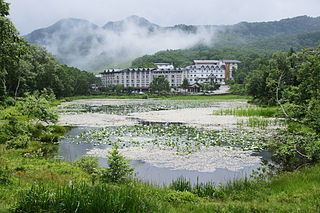
Nagano Prefecture is a landlocked prefecture of Japan located in the Chūbu region of Honshū. Nagano Prefecture has a population of 2,007,682 and has a geographic area of 13,561.56 square kilometres (5,236.15 sq mi). Nagano Prefecture borders Niigata Prefecture to the north, Gunma Prefecture to the northeast, Saitama Prefecture to the east, Yamanashi Prefecture to the southeast, Shizuoka Prefecture and Aichi Prefecture to the south, and Gifu Prefecture and Toyama Prefecture to the west.

The Central Highland, or Koshin Region, is an inland region on central Honshū in Japan. It forms the central part of the Chūbu region.

Matsukawa is a town located in Nagano Prefecture, Japan. As of 1 April 2019, the town had an estimated population of 13,043 in 4364 households, and a population density of 180 persons per km². The total area of the town is 72.79 square kilometres (28.10 sq mi). Like many other small Southern Nagano villages, it is famous for its apples.

Tenryū is a village located in Nagano Prefecture, Japan. As of 1 April 2019, the village had an estimated population of 1,275 in 712 households, and a population density of 12.1 persons per km². The total area of the village is 109.44 square kilometres (42.26 sq mi).
Shimoina is a district located in southern Nagano Prefecture, Japan.

The Tenryū River is a river in central Honshū, Japan. With a length of 213 km (132 mi), it is Japan's ninth longest river.
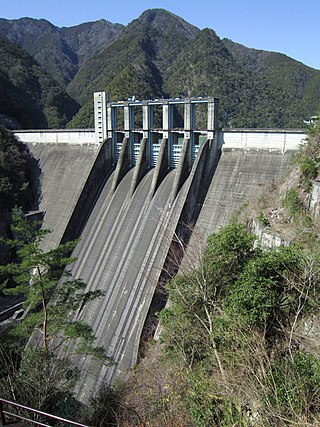
The Sakuma Dam is a dam on the Tenryū River, located on the border of Toyone, Kitashitara District, Aichi Prefecture on the island of Honshū, Japan. It is one of the tallest dams in Japan and supports a 350 MW hydroelectric power station. Nearby a frequency converter station is installed, allowing interchange of power between Japan's 50 Hz and 60 Hz AC networks.

Hiraoka Station is a railway station on the Iida Line in the village of Tenryū, Shimoina, Nagano Prefecture, Japan, operated by Central Japan Railway Company.
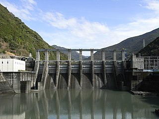
The Akiba Dam is a dam on the Tenryū River, located in Tenryū-ku, Hamamatsu, Shizuoka Prefecture on the island of Honshū, Japan.

Tenryū-Okumikawa Quasi-National Park is a quasi-national park in the Tōkai region of Honshū in Japan. It is rated a protected landscape according to the IUCN. The park includes the Tenryū-kyō Gorge of the upper Tenryū River in Iida, Sakuma Dam and its surrounding forests, Atera Seven Falls, Chausu Mountains and Mount Horaiji. It straddles the border between Shizuoka, Aichi and Nagano Prefectures. The area was designated a quasi-national park on October 1, 1969.

Chausuyama is a mountain located on the border between Aichi and Nagano Prefectures, with its highest point on the Aichi side. With a height of 1,415.2 metres (4,643 ft), it is the tallest peak within Aichi Prefecture. The mountain is within the borders of the Tenryū-Okumikawa Quasi-National Park. During wintertime, the area hosts a popular ski resort.

Himekawa Dam is a set of three dams in Hakuba, Nagano Prefecture, Japan.

Ikusaka Dam is a dam in the village of Ikusaka, Nagano Prefecture, Japan, completed in 1964.

Inagawa Dam is a dam in Ōkuwa, Nagano Prefecture, Japan, completed in 1977.

Inekoki Dam is a dam along the Azusa River in Matsumoto, Nagano Prefecture, Japan, completed in 1968.
Iwakura Dam is a dam in Urugi, Nagano Prefecture, Japan, completed in 1936.

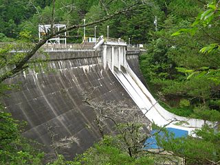
Katagiri Dam is a dam in the Nagano Prefecture, Japan, completed in 1989.

Kiso Dam is a dam in the Nagano Prefecture, Japan, completed in 1968.

Koshibu Dam is a dam in the Nagano Prefecture, Japan, completed in 1969.

