Hixson, Tennessee

Last updated

Hixson, Tennessee
Neighborhood
USA Tennessee location map.svg
Red pog.svg
Hixson
Usa edcp location map.svg
Red pog.svg
Hixson
Coordinates: 35°02′55″N85°20′00″W / 35.04861°N 85.33333°W / 35.04861; -85.33333
Country United States
State Tennessee
County Hamilton
City Chattanooga
Elevation
[1]
686 ft (209 m)
Time zone UTC-5 (Eastern (EST))
  Summer (DST) UTC-4 (EDT)
ZIP codes
37343
Area code 423
FIPS code 47065
GNIS feature ID1306579 [1]

Hixson is a former unincorporated community and now part of the city of Chattanooga in Hamilton County, Tennessee, United States. It is in the northeastern part of Chattanooga and is part of the Chattanooga, TN-GA Metropolitan Statistical Area.

Contents

Hixson is typically defined as the area north of Rivermont (a Chattanooga neighborhood), east of the city of Red Bank and U.S. Highway 27, and south of unincorporated Middle Valley and Thrasher Pike. It is bordered to the east by the Tennessee River. [2] Neighborhoods within Hixson include DuPont, Northgate, Big Ridge, and Valleybrook.

History

The land around Hixson was first settled by Europeans around 1821 by pioneers John and Elendar Hixson. While Elendar was born in Bledsoe County, Tennessee, John Hixson, born in 1797, came from Virginia. This family of Hixsons first came to America in the mid-1600's when John Hixson's great great grandfather, William Hixson II from Frodsham, sailed to New Jersey. John and Elendar had 9 children between 1821 and 1851. Greatly opposed to any involvement in a civil war, some of the family began traveling further westward in 1852 to southern Missouri with the incorrect hopes that state would remain a neutral location in the looming national conflict. [3]

Government

Hixson is represented on the Chattanooga City Council with two district seats – District 2 currently held by Jenny Kellog-Hill and District 3 currently held by Ken Smith. [4] [5] Hixson is represented on the Hamilton County Commission in two districts as well: District 1, currently held by Gen O Shipley; and District 3, held by Ken Smith(2022). [6]

Retail

Hixson has a retail center based around Northgate Mall. Originally built in 1972, it is one of two major mall shopping venues for Chattanooga (the other is the larger Hamilton Place). CBL in 2012 purchased Northgate Mall for $11.5 million and has announced a major renovation for the mall. [7]

Schools

The school system is run by the Hamilton County government, as the county and city school systems were merged in 1997, after a 1995 voting referendum. [8] Hixson has one public high school – the Hixson High School. [9] Hixson also has one predominant middle school – the Hixson Middle School [10]  – although Loftis Middle School serves a small portion of the community on the north side of Big Ridge. [11] Currently there are five elementary schools in the public system that serve the area: Big Ridge Elementary, McConnell Elementary, Ganns Middle Valley Elementary, DuPont Elementary, and Hixson Elementary. [12] However, this is likely to change in the near future as the Hamilton County Board of Education has selected two of these schools for reassignment. Current plans call for DuPont Elementary to be closed and merged with Alpine Crest and Rivermont Elementary. Ganns Middle Valley Elementary will have a larger school built on a site which is yet to be determined. [13]

Attractions

Hixson has several area attractions. The Chickamauga Dam is part of its eastern border along with several marinas along the Tennessee River. Greenway Farms is part of the North Chickamauga Creek Conservancy and offers hiking, canoeing, sports, and a dog park. [14] Valleybrook Golf Course hosts the Choo Choo Classic and was a regular PGA stop from 1983 to 1991 with the Chattanooga Classic.

  1. 1 2 U.S. Geological Survey Geographic Names Information System: Hixson, Tennessee
  2. Tennessee Hometown Locator
  3. Bell, Alma (1985). Biography of Luellen Williams-Hixson. Self.
  4. "City Council Map; dated ". Archived from the original on July 18, 2012. Retrieved December 27, 2012.
  5. "Berke is Elected Mayor; Hakeem Has 6 More Votes Than Murphy; Henderson Wins District 1, Mitchell Takes District 2, McGary Loses to Freeman, Anderson Topples Rico, Smith Beats Ladd, Benson in Runoff with Grohn". March 6, 2013.
  6. "District Map; dated ". Archived from the original on January 27, 2013. Retrieved December 27, 2012.
  7. Northgate to get Multimillion; October 14, 2012 Chattanooga Times Free Press article; retrieved .
  8. "School District Profile". Archived from the original on February 1, 2013. Retrieved December 27, 2012.
  9. zone map hixson high.pdf Hamilton County HS zone maps [ permanent dead link ]
  10. "Hamilton County MS zone maps" (PDF). Archived from the original (PDF) on December 27, 2010. Retrieved December 27, 2012.
  11. zone map loftis.pdf Loftis [ permanent dead link ]
  12. zone map big ridge elementary.pdf Hamilton County ES zone maps [ permanent dead link ]
  13. Carroll, David (December 4, 2012). "Hamilton County schools struggle with building needs". Local3News.com. Retrieved March 23, 2024.
  14. North Chick.org

Related Research Articles

<span class="mw-page-title-main">Rhea County, Tennessee</span> County in Tennessee, United States

Rhea County is a county located in the U.S. state of Tennessee. As of the 2020 census, its population was 32,870. Its county seat is Dayton. Rhea County comprises the Dayton, TN micropolitan statistical area, which is also included in the Chattanooga-Cleveland-Dalton, TN-GA-AL combined statistical area.

<span class="mw-page-title-main">Marion County, Tennessee</span> County in Tennessee, United States

Marion County is a county located in the U.S. state of Tennessee. As of the 2020 census, the population was 28,837. Its county seat is Jasper. Marion County is part of the Chattanooga, AL–TN–GA Metropolitan Statistical Area. Marion County is in the Central time zone, while Chattanooga proper is in the Eastern time zone.

<span class="mw-page-title-main">Hamilton County, Tennessee</span> County in Tennessee, United States

Hamilton County is a county located in the U.S. state of Tennessee. It is located in the southern part of East Tennessee on the border with Georgia. As of the 2020 census, the population was 366,207, making it the fourth-most populous county in Tennessee. Its county seat is Chattanooga, located along the Tennessee River. The county was named for Alexander Hamilton, the first secretary of the treasury.

<span class="mw-page-title-main">Chattanooga, Tennessee</span> City in Tennessee, United States

Chattanooga is a city in and the county seat of Hamilton County, Tennessee, United States. It is located along the Tennessee River, and borders Georgia to the south. With a population of 181,099 in 2020, it is Tennessee's fourth-largest city and one of the two principal cities of East Tennessee, along with Knoxville. It anchors the Chattanooga metropolitan area, Tennessee's fourth-largest metropolitan statistical area, as well as a larger three-state area that includes Southeast Tennessee, Northwest Georgia, and Northeast Alabama.

Harrison is a census-designated place (CDP) in Hamilton County, Tennessee, United States. The population was 7,902 at the 2020 census. It is part of the Chattanooga metropolitan area. Harrison Bay State Park, the Hamilton County Landfill, Bear Trace Golf Course, a course designed by Jack Nicklaus, and Skull Island, a recreational area owned by TVA, are all located in Harrison.

<span class="mw-page-title-main">Signal Mountain, Tennessee</span> Town in Tennessee, United States

Signal Mountain is a town in Hamilton County, Tennessee, United States. The town is a suburb of Chattanooga and is located on Walden Ridge. "Signal Mountain" is used as a colloquial name for the part of Walden Ridge close to the town. The town population was 8,852 as of the 2020 census and estimated to be 8,567 in 2018.

<span class="mw-page-title-main">Soddy-Daisy, Tennessee</span> City in Tennessee, United States

Soddy-Daisy is a city in Hamilton County, Tennessee, United States. The population was 13,070 at the 2020 census and estimated to be 13,619 in 2022. The city was formed in 1969 when the communities of Soddy and Daisy, along with nearby developed areas along U.S. Highway 27, merged to form Soddy-Daisy. It is becoming a bedroom community of nearby Chattanooga and is part of the Chattanooga Metropolitan Statistical Area. Sequoyah Nuclear Generating Station is located in Soddy-Daisy.

<span class="mw-page-title-main">East Tennessee</span> Geographic region of Tennessee

East Tennessee is one of the three Grand Divisions of Tennessee defined in state law. Geographically and socioculturally distinct, it comprises approximately the eastern third of the U.S. state of Tennessee. East Tennessee consists of 33 counties, 30 located within the Eastern Time Zone and three counties in the Central Time Zone, namely Bledsoe, Cumberland, and Marion. East Tennessee is entirely located within the Appalachian Mountains, although the landforms range from densely forested 6,000-foot (1,800 m) mountains to broad river valleys. The region contains the major cities of Knoxville and Chattanooga, Tennessee's third and fourth largest cities, respectively, and the Tri-Cities, the state's sixth largest population center.

<span class="mw-page-title-main">Chattanooga Area Regional Transportation Authority</span> American mass transit provider in Tennessee

The Chattanooga Area Regional Transportation Authority (CARTA) is the mass transit provider for Chattanooga, Tennessee and its vicinity.

<span class="mw-page-title-main">Chickamauga Creek</span> Tributary of the Tennessee River in the United States of America

North and South Chickamauga Creek are short tributaries of the Tennessee River which join it near Chattanooga, Tennessee on the north and the south. West Chickamauga Creek is a much longer tributary of South Chickamauga Creek.

Northgate Mall, also called Northgate, is an enclosed shopping mall in the Chattanooga, Tennessee suburb of Hixson. Opened on March 15, 1972, it was the second mall built in Chattanooga. Anchor stores are Belk, with two vacant anchors that were formerly Sears and JCPenney.

<span class="mw-page-title-main">Hamilton County Schools</span> School district in Tennessee, United States

Hamilton County Schools is the school district that serves Hamilton County, Tennessee, USA. After a 1995 referendum, the then-separate Chattanooga City Schools district was merged into the county district in 1997. About 2,300 high school seniors graduated from the system in May 2011.

Loveman's was a Chattanooga, Tennessee-based chain of department stores with locations throughout East Tennessee and North Georgia. Relatives of the founder of the chain founded Loveman's of Alabama and Loveman's located in Nashville, Tennessee.

Miller's Department Store was a chain of department stores based in East Tennessee.

<span class="mw-page-title-main">Rock Spring, Georgia</span> Place in Georgia, USA

Rock Spring is an unincorporated community and census-designated place located in northwest Georgia, United States, approximately 14 miles (23 km) south of Chattanooga, Tennessee. It is in Walker County which resides in Georgia's 14th congressional district. Rock Spring is included in the Chattanooga, TN-GA Metropolitan Statistical Area.

<span class="mw-page-title-main">Tennessee State Route 319</span> Highway in Tennessee

State Route 319 is a state highway in southeast Tennessee, starting at the intersection of SR 153 in Chattanooga, traveling to the area of Soddy-Daisy where it intersects with US 27, and the route comes to an end.

<span class="mw-page-title-main">Chattanooga metropolitan area</span> Metropolitan area in Tennessee and Georgia, United States

The Chattanooga, TN-GA metropolitan statistical area, as defined by the United States Office of Management and Budget, is an area consisting of six counties – three in southeast Tennessee and three in northwest Georgia – anchored by the city of Chattanooga. As of the 2020 census, the Chattanooga metropolitan area had a population of 562,647. This metropolitan area traverses two time zones.

The Chattanooga–Cleveland–Dalton, TN–GA–AL Combined Statistical Area covers a total of thirteen counties – seven in southeast Tennessee, six in northwest Georgia and one in northeast Alabama. The combined statistical area consists of three metropolitan statistical areas – Chattanooga, Cleveland, and Dalton – as well as the Athens, Scottsboro, and Summerville micropolitan statistical areas. At the 2010 census, the CSA had a population of 1,010,000.

<span class="mw-page-title-main">U.S. Route 27 in Tennessee</span> United States Numbered Highway in Tennessee

U.S. Route 27 (US 27) in Tennessee runs from the Georgia state line in Chattanooga to the Kentucky state line in Isham. It forms the informal border between the Eastern and Central timezones of the state. It stays, however, in the Eastern Time Zone.

<span class="mw-page-title-main">Tennessee State Route 153</span> Highway in Tennessee

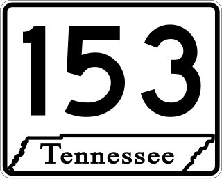
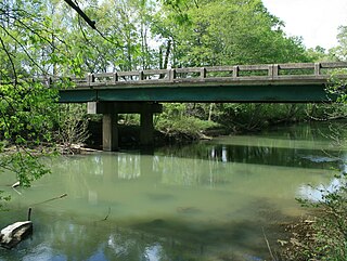
State Route 153 is a state highway in Chattanooga, Tennessee. It runs from Interstate 75/U.S. Route 74 (I-75/US 74) a few miles east of the I-24 interchange, to US 27 just south of Soddy-Daisy. The route serves as a bypass around downtown Chattanooga for I-75 travelers heading towards US 27 north. It is also an important route for drivers from Soddy-Daisy, Hixson, and other parts of northwestern Hamilton County who are heading for I-75 and the eastern half of the county. It is also an important link to the Tennessee Valley Authority Chickamauga Dam, which the highway crosses on the Wilkes T. Thrasher Bridge. It also serves as the primary access to the Chattanooga Metropolitan Airport.