Hnanice | |
|---|---|
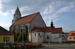 Church of Saint Wolfgang | |
 Flag  Coat of arms | |
 Hnanice Location in the Czech Republic | |
| Coordinates: 48°47′55″N15°59′12″E / 48.79861°N 15.98667°E | |
| Country | |
| Region | South Moravian |
| District | Znojmo |
| First mentioned | 1201 |
| Area | |
• Total | 7.77 km2 (3.00 sq mi) |
| Elevation | 268 m (879 ft) |
| Population (2025-01-01) [1] | |
• Total | 357 |
| • Density | 46/km2 (120/sq mi) |
| Time zone | UTC+1 (CET) |
| • Summer (DST) | UTC+2 (CEST) |
| Postal code | 669 02 |
| Website | www |
Hnanice (German : Gnadlersdorf) is a municipality and village in Znojmo District in the South Moravian Region of the Czech Republic. It has about 400 inhabitants.
Contents
Hnanice lies approximately 8 kilometres (5 mi) south-west of Znojmo, 65 km (40 mi) south-west of Brno, and 182 km (113 mi) south-east of Prague.