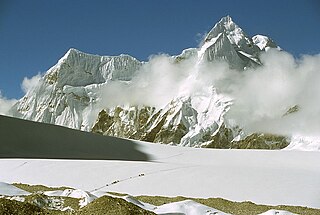
Lhotse is the fourth-highest mountain on Earth, after Mount Everest, K2, and Kangchenjunga. At an elevation of 8,516 metres (27,940 ft) above sea level, the main summit is on the border between Tibet Autonomous Region of China and the Khumbu region of Nepal.

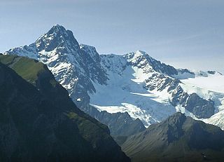
Wildspitze is the highest mountain in the Ötztal Alps and in North Tyrol, as well as the second highest mountain in Austria after the Großglockner and in terms of prominence is the fourth summit of the Alps and the fifteenth of Europe.

Serles is a mountain of the Stubai Alps in the Austrian state of Tyrol, Austria, between the Stubai Valley and Wipptal, near the Italian border. Its nickname is Altar von Tirol, literally the Altar of Tyrol. It has several lower peaks, including Sonnenstein to the north.

Noshaq, also called Noshakh or Nowshakh, is the second highest peak in the Hindu Kush Range after Tirich Mir at 7,492 m (24,580 ft). It lies on the border between Afghanistan and Pakistan. The north and west sides of the mountain are in Afghanistan whereas the south and eastern sides are in Pakistan. Noshaq is Afghanistan's highest mountain and is located in the northeastern corner of the country along the border with Pakistan. It is the westernmost 7,000 m (22,966 ft) peak in the world. Easiest access to Noshaq is from Wakhan Afghanistan.

Ushba is one of the most notable peaks of the Caucasus Mountains. It is located in the Svaneti region of Georgia, just south of the border with the Kabardino-Balkaria region of Russia. Although it does not rank in the 10 highest peaks of the range, Ushba is known as the "Matterhorn of the Caucasus" for its picturesque, spire-shaped double summit. Due to its steep profile and unstable weather, Ushba is considered by many climbers as the most difficult ascent in the Caucasus.

The Zuckerhütl is a mountain in Tyrol, Austria. At 3,505 metres, it is the highest peak of the Stubai Alps and lies at the southern end of the Stubaital Valley.

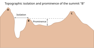
The topographic isolation of a summit is the minimum distance to a point of equal elevation, representing a radius of dominance in which the peak is the highest point. It can be calculated for small hills and islands as well as for major mountain peaks and can even be calculated for submarine summits. Mount Everest, the highest point on Earth, has an undefined isolation, since there are no higher points to reference.
Kurumdy Mountain is a mountain in the Pamir Mountains of Central Asia, in the eastern section of the Trans-Alay Range. Kurumdy has an elevation of 6,614 metres (21,699 ft) above sea level and sits on the international border between Kyrgyzstan and China.

The Aiguille des Glaciers is a mountain in the Mont Blanc massif of the Graian Alps. It lies on the borders of Savoie and Haute-Savoie in France and Aosta Valley in Italy.

Mount Rosa is a mountain summit of the Pikes Peak Massif in the southern Front Range of the Rocky Mountains of North America. The 11,504-foot (3,506 m) peak is located in Pike National Forest, 12.8 miles (20.6 km) southwest by west of downtown Colorado Springs in Teller County, Colorado, United States.

The Hochgolling is a mountain of the Eastern Alps, located on the border of Steiermark and Salzburg, Austria, near the ski resort of Schladming. It is the highest peak of the Lower Tauern range.

The Lienz Dolomites are an alpine mountain range located in the Austrian states of East Tyrol and Carinthia. It lies at the western side of the wider Gailtal Alps and contains its highest peaks. The range lies between the Drau Valley in the north and the Gail Valley to the south.

The Daniel is a mountain in the Austrian state of Tyrol, and the highest peak in the Ammergau Alps, a range within the Northern Limestone Alps . Located near the villages of Ehrwald and Lermoos, it is a popular mountain with hikers. Its North Face is around 200 metres high and its South Face has a more schrofen-like character. With the almost equally high Upsspitze (2,332 m) it forms a double summit. To the northwest is a neighbouring peak, the Hochschrutte (2,247 m).

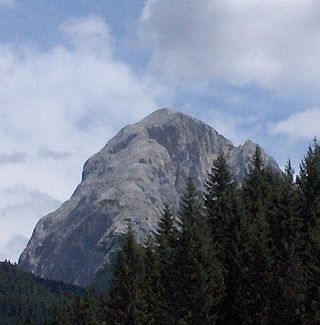
Peralba is a mountain of the Carnic Alps in Veneto, northeastern Italy, although its summit is only a few hundred metres from the Austrian border. It has a height of 2,694 m making it the second highest mountain of the Carnics, after Coglians. It lies on the main chain of the range, between the Austrian Lesachtal Valley in the north and the Italian Piave Valley in the south. The mountain resembles a huge cubic block of the stone, with a large summit plateau, and dominates the view from miles around.

Geierhaupt is a mountain of the Lower Tauern in Styria, Austria. It is the highest mountain of the Seckau Tauern sub group.

The Großer Rosennock is, at 2,440 m AA (8,010 ft), the second highest of the Gurktal Alps in Carinthia, Austria, after the Eisenhut, which is just one meter higher.

Gartnerkofel is a mountain of the Carnic Alps in Carinthia, Austria. It is located on the main chain of the Carnics above the Naßfeld Pass, near the border with Italy. The nearest town is Hermagor-Pressegger See. The mountain has two summits, and ravines fall down from its northern slopes, which are separated by rocky ridges. The normal route is from the northwest, from where it an easy climb across the ridge to the summit. The mountain is also a popular ski touring destination.

Stuhleck is a mountain in Steiermark, Austria. It is the highest mountain of the Fischbach Alps and of the Prealps east of the Mur.

Lunag Ri is a mountain in the Rolwaling Himal mountain range of the Himalayas.

Hochstadel is a mountain of the Lienz Dolomites in Carinthia, Austria.


