Aschaffenburg is a town in northwest Bavaria, Germany. The town of Aschaffenburg is not considered part of the district of Aschaffenburg, but is the administrative seat.
Aschaffenburg is a Landkreis (district) in Bavaria, Germany. It is bounded by the districts of Darmstadt-Dieburg, Offenbach, Main-Kinzig, the districts Main-Spessart and Miltenberg, and the town of Aschaffenburg.

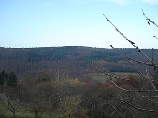
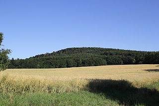
Spessart is a Mittelgebirge, a range of low wooded mountains, in the States of Bavaria and Hesse in Germany. It is bordered by the Vogelsberg, Rhön and Odenwald. The highest elevation is the Geiersberg at 586 metres above sea level.
Main-Spessart is a Landkreis (district) in the northwest of Bavaria, Germany. It is located in Lower Franconia and derives its name from the river Main and the wooded hills of the Spessart.
Miltenberg is a Landkreis (district) in Bavaria, Germany. It is bounded by the city of Aschaffenburg, the districts of Aschaffenburg and Main-Spessart, and the states of Baden-Württemberg and Hesse.
Hohe Warte may refer to the following geographical locations:

Haibach is a community in the Aschaffenburg district in the Regierungsbezirk of Lower Franconia (Unterfranken) in Bavaria, Germany. It has a population of around 8,300.

Mespelbrunn is a community in the Aschaffenburg district in the Regierungsbezirk of Lower Franconia (Unterfranken) in Bavaria, Germany and a member of the Verwaltungsgemeinschaft of Mespelbrunn, whose seat is in Heimbuchenthal.

Weibersbrunn is a community with a population of close to 2,000 in the Aschaffenburg district in the Regierungsbezirk of Lower Franconia (Unterfranken) in Bavaria, Germany.

Sulzbach am Main is a market municipality in the Miltenberg district in the Regierungsbezirk of Lower Franconia (Unterfranken) in Bavaria, Germany.
Flörsbachtal is a municipality in the Main-Kinzig district, in Hesse, Germany. It has a population close to 2,400. Flösbachtal contains both the oldest parish and the youngest settlement established in the Spessart hills. Located within the municipal territory is the Hermannskoppe, the highest elevation in the Hessian part of the Spessart and the Wiesbüttmoor, a rare hanging bog.

The Ludwig Western Railway is a German railway line that was originally funded by the Kingdom of Bavaria. It runs from Bamberg via Würzburg to Aschaffenburg and on into the former "Kurhessian" Hanau.

The Main-Spessart Railway is a 110 kilometre-long railway line in the Bavarian province of Lower Franconia and the neighbouring state of Hesse in south central Germany. It runs from Würzburg via Gemünden (Main) and Aschaffenburg to Hanau. It is particularly important for long-distance and goods traffic because it links the Rhine-Main conurbation immediately northwest of Aschaffenburg with the Lower Franconian city of Würzburg and beyond it to the metropoles of Nuremberg and Munich. Its name derives from the fact that it initially runs parallel to the River Main and then cuts through the Spessart hills. It was opened on 22 June 1854 by the Frankfurt-Hanau Railway Company and is one of the oldest railways in Germany.
Heidkopf (Spessart) is a wooded hill of Bavaria, Germany, located in the Mittelgebirge Spessart.

Hohe Mark (Spessart) is a wooded hill of Bavaria, Germany. It is part of the Mittelgebirge Spessart and lies in the district of Aschaffenburg, near Alzenau.

Hohe Warte (Spessart) is a wooded hill of Bavaria, Germany. It has an elevation of up to 572 meters above NHN and lies in the Spessart range.

Pfaffenberg is a 432-meter-high (1,417 ft) hill of Bavaria, Germany. The Pfaffenberg hill lies in the Spessart range in the districts of Aschaffenburg and Miltenberg.
Schanzenkopf (Spessart) is a wooded hill of Bavaria, Germany. It lies in the Mittelgebirge Spessart in the district of Aschaffenburg.
Schwarzkopf is a wooded hill located in the Aschaffenburg district of Bavaria, Germany. It is part of the Mittelgebirge Spessart. Schwarzkopf lies east of Laufach and south of Heigenbrücken. It is located in the unincorporated area Forst Hain im Spessart.