Hoher Bogen

Last updated
Hoher Bogen
Kotztingblick.JPG
The ridge of the Hoher Bogen
Highest point
Elevation 1,079 m above  sea level (NHN) (3,540 ft) [1]
Listing Towers of the former telecommunication sector F
Hoher Bogen Transmitter
Coordinates 49°14′02″N12°56′04″E / 49.233859°N 12.934491°E / 49.233859; 12.934491
Geography
Bavaria relief location map.jpg
Red triangle with thick white border.svg
Hoher Bogen
Parent range Bavarian Forest
Geology
Type of rock amphibolite, gabbro

The Hohe Bogen (archaically often Hohenbogen) is a roughly 8-kilometre-long mountain ridge in the Bavarian Forest.

Contents

It rises in the Bavarian province of Upper Palatinate in the county of Cham and is almost equally divided between the municipalities of Neukirchen b. Hl. Blut, Rimbach and Eschlkam between Furth im Wald and Bad Kötzting. Its territory includes, from northwest to southeast, the summits of the Burgstall (976 m), Bärenriegel (1,017 m), Eckstein (1,073 m), Schwarzriegel (1,079 m) and Ahornriegel (1,050 m). On the Burgstall there is a transmission site, on the Schwarzriegel is an old Luftwaffe transmission tower.

On the northern slopes of the Ahornriegel is a ski area. A double chairlift, 1.36 kilometres long, transports passengers through 393 vertical metres in 15 minutes and runs to the top of the mountain.

Name

According to research by local historian, Ludwig Baumann, from Bad Kötzting, the mountain's name, "Hoher Bogen", does not - as is often assumed - derive from the ridge's morphological landscape shape of a "high arc" (Hoher = "high", Bogen = "arc" or "bow"), but from the counts of Bogen who built a castle on the Burgstall (Burgstall = site of a former castle") around 1190 (where today's transmitter is). Its owner, Albert III of Bogen, was banished in 1193, so that the remote castle probably remained unfinished and fell into ruin. Remains of a moat have survived. Thus the name "Hohenbogen" is to be understood as the higher castle of the Bogen family (as opposed to the lower castle near Bogen). A similar development of names can be seen in the "Hohenstaufen" (high seat of the Staufer family), "Hohenschwangau" (House of Welf) and "Hohenzollern". In 1242, the Hoher Bogen went to the House of Wittelsbach.

Geography

Apart from the lower southwestern slopes, the Hoher Bogen occupies a special geological position in the Bavarian Forest. It forms the southern end of a gabbro-amphibolite massif in the immediate vicinity of the Bohemian Massif, whereby the gabbros were almost completely converted into amphibolite.

The low seepage capacity of the subsoil allows hundreds of small springs and stream channels to form on the flanks of the Hoher Bogen. To the north these flow into the Kaltenbach, a tributary of the Freybach; the south-flowing streams are collected by the White Regen river.

Until 1991, the German Met Office operated a precipitation-measuring station on the mountain at an altitude of 903 metres, which determined an average annual of 1,051 millimetres of precipitation from 1931 to 1960. The average snow cover from September to May is 46.8 centimetres.

In addition to the 922 hectares of state forest managed by the Bavarian State Forests (subdivision: Forstbetrieb Roding), there is about twice as much private forest with an average plot size of 2 to 3 hectares in the area of the Hoher Bogen, especially on the lower slopes.

The vegetation consists mainly of spruce forest, but especially in the state forest there are also extensive beech woods and mixed beech forests. The liverleaf and spring vetch grow here, the only place they occur in the Bavarian Forest.

Surveillance tower

Telecommunication tower on the Hoher Bogen Fernmeldeturm0.JPG
Telecommunication tower on the Hoher Bogen

A NATO listening post for the so-called Communication Sector F, also located here, was shut down in 2004. As well as members of the Bundeswehr, American units were stationed there until 1992 and French units until 1994. It consisted of two towers and a complex passive reception and monitoring system. Since autumn 2014, the 75-metre-high main tower has been fitted with an externally-mounted steel staircase and a viewing platform at a height of 50 metres and is open to the public as a viewing tower at certain visiting times. [2] In the medium term, various media in the area of the stairs and viewing platform will be used to inform visitors about the history of the site and its planned future use as a European meeting centre. [3] The owner of the facility is the Hoher Bogen Mountain Resort.

Hoher Bogen sport and leisure centre

At the foot of the Hoher Bogen is a sport and leisure centre. In summer you can take the sommerrodelbahn from the middle station of the cable car. There is also a skate- and fun park and a grass kart run. In winter, in addition to downhill skiing and snowboarding, there is also a toboggan run and also a ski jump at the top station. The facility can be used all year round.

Hoher Bogen transmitter site

On the 976-metre-high Burgstall near Furth im Wald the Bayerischer Rundfunk operate the Hoher Bogen Transmitter. It broadcasts VHF, DAB and TV programmes and is a radio relay and mobile telephone mast.

Treasure at the Hoher Bogen

In their book Der bayrische Wald (1846), Bernhard Grueber and Adalbert Müller describe in detail a legend about the treasure, which is supposed to be kept in a copper brewing kettle under the Burgstall. When the right finder comes along and performs certain tasks exactly, the kettle lifts itself and pours out its contents of gold and diamonds. When in 1803 or 1804, a Bohemian travel company played music at the Burgstall, farmers came along with picks and shovels because they suspected that someone had lifted the treasure.

Related Research Articles

<span class="mw-page-title-main">Bavarian Forest</span> Region in Bavaria, Germany

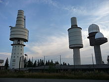
The Bavarian Forest is a wooded, low-mountain region in Bavaria, Germany that is about 100 kilometres long. It runs along the Czech border and is continued on the Czech side by the Bohemian Forest. Most of the Bavarian Forest lies within the province of Lower Bavaria, but the northern part lies within Upper Palatinate. In the south it reaches the border with Upper Austria.

<span class="mw-page-title-main">Hoher Meißner</span> Mountain in Germany

The Hoher Meißner is a mountain massif with a height of 753.6 m and is located in the Meißner-Kaufunger Wald nature park in Hesse, Germany.

<span class="mw-page-title-main">Rimbach, Upper Palatinate</span> Municipality in Bavaria, Germany

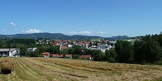
Rimbach is a municipality in the district of Cham (district) in the Upper Palatinate in Bavaria in Germany.

<span class="mw-page-title-main">Arnschwang</span> Municipality in Bavaria, Germany

Arnschwang is a rural municipality in the district of Cham in Bavaria, Germany. The population was 2,004 as of the 2010 census. In recent years Arnschwang has focused on the production of environmentally friendly energy from biomass and water.

<span class="mw-page-title-main">Kollnburg</span> Municipality in Bavaria, Germany

Kollnburg is a municipality in the district of Regen, in Bavaria, Germany. A part of the municipal area, including the parish village of the same name, is a state-approved resort.

<span class="mw-page-title-main">Obernzell</span> Municipality in Bavaria, Germany

Obernzell is a municipality in the district of Passau in Bavaria in Germany.

<span class="mw-page-title-main">Mittagstein</span> Mountain in Germany

The Mittagstein is a 1,034-metre-high (3,392 ft) mountain peak which rises in the middle of the Kaitersberg in the Bavarian Forest in southern Germany.

<span class="mw-page-title-main">Einödriegel</span> Mountain in Germany

The Einödriegel is a mountain, 1,120.6 m above sea level (NHN), in the Bavarian Forest in Germany. It rises southwest of the Lower Bavarian county town of Regen and northeast of the county town of Deggendorf. It is the highest point in the Danube Hills and the county of Deggendorf and lies in the municipality of Grafling.

A burgstall is a German term referring to a castle of which so little is left that its appearance cannot effectively be reconstructed.

<span class="mw-page-title-main">Burgstall Schlosshügel</span>

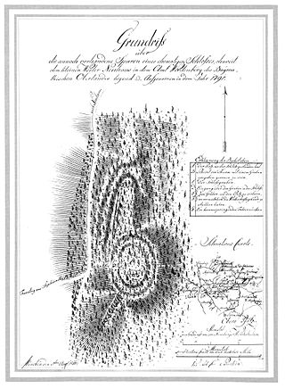
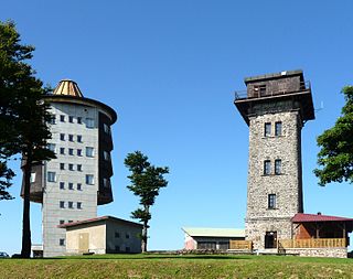
The Burgstall of Schlosshügel near Weidenberg is a lost hill castle or circular rampart site of the type known as a motte from the Early Middle Ages. It lies on the southern perimeter of the Fichtel Mountains at a height of 699 metres above sea level (NN) above the village of Sophienthal, which is part of the market borough of Weidenberg in the Upper Franconia county of Bayreuth in Bavaria. The burgstall or lost castle site was partly investigated by means of an archaeological test excavation and was also mapped several times in the past.

<span class="mw-page-title-main">Čerchov</span> Mountain at the Czech-German border

Čerchov is the highest mountain in the Upper Palatine Forest, at 1,042 metres (3,419 ft) above sea level.

<span class="mw-page-title-main">Altes Schloss (Affalterthal)</span>

The burgstall of the Altes Schloss is the site of an old castle near the village of Affalterthal in Bavaria, that was probably built in the High Middle Ages for the nobility. It lies within the municipality of Egloffstein in the Upper Franconian county of Forchheim.

<span class="mw-page-title-main">Altes Schloss (Oberzaunsbach)</span>

The burgstall of the Altes Schloss is the site of a, now levelled, mediaeval castle on the hillside of the Zaunsbacher Berg above the valley of the Trubach. It lies around 1,000 metres south-shouteast of the village of Oberzaunsbach in the Upper Franconian municipality of Pretzfeld in the south German state of Bavaria.

<span class="mw-page-title-main">Schlossberg Castle (Haidhof)</span>

The burgstall of Schlossberg Castle, also called the Burgstall on the Flöss or the Heidenstein, is a now levelled, probably high mediaeval, nobleman's castle. It is situated above Haidhof, a village in the municipality of Gräfenberg in the Upper Franconian county of Forchheim in the south German state of Bavaria.

<span class="mw-page-title-main">Anterior Bavarian Forest</span>

The Anterior Bavarian Forest, also variously called the Vorderer Forest, Vorderer Wald or Danube Hills, is part of the Bavarian Forest, a low mountain range in Germany.

<span class="mw-page-title-main">Upper Bavarian Forest Nature Park</span>

The Upper Bavarian Forest Nature Park covers an area of 1,796 km² and is thus one of the largest nature parks in the German state of Bavaria.

<span class="mw-page-title-main">Cham-Furth Depression</span>

The Cham-Furth Depression or Všeruby Highlands is a lowland in the Upper Palatine-Bavarian Forest that separates the Upper Palatinate Forest from the Bavarian Forest. At the same time it connects the Upper Palatinate with Bohemia.

<span class="mw-page-title-main">Regen Depression</span>

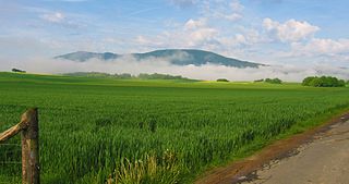
The Regen Depression is a wide river valley in the Bavarian Forest along the River Regen.

<span class="mw-page-title-main">Buchberger Leite</span>

The Buchberger Leite is a gorge near Hohenau in the Lower Bavarian county of Freyung-Grafenau in Bavaria.

References

  1. Map services of the Federal Agency for Nature Conservation
  2. Viewing platform on the website of Sector F
  3. Sector.Q: Once a listening tower, now a viewing platform. Website of the magazine reisen EXCLUSIV, retrieved 7 November 2014.

Literature