Home Valley, Washington | |
|---|---|
 Home Valley  Home Valley | |
| Coordinates: 45°41′53″N121°46′35″W / 45.69806°N 121.77639°W | |
| Country | United States |
| State | Washington |
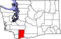
| County | Skamania |
| Elevation | 79 ft (24 m) |
| Time zone | UTC-8 (Pacific (PST)) |
| • Summer (DST) | UTC-7 (PDT) |
| GNIS feature ID | 1512308 [1] |
Home Valley is an unincorporated community in the Columbia River Gorge National Scenic Area along the Columbia River in Skamania County, Washington, United States. [1] The community is located on Washington State Route 14 and lies southeast of nearby Carson.