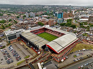
Bramall Lane is a football stadium in Sheffield, South Yorkshire, England, which is the home of Sheffield United.

Castle Square is the plaza at the intersection of High Street, Angel Street, and Arundel Gate in the City of Sheffield, England. This name was given to the square in the 1960s to reflect the proximity of the square to the site of Sheffield Castle, which was formerly located a short distance to the north-east.
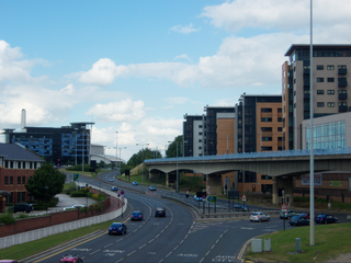
The Sheffield Parkway is a major dual carriageway which runs between the City of Sheffield and junction 33 of the M1 in South Yorkshire, England. The 5.5-mile (8.9 km) road was opened in 1974.

Fargate is a pedestrian precinct and shopping area in Sheffield, England. It runs between Barker's Pool and High Street opposite the cathedral. It was pedestrianised in 1973. Fargate also holds a Continental Market approximately 4 times a year, which includes European stalls selling cheeses, confectionery, clothing, plants and crafts including jewellery and ornaments.

The Cultural Industries Quarter is a district in the city centre of Sheffield, England, and one of the eleven Quarters designated in the 1994 City Centre Strategy. It is roughly triangular in shape, and is bound by Howard Street, Sheaf Square and Suffolk Road to the north-east, St Mary's Road to the south and Eyre Street and Arundel Gate to the north-west, with Granville Square in the south-east. The name given reflects the intention to create a cluster of music, film and science-based businesses in the area.

Fitzalan Square is a municipal square situated in the city centre of Sheffield in South Yorkshire, England. The present day square is one of the busiest areas of the city centre, with traffic and pedestrians continually moving through the area. It has a Sheffield Supertram stop and a taxi rank.
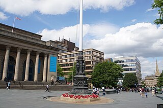
Barker's Pool is a public city square and street in the centre of Sheffield, England. The focus of Barker's Pool is the Grade II* listed 90-foot-tall (27 m) war memorial that was unveiled on 28 October 1925 to commemorate the First World War. The Grade II* listed Sheffield City Hall is on the north side of the plaza facing the Grade II listed former John Lewis & Partners department store.

Sheaf Square is a municipal square lying immediately east of the city centre of Sheffield, England.
Norton Lees is a residential suburb in the Graves Park ward of the City of Sheffield, England located to the east of Woodseats.

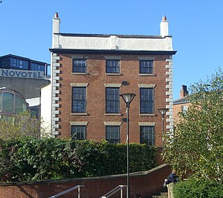
Dyson House was a building which was part of Sheffield Hallam University's city campus in Sheffield, South Yorkshire, England. The building was on Sheaf Square, next to the Sheffield Midland Station. Dyson House became unused by the university for several years, and was bought by Yorkshire Forward as part of the Heart of the city scheme funded by EU regeneration money and was demolished in 2006. The site along with the adjacent Sheaf House has a proposal for a new 200,000 sq ft (19,000 m2) office block, shops and 200 apartments in a mixed use scheme of a futuristic modern design by Make Architects designers of the acclaimed Swiss Re (Gerkin) building in London.
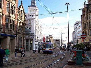
High Street is one of the main thoroughfares and shopping areas in the city centre of Sheffield in South Yorkshire, England, located at the approximate grid reference of SK356874. High Street starts at the Commercial Street, Fitzalan Square and Haymarket junction and runs for approximately 400 metres west to conclude near the Sheffield Cathedral where it forms a Y-junction with Fargate and Church Street. High Street has the traditional wide variety of shops, financial institutions and eating places which are associated with any British town centre.

Leopold Square is a mixed-use development in Sheffield's West End, England, located at the corner of Leopold Street and West Street. The development, by Ask Developments and Gleeson's in collaboration with local architects AXIS Architecture, comprises the refurbishment of the former Central Technical School buildings, built between 1870 and 1894, into apartments, bars, restaurants and a hotel. The development also has a new angular building to house a bar and a restaurant, and the creation of a brand new public square. The redevelopment of the old buildings began in 2004, following years of use as council offices after the closure of the Schools.

The Castlegate Quarter is one of the eleven quarters of Sheffield city centre. It is named after Castlegate, the quarter's main thoroughfare. The boundaries of the Castlegate Quarter are formed by Castlegate and the River Don to the north, Exchange Place to the east, Commercial Street and part of the High Street to the south, and Angel Street and Snig Hill to the west. For the latter part of the 20th century, the Castlegate Quarter was dominated by Castle Market, a large indoor market building. Following the demolition of Castle Market in 2015, the quarter is now undergoing regeneration as of 2020.

Church Street is in the centre of Sheffield, South Yorkshire, England, at grid reference SK353874. It runs for approximately 490 yards (450 m) in a westerly direction from its junction with Fargate and High Street to its termination at the crossroads formed by the junction with West Street, Leopold Street and Townhead Street. Church Street has its own Sheffield Supertram stop directly in front of the Sheffield Cathedral and it carries that name.

Millennium Square is a modern city square in Sheffield, England. It was created as part of the Heart of the City project that began in 1998 and has become a central feature in Sheffield's redeveloped city centre. It contains fountains in the shape of steel spheres, recalling Sheffield's past as a centre of the steel making industry, whilst linking with the fountains of the Peace Gardens, as well as Sheaf Square, Hallam Square and Barkers Pool. The square forms part of the 'Gold Route', designed by Sheffield City Council to guide visitors through the city centre from Sheffield Station to Devonshire Green.

Sandygate is a football and cricket stadium in the Sheffield suburb of Crosspool, South Yorkshire, England. It is home to Hallam F.C. and Hallam C.C.
Sheaf Valley Quarter is an area in the centre of Sheffield, England. It is one of Sheffield's 11 designated City Centre Quarters, situated around the rail station and River Sheaf. Its borders are Commercial Street and a bowstring bridge to the north, the railway line to the east, Granville Road to the south (excluding Granville Square, Suffolk Road, Sheaf Square and Howard Street to the south west and Arundel Gate to the west. It is named after the River Sheaf, which flows from the south of the city, underneath the current station and into the River Don and Castlegate. It is one of only 2 quarters with some land outside the ring road.

Fulwood Hall, is an English country house situated on Harrison Lane in the suburb of Fulwood in Sheffield, England. It is a Grade II listed building. The hall stands in a lofty position on the north side of the Mayfield Valley at a height of 270 metres. The hall is referred to as Fullwood Hall on old maps and the gate to the hall uses this spelling with two Ls.
Leader House is a Georgian townhouse on Surrey Street in the city centre of Sheffield, England. It overlooks Arundel Gate and is a Grade II listed building.
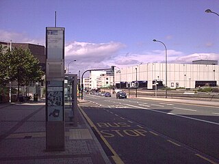
Arundel Gate is one of the main thoroughfares in Sheffield, England. It is located in the Heart of the City area of Sheffield City Centre. Arundel Gate also features a fifteen-stand bus station, including a ticket office building, completed in 2005.

