Huaribamba District

Last updated
Huaribamba
Wari Pampa
Huaribamba.jpg
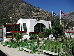
Huaribamba government building
Huaribamba District
Country Flag of Peru.svg  Peru
Region Huancavelica
Province Tayacaja
Capital Huaribamba
Government
   Mayor Nilton Fortunato Minaya Romani
Area
  Total
359.93 km2 (138.97 sq mi)
Elevation
2,996 m (9,829 ft)
Population
  Total
7,962
  Density22/km2 (57/sq mi)
Time zone UTC-5 (PET)
UBIGEO 090709

Huaribamba District is one of sixteen districts of the Tayacaja Province in Peru. [1]

Contents

Geography

One of the highest peaks of the district is Yana Urqu at approximately 4,600 m (15,100 ft). Other mountains are listed below: [2]

Ethnic groups

The people in the district are mainly Indigenous citizens of Quechua descent. Quechua is the language which the majority of the population (65.63%) learnt to speak in childhood, 34.07% of the residents started speaking using the Spanish language (2007 Peru Census). [3]

References

  1. (in Spanish) Instituto Nacional de Estadística e Informática. Banco de Información Distrital Archived 2008-04-23 at the Wayback Machine . Retrieved April 11, 2008.
  2. escale.minedu.gob.pe/ UGEL map Tayacaja Province (Apurímac Region)
  3. inei.gob.pe Archived 2013-01-27 at the Wayback Machine INEI, Peru, Censos Nacionales 2007, Frequencias: Preguntas de Población: Idioma o lengua con el que aprendió hablar (in Spanish)

12°16′46″S74°56′18″W / 12.2795°S 74.9382°W / -12.2795; -74.9382