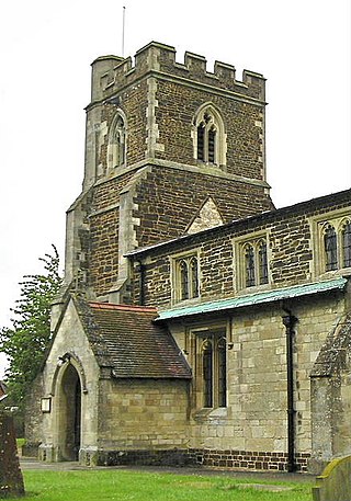
Preston is a village and civil parish about 3 miles (4.8 km) south of Hitchin in Hertfordshire, England. At the 2011 Census the population was 420.

Old Warden is a village and civil parish in the Central Bedfordshire district of the county of Bedfordshire, England, about 6.5 miles (10 km) south-east of the county town of Bedford.

Billington is a civil parish in Bedfordshire about 3 miles (4.8 km) south of Leighton Buzzard and not far from the Buckinghamshire border. There are two settlements: Little Billington and one that is now called Great Billington.

Everton is a small rural village of about 200 dwellings and civil parish in the Central Bedfordshire district of Bedfordshire, England about 9 miles (14 km) east of the county town of Bedford.

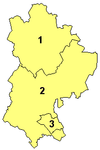
A civil parish is a country subdivision, forming the lowest unit of local government in England. There are 125 civil parishes in the ceremonial county of Bedfordshire, most of the county being parished: Luton is completely unparished; Central Bedfordshire is entirely parished. At the 2001 census, there were 312,301 people living in the 125 parishes, which accounted for 55.2 per cent of the county's population.

Holwell is a small village and a civil parish two miles north of Hitchin in Hertfordshire, England, near the Bedfordshire border. The parish was historically part of Bedfordshire, being transferred to Hertfordshire on 30 September 1897. At the 2011 Census the population of the village was 361.

Tilbrook is a village and civil parish in Cambridgeshire, England. Tilbrook lies approximately 10 miles (16 km) west of Huntingdon, near Covington. Tilbrook is situated within Huntingdonshire which is a non-metropolitan district of Cambridgeshire as well as being a historic county of England, although Tilbrook belongs historically to Bedfordshire.

Ampthill was a rural district in Bedfordshire, England from 1894 to 1974. It entirely surrounded but did not include the urban district of Ampthill.
Knotting and Souldrop is a civil parish in the Borough of Bedford in the county of Bedfordshire, England.

Moggerhanger is a village in the English county of Bedfordshire. It is west of Sandy on the road to Bedford. Its population in 2001 was 636, but had reduced to 620 at the 2011 Census. In the twentieth century the village name was spelled variously as: Moggerhanger, Mogerhanger, Muggerhanger and Morehanger. Local pronunciation of the name is as Morhanger.

Stanbridge is a village and civil parish in Bedfordshire which lies 3 miles (5 km) east of Leighton Buzzard. It also borders the Bedfordshire villages of Hockliffe, Eggington, Tilsworth, Totternhoe and Billington.

Melchbourne and Yielden is a civil parish in the Borough of Bedford in the county of Bedfordshire, England.

Willington is a village and civil parish located in the English county of Bedfordshire. It is west of Moggerhanger on the road from Sandy to Bedford. The village is recorded in the Domesday Book as Welitone and as Wilitona in c. 1150, from Old English tun (homestead) among the willows, and is part of the ancient hundred of Wixamtree.

Ousden is a village and civil parish in the West Suffolk district of Suffolk in eastern England. It is located around six miles west of Bury St Edmunds and 72 miles north of London, and as of 2011, its population is 266. The village has an Anglican church of St Peter's and a chapel in the cemetery dedicated to St Barnabas.

Hulcote is a village and a former civil parish, now in the parish of Hulcote and Salford, in the Central Bedfordshire district of the ceremonial county of Bedfordshire, England. In 1931 the parish had a population of 39.

Salford is a village and former civil parish, now in the parish of Hulcote and Salford, in the Central Bedfordshire district, in the ceremonial county of Bedfordshire, England. It is located near the large new town of Milton Keynes and the M1 motorway. In 1931 the parish had a population of 133. On 1 April 1933, the parish was merged with Hulcote to form "Hulcote and Salford".
Fancott is a hamlet located in the Central Bedfordshire district of Bedfordshire, England.

Easton Neston is situated in south Northamptonshire, England. Though the village of Easton Neston which was inhabited until around 1500 is now gone, the parish retains the name. At the 2011 Census the population of the civil parish remained less than 100 and was included in the town of Towcester.


