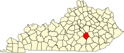
Hummel, Kentucky

Last updated
Hummel
USA Kentucky location map.svg
Red pog.svg
Hummel
Usa edcp location map.svg
Red pog.svg
Hummel
Coordinates: 37°23′47″N84°17′07″W / 37.39639°N 84.28528°W / 37.39639; -84.28528 Coordinates: 37°23′47″N84°17′07″W / 37.39639°N 84.28528°W / 37.39639; -84.28528
Country United States
State Kentucky
County Rockcastle
Elevation
[1]
1,056 ft (322 m)
Time zone UTC-5 (Eastern (EST))
  Summer (DST) UTC-4 (EDT)
ZIP code
38530
Area code(s) 606
GNIS feature ID512847 [1]

Hummel is an unincorporated community in Rockcastle County, Kentucky, United States. [1] The community is accessed from Kentucky Route 1786 (Wildie Road) or U.S. Route 25 via Hummel Road.

Geography

Hummel has an elevation of 1,065 ft (325 m). Roundstone Creek passes through the community. [1]

Related Research Articles

Danville, Kentucky City in Kentucky, United States

Danville is a home rule-class city in Boyle County, Kentucky, United States. It is the seat of its county. The population was 16,218 at the 2010 Census. Danville is the principal city of the Danville Micropolitan Statistical Area, which includes all of Boyle and Lincoln counties. In 2001, Danville received a Great American Main Street Award from the National Trust for Historic Preservation. In 2011, Money magazine placed Danville as the fourth-best place to retire in the United States. Centre College in Danville was selected to host U.S. vice-presidential debates in 2000 and 2012.

Annville is an unincorporated community and census-designated place (CDP) in Jackson County, Kentucky, United States. The population was 1,095 at the 2010 census. The community was named for local resident Nancy Ann Johnson. It is the largest community in Jackson County.

Nicholasville, Kentucky City in Kentucky, United States

Nicholasville is a home rule city in and the county seat of Jessamine County, Kentucky, United States. The population was 28,015 during the 2010 U.S. Census, making Nicholasville the 11th-largest settlement in the state.

U.S. Route 68 is a United States highway that runs for 560 miles (900 km) from northwest Ohio to Western Kentucky. The highway's western terminus is at US 62 in Reidland, Kentucky. Its present northern terminus is at Interstate 75 in Findlay, Ohio, though the route once extended as far north as Toledo. US 68 intersects with US 62 three times during its route.

U.S. Route 119 (US 119) is a spur of US 19. It is a north–south route that was an original United States highway of 1926. It is Corridor G of the Appalachian Development Highway System (ADHS) east of US 23 and KY 80 in Kentucky to Interstate 64 at Charleston, West Virginia.

Interstate 265 (I-265) is a 41.8-mile (67.3 km) Interstate Highway partially encircling the Louisville metropolitan area. Starting from I-65 in the southern part of Louisville, it runs through Jefferson County, Kentucky, crosses the Ohio River on the Lewis and Clark Bridge into Indiana, meets I-65 for a second time, and then proceeds westbound to terminate at the I-64 interchange.

Hebron, Kentucky Census-designated place in Kentucky, United States

Hebron is an unincorporated community and census-designated place (CDP) in Boone County, Kentucky, United States. The city is named after the Biblical city of Hebron. As of the 2010 census, it had a population of 5,929. It is home to the Cincinnati/Northern Kentucky International Airport, which serves Cincinnati and the Tri-State (Ohio-Kentucky-Indiana) area.

U.S. Route 31E (US 31E) is the easternmost of two parallel routes for U.S. Highway 31 from Nashville, Tennessee, to Louisville, Kentucky.

U.S. Route 25E is the eastern branch of U.S. Route 25 from Newport, Tennessee, where US 25 splits into US 25E and US 25W, to North Corbin, Kentucky, where the two highways rejoin. The road, however, continues as US 25E for roughly 2 miles (3.2 km) until it joins Interstate 75 in the Laurel County community of North Corbin at exit 29. The entire route serves as a arterial expressway for long-distance travelers and truckers connecting central Appalachia to the Great Lakes and Eastern Seaboard regions of the U.S. via access to Interstate highways.

U.S. Route 60 (US 60) is a major U.S. Highway in the American state of Kentucky. In the early days of the U.S. Highway System, US 60 was originally to be numbered as US 62. Following extensive lobbying and complaints filed by Kentucky governor William J. Fields to the American Association of State Highway Officials, the route was re-designated as US 60 before the system was finalized. In Kentucky, US 60 parallels the Ohio River. US 60 enters Kentucky from Cairo, Illinois, traveling northeast to Louisville, then takes a direct eastward route to rejoin the Ohio River in downtown Ashland, Kentucky. Both US 60 and US 23 run concurrently from Ashland to Catlettsburg where US 60 turns east and enters Kenova, West Virginia.

Lincoln Heritage Trail

The Lincoln Heritage Trail is a designation for a series of highways in the U.S. states of Illinois, Indiana and Kentucky that links communities with pre-presidential period historical ties to U.S. president Abraham Lincoln.

Kentucky Route 70 (KY 70) is a long east-east state highway that originates at a junction with U.S. Route 60 (US 60) in Smithland in Livingston County, just east of the Ohio River. The route continues through the counties of Crittenden, Caldwell, Hopkins, Muhlenberg, Butler, Edmonson, Barren, Barren, Metcalfe, Green, Taylor, Casey, Pulaski, Lincoln and back into Pulaski again to terminate at a junction with US 150 near Maretburg in Rockcastle.

Several special routes of U.S. Route 23 exist. There are 15 extant special routes along U.S. Route 23 and eight former routes, including those in Michigan.

U.S. Route 27 (US 27) in Kentucky runs 201.120 miles (323.671 km) from the Tennessee border to the Ohio border at Cincinnati. It crosses into the state in the Lake Cumberland area, passing near or through many small towns, including Somerset, Stanford, and Nicholasville. The road then passes straight through the heart of Lexington, including past the University of Kentucky (UK) and Transylvania University. North of Lexington it passes through Cynthiana and Falmouth before entering Campbell County and passing through many Northern Kentucky suburbs before ending at the Ohio state line on the Taylor Southgate Bridge in Cincinnati.

Kentucky Route 92 (KY 92) is a 112.485-mile-long (181.027 km) state highway Kentucky. The route is split into two segments by Lake Cumberland, one of a few state routes in Kentucky with two discontinued segments on both sides of a body of water. The western segment, which is 17.221-mile-long (27.715 km), runs from Kentucky Route 55 west of Joppa to a dead end on Lake Cumberland south of Jamestown via Joppa, Montpelier, Esto, and Jamestown. The eastern segment, which is 95.264-mile-long (153.313 km), runs from a boat ramp on Lake Cumberland northwest of Monticello to U.S. Route 25E west of Fourmile via Monticello, Barrier, Stearns, Carpenter, Timsley, and Ingram.

U.S. Route 431 in Kentucky runs 86.93 miles (139.90 km) from the Tennessee state line south of Adairville to US 60 at Owensboro. It crosses the state in mainly west-central portions of the state, passing through or near towns such as Russellville, Lewisburg, Central City and Livermore. The route goes through Logan, Muhlenberg, McLean County, and Daviess counties.

Cincinnati metropolitan area Metropolitan area in the United States

The Cincinnati metropolitan area is a metropolitan area centered on Cincinnati and including surrounding counties in the U.S. states of Ohio, Kentucky, and Indiana. The area is commonly known as Greater Cincinnati.

References