
Boyle Travers Finniss was the first premier of South Australia, serving from 24 October 1856 to 20 August 1857.

The Mid Murray Council is a local government area in South Australia in the Murray and Mallee region of South Australia. The council spans the area from the Riverland through the Murraylands to the eastern slopes of the Mount Lofty Ranges. It includes 220 km of the Murray River. The council seat is at Mannum; it also maintains secondary offices at Cambrai and Morgan.
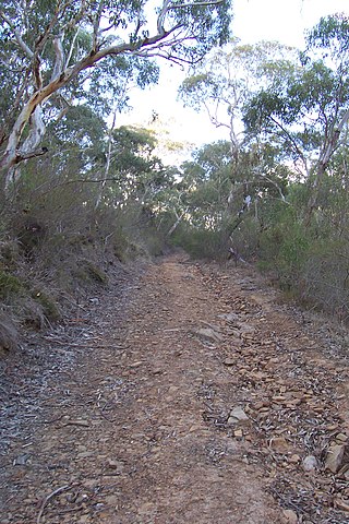
Finniss Conservation Park is a protected area in the Australian state of South Australia located in the Mount Lofty Ranges about 43 kilometres south of the state capital of Adelaide and about 7 kilometres west of Ashbourne. It is located within the gazetted locality of Mount Magnificent.
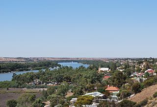
Mannum is a historic town on the west bank of the Murray River in South Australia, 84 kilometres (52 mi) east of Adelaide. Mannum is the seat of the Mid Murray Council, and is situated in the state electoral district of Hammond and the federal Division of Barker.

The County of Sturt is one of the 49 cadastral counties of South Australia. It was proclaimed by Governor George Grey in 1842 and named for early Australian explorer, Charles Sturt. It stretches from the Bremer River and eastern slopes of the Adelaide Hills at Nairne and Tungkillo to the Murray River in the east and in the south, the portion of Lake Alexandrina north of a line from Point Sturt to Pomanda Island. This includes the west-of-river parts of the contemporary local government areas of the Mid Murray Council and Murray Bridge City.

The Fog Bay and Finniss River Floodplains comprise the floodplain of the lower reaches of the Finniss River with the adjoining intertidal mudflats of Fog Bay in the Top End of the Northern Territory of Australia. It is an important site for waterbirds.

The Finniss River is a river south of Darwin, running west from the flank of Mount Minza, passing north of Litchfield National Park and flowing into the sea at Fog Bay. The East Branch of the Finniss was heavily polluted during the 1970s due to uranium mining at Rum Jungle mine about 105 km south of Darwin. The Finniss River Land Claim was presented to Judge John Toohey in 1981 but the former Rum Jungle mine site, contained within Area 4 of the Finniss River Land Claim (1981) was excluded from the grant to the Finniss River Land Trust due to the concerns of the Kungarakany and Warai peoples who are joint traditional Aboriginal owners of that area.

The County of Hindmarsh is one of the 49 cadastral counties of South Australia. It was proclaimed by Governor George Grey in 1842 and named for Governor John Hindmarsh.

The County of Eyre is one of the 49 cadastral counties of South Australia. It was proclaimed by Governor George Grey in 1842 and named for the explorer Edward John Eyre. It covers a portion of the state between the Adelaide Hills in the west and the Murray River in the east from Robertstown and Mannum on the northern boundary to Sedan and Swan Reach on the southern boundary.
The District Council of Port Gawler was a local government area in South Australia from 1856 to 1935. It was proclaimed on 11 September 1856 after being severed from the District Council of Mudla Wirra.
The District Council of Mannum was a local government area in South Australia from 1877 to 1997, centring on the town of Mannum.
The District Council of Mount Pleasant was a local government area in South Australia from 1935 to 1997. The council seat was located at Mount Pleasant.
The District Council of Kondoparinga was a local government area in South Australia from 1853 until 1935, at which point the council lands and resources formed the heart of the new District Council of Meadows.
Cowirra is a locality in the Murraylands region of South Australia. It is on the left (east) bank of the Murray River, opposite Mannum.
Charlotte is a locality in the Northern Territory of Australia located about 36 kilometres (22 mi) south of the territorial capital of Darwin.
William Pearson was a surveyor in the early days of the colony of South Australia.

