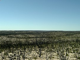
Ngarkat Conservation Park is a protected area located in South Australia's south-eastern corner about 200 kilometres south east of the Adelaide city centre.
The Clan Malcolm, also known as the Clan MacCallum, is a Highland Scottish clan. The Clan MacCallum may have originally been a separate clan until the 18th century, when the chief of the Clan MacCallum adopted the name Malcolm after inheriting the Malcolm estate, and the two clans were drawn together under the same chief.

Tatiara District Council is a local government area located in south-eastern South Australia. The name Tatiara is said to mean "the good country", a phrase which dates back to the area's first inhabitants, the Bodaruwitj people. It is one of the largest local government areas in South Australia at 6,476 km2 (2,500 sq mi). The district's economy is based primarily on agriculture, with cereal crops such as wheat, barley and oats and with livestock such as sheep, cattle and pigs prominent.
This is a list of members of the Western Australian Legislative Assembly between the 1933 election and the 1936 election, together known as the 15th Parliament.

John Campbell was an Australian politician. He was a member of the New South Wales Legislative Council in 1856 and between 1861 and 1886. He was also a member of the New South Wales Legislative Assembly between 1856 and 1860.
This is a list of members of the South Australian Legislative Council from 1918 to 1921.
Thomas McCallum was a politician in South Australia.
This is a list of members of the South Australian Legislative Council from 1938 to 1941.
Ngarkat is a locality in the Australian state of South Australia located in the south-east of the state at the border with the state of Victoria in both the Murray Mallee and the Limestone Coast regions about 227 kilometres south east of the state capital of Adelaide.

The County of Buckingham is one of the 49 cadastral counties of South Australia. It was proclaimed by Governor James Fergusson in 1869 and named for the third Duke of Buckingham and Chandos, Richard Temple-Nugent-Brydges-Chandos-Grenville who was appointed Secretary of State for the Colonies in 1867. It is located adjacent to the Victorian border in the state's upper south east. This includes most of the contemporary local government area of Tatiara District Council and a small east portion of Coorong District Council.
The County of Musgrave is a cadastral unit in the Australian state of South Australia that covers land on the west coast of Eyre Peninsula. It was proclaimed on 22 June 1876 and named after Anthony Musgrave, the Governor of South Australia from 9 June 1876 to 29 January 1877.

The County of Jervois is a cadastral unit in the Australian state of South Australia that covers land on the east coast of the Eyre Peninsula. It was proclaimed on 24 January 1878 and named after William Jervois, the Governor of South Australia from October 1877 to January 1883.
The Ngarkat is a recorded title of a tribal group from South Australia. The Ngarkat lands had linked the mallee peoples of Victoria and South Australia to the river peoples of the Murray River Murraylands. Ngarkat language has been loosely grouped with Peramangk language though not by linguists, and the grouping was perhaps partly owed to the co-ownership of lands in both the Ninety Mile Desert and Echunga by John Barton Hack, and partly to the occasional meeting of tribes. The language of the Ngarkat was recorded as being Boraipur by Ryan in recent times though sources were not given, while it may yet be telling that the citing work concerns Mallee peoples to the east. The language may have been midway between that of mallee peoples to the east, and that of peoples to the west recorded by Teichelmann and Schurman. It is known that songlines linked the Coorong to the Mallee regions, hence went through Ngarkat land. It is also known that Ngarkat people did meet regularly with tribes to the east, at sites along the Murray.
The Hundred of Makin is a cadastral unit of hundred located in the Australian state of South Australia within the County of Buckingham and the state government region of the Limestone Coast about 210 kilometres (130 mi) south-east of the state capital of Adelaide and about 50 kilometres (31 mi) north-west and 120 kilometres (75 mi) south-east respectively of the municipal seats of Bordertown and Tailem Bend.
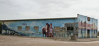
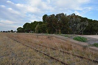
Cannawigara is a locality in the Limestone Coast region of South Australia. It is crossed by the Dukes Highway and Adelaide-Melbourne railway line northwest of Bordertown. The southern end of the Ngarkat Highway is the Dukes Highway adjacent to the Cannawigara railway station. While the Dukes Highway runs northwest from Bordertown, Cannawigara Road runs due west.
The County of Chandos is one of the 49 cadastral counties of South Australia. It was proclaimed in 1893 and named by Governor Kintore for the Duke of Buckingham and Chandos, Richard Temple-Nugent-Brydges-Chandos-Grenville who was appointed Secretary of State for the Colonies in 1867. It covers a large portion of the southern Mallee region, adjacent to the state border with Victoria in the state's south east.
Ngarkat were an indigenous Australian people of South Australia.