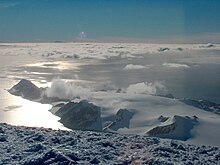
Balkan Snowfield is an ice-covered plateau of elevation ranging from 150 to 280 m in eastern Livingston Island in the South Shetland Islands, Antarctica, situated south of lower Perunika Glacier, northwest of Huntress Glacier and north of Contell Glacier. It is 3 km long in southwest-northeast direction and 2 km wide, and bounded by Burdick Ridge to the east, Willan Nunatak and Castillo Nunatak to the southeast, and Krum Rock to the southwest. The feature slopes gently northwestwards with its foot bounded by the hills along Bulgarian Beach. It is named after the Balkans.

Ballester Point is a point forming the south side of the entrance to Johnsons Dock and the northeast side of the entrance to Española Cove in Hurd Peninsula, Livingston Island in the South Shetland Islands, Antarctica. The area was visited by early 19th century sealers operating from Johnsons Dock.

Castellvi Peak is a peak rising to 350 m on Hurd Peninsula, Livingston Island. Situated 800 m northeast of MacGregor Peaks and 1.4 km southwest of Dorotea Peak. Spanish early mapping in 1991. Named for Josefina Castellví i Piulachs, a doyen of the Spanish Antarctic Program.

Willan Nunatak is an ice-free tipped peak rising to 449 m on the glacial divide between Huntress Glacier and Balkan Snowfield on Hurd Peninsula in eastern Livingston Island in the South Shetland Islands, Antarctica. It is linked to Burdick South Peak to the northeast by Willan Saddle and, via Castillo Nunatak and Charrúa Gap, to Charrúa Ridge to the west.

Napier Peak is the partly ice-free peak rising to 380 m on Hurd Peninsula, Livingston Island in the South Shetland Islands, Antarctica. It is linked to Charrúa Gap to the north by a 1.5 km ice-covered col, and by an ice-covered saddle to Mirador Hill to the south-southwest, and surmounts Johnsons Glacier to the northwest and west, Huntress Glacier to the east, and False Bay to the south.

Johnsons Glacier is the 1.8 km long and 2.3 km wide glacier on Hurd Peninsula, Livingston Island in the South Shetland Islands, Antarctica bounded by Charrúa Ridge and Charrúa Gap to the north, Napier Peak to the east, Mirador Hill to the southeast, Hurd Ice Cap to the southwest and Mount Reina Sofía to the west. It is draining northwestwards into Johnsons Dock. The glacier provides overland access from the Spanish base Juan Carlos Primero to the interior of the eastern Livingston Island.

Contell Glacier is 1.2 nmi long and 0.4 nautical miles wide glacier on Hurd Peninsula, Livingston Island in the South Shetland Islands, Antarctica bounded by Atlantic Club Ridge to the northwest, Krum Rock to the north, Balkan Snowfield to the northeast, and Charrúa Ridge and Charrúa Gap to the south. It is crescent-shaped, running northwestwards in its upper course, then between Charrúa Ridge and Krum Rock turning west-southwestwards to flow into South Bay north of Johnsons Dock.

Castillo Nunatak is a conspicuous rocky peak rising to 437 m on the glacial divide between Huntress Glacier and Balkan Snowfield on Hurd Peninsula in eastern Livingston Island in the South Shetland Islands, Antarctica. It is linked to Charrúa Ridge to the west Charrúa Gap and, via Willan Nunatak and Willan Saddle, to Burdick Ridge to the east-northeast. Castillo Nunatak is a prominent landmark in the Charrúa Gap area.

Mirador Hill is the rocky hill rising to 307 m on Hurd Peninsula, Livingston Island in the South Shetland Islands, Antarctica and surmounting Johnsons Glacier to the north-northwest and False Bay to the southeast.

Moores Peak is the prominent rocky peak rising to 407 m on Hurd Peninsula, Livingston Island in the South Shetland Islands, Antarctica and surmounting False Bay to the southeast.

Polish Bluff is a point forming the southwest side of the entrance to Española Cove and the northeast side of the entrance to Argentina Cove in Hurd Peninsula, Livingston Island in the South Shetland Islands, Antarctica. The area was visited by early 19th century sealers operating from nearby Johnsons Dock.

Henry Bluff is a point forming the southwest side of the entrance to Argentina Cove and the north side of the entrance to Las Palmas Cove in Hurd Peninsula, Livingston Island in the South Shetland Islands, Antarctica. The point is dominated by a prominent monolithic formation rising to 163 m and named El Peñón by personnel of the nearby Spanish Antarctic Base. The area was visited by early 19th century sealers operating from nearby Johnsons Dock.

Salisbury Bluff is the point forming the south side of the entrance to Las Palmas Cove in Hurd Peninsula, Livingston Island in the South Shetland Islands, Antarctica and surmounted by a 161 m height. The area was visited by early 19th century sealers operating from nearby Johnsons Dock.

Sally Rocks is a small group of rocks trending southwestwards in South Bay just off the west coast of Hurd Peninsula, Livingston Island in the South Shetland Islands, Antarctica.

Argentina Cove is a 1.28 km wide embayment indenting for 330 m the southeast coast of Hurd Peninsula, Livingston Island in the South Shetland Islands, Antarctica. It is part of South Bay, entered between Polish Bluff and Henry Bluff. The area was frequented by early 19th century sealers operating from nearby Johnsons Dock.

Las Palmas Cove is a 1.97 km wide embayment indenting for 500 m the northwest coast of Hurd Peninsula on Livingston Island in the South Shetland Islands, Antarctica. It is part of South Bay, Livingston Island entered between Henry Bluff and Salisbury Bluff. The area was visited by early 19th century sealers operating from nearby Johnsons Dock. It also where the Las Palmas Glacier terminates.

Mount Reina Sofía is the mostly ice-free peak rising to 275 m on Hurd Peninsula, Livingston Island in the South Shetland Islands, Antarctica and surmounting Johnsons Glacier to the east and northeast, and the Spanish Antarctic base Juan Carlos Primero to the north-northwest.

Pirámide Peak is a sharp rocky peak rising to 366 m at the southeast edge of Hurd Ice Cap on Hurd Peninsula, Livingston Island in the South Shetland Islands, Antarctica and surmounting False Bay to the southeast.

Buena Nueva Cove is a small open cove, 900 m wide and indenting for 200 m the northwest coast of False Bay, Livingston Island in the South Shetland Islands, Antarctica southeast of MacGregor Peaks and east of Castro Peak on Hurd Peninsula. The area was visited by early 19th century sealers.

Glaciar Rocoso Cove is a small open cove, part of False Bay, Livingston Island in the South Shetland Islands, Antarctica. It is 920 m wide and indenting for 180 m the southeast coast of Hurd Peninsula east-northeast of Binn Peak and south-southwest of Nusha Hill. The area was visited by early 19th century sealers.


