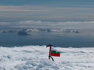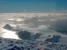
Rugged Island is an island 3 miles (4.8 km) long and 1 mile (1.6 km) wide, lying west of Livingston Island in the South Shetland Islands. Its surface area is 10.4 square kilometres (4.0 sq mi). The island's summit San Stefano Peak rises to 256 metres (840 ft) above sea level. Rugged Island is located at 62°38′S61°15′W. Rugged Island was known to both American and British sealers as early as 1820, and the name has been well established in international usage for over 100 years.

Hesperides Hill is a ridge linked by a saddle of elevation 52 m with the northern slopes of Atlantic Club Ridge on Hurd Peninsula, eastern Livingston Island in the South Shetland Islands, Antarctica. The hill surmounts the South Bay coast north of Johnsons Dock to the southwest, and Bulgarian Beach to the northeast and is bounded to the southwest by Sea Lion Glacier. The ridge extends 420 m in south-southeast to north-northwest direction and is 250 m wide and narrowing towards north-northwest. Hesperides Hill has two heights, 94 and 63 m, the latter surmounting Hespérides Point. The hill is snow-free in summer months and is named from the adjacent Hespérides Point.

Kuzman Knoll is a solitary ice-covered knoll rising to 620 m in eastern Livingston Island in the South Shetland Islands, Antarctica. The knoll forms a conspicuous landmark in Wörner Gap area, overlooking Huron Glacier and upper Perunika Glacier. It was named after Kuzman Tuhchiev, participant in the 1993/94 Bulgarian Antarctic campaign and base commander at St. Kliment Ohridski during the 1994-96 seasons.

Magura Glacier on the southeast side of Tangra Mountains on Livingston Island in the South Shetland Islands, Antarctica is located to the north of M'Kean Point, northeast of Srebarna Glacier, south of Iskar Glacier and southwest of Dobrudzha Glacier. It is bounded by Great Needle Peak to the west, Vitosha Saddle, Vihren Peak and Helmet Peak to the northwest, Plovdiv Peak and Shishman Peak to the north, and Devin Saddle and Kuber Peak to the northeast. The glacier extends 3.5 km in southwest-northeast direction and 1.9 km in northwest-southeast direction, and flows southeastward into Bransfield Strait.

Nikopol Point is an ice-free point on the south coast of Byers Peninsula, Livingston Island in the South Shetland Islands, Antarctica projecting 650 m east-southeastwards into Bransfield Strait and linked by a spit to Vietor Rock to the south. The area was visited by early 19th century sealers who had dwellings at the foothills of nearby Sealer Hill.

Orpheus Gate, also Orpheus Pass, is the 548 m high and 380 m wide pass in eastern Livingston Island in the South Shetland Islands, Antarctica, bounded by Pliska Ridge on the southeast and Polanco Peak in Burdick Ridge on the northwest, Huntress Glacier on the southwest and Perunika Glacier on the northeast.

Prespa Glacier on Rozhen Peninsula, Livingston Island in the South Shetland Islands, Antarctica is situated east-northeast of Tarnovo Ice Piedmont, east of the head of Charity Glacier, southeast of Ruen Icefall and southwest of Macy Glacier. It is bounded to the east by Needle Peak and Ludogorie Peak, to the northwest by St. Cyril Peak and St. Methodius Peak, and to the southwest by Shumen Peak and Yambol Peak, and flows southeastward into Bransfield Strait between Gela Point and Samuel Point. The feature extends 3.5 km in east-west direction and 2.5 km in north-south direction. The glacier is named after Prespa Peak in the Rhodope Mountains, Bulgaria.

Rezovski Creek is a meltwater stream located on Livingston Island, Antarctica.

Spanish Knoll has a highest point of elevation 48 m located on Bulgarian Beach on Hurd Peninsula, eastern Livingston Island in the South Shetland Islands, Antarctica.

Spanish Point is located on Bulgarian Beach on Hurd Peninsula, eastern Livingston Island in the South Shetland Islands, Antarctica formed by an offshoot of Spanish Knoll.

Varna Peninsula is a roughly rectangular predominantly ice-covered peninsula forming the northeast extremity of Livingston Island in the South Shetland Islands, Antarctica. It is bounded by Hero Bay to the northwest, by Moon Bay to the southeast, and by McFarlane Strait to the northeast.

Vergilov Rocks are a group of rocks off Bulgarian Beach on Hurd Peninsula in eastern Livingston Island in the South Shetland Islands, Antarctica, consisting of one main rock and two adjacent smaller ones submerging at high water.

Wörner Gap is a flat saddle extending 3 km in the south-north direction between Friesland Ridge and Bowles Ridge in eastern Livingston Island in the South Shetland Islands, Antarctica. Its elevation decreases from 585 m in the south to 541 m in the middle, and 525 m in the north. The gap separates the glacial catchments of Perunika Glacier to the west and Huron Glacier to the east, and is linked to the east to Kuzman Knoll, a conspicuous landmark in the area. The gap is visited by field parties from St. Kliment Ohridski Base and Juan Carlos I Base and is subject to Spanish and Bulgarian glaciological studies.

Bowles Ridge is the central ridge of eastern Livingston Island. The ridge extends 6.5 km in the east-west direction and is 1.5 km wide. The summit of the ridge is Mount Bowles which rises to 822m and is located 9.77 km northwest of Great Needle Peak, 6.08 km north by west of Mount Friesland, 8.77 km east-northeast of St. Kliment Ohridski base and 9.25 km south by west of Miziya Peak.

Start Point is a point marking the northwest end of Byers Peninsula, Livingston Island in the South Shetland Islands, Antarctica and forming the southwest side of the entrance to Svishtov Cove and the northeast side of the entrance to the New Plymouth bay. Discovered by Edward Bransfield in January 1820, and so named by him because of its resemblance to a point on the south coast of England by the same name and because it was the place where his operations began.

Desolation Island is one of the minor islands in the South Shetlands archipelago, Antarctica situated at the entrance to Hero Bay, Livingston Island. The island is V-shaped with its northern coast indented by Kozma Cove. Surface area is 3.12 square kilometres (1.20 sq mi).

Cape Shirreff is a prominent cape at the north end of the rocky peninsula which separates Hero Bay and Barclay Bay on the north coast of Livingston Island, in the South Shetland Islands of Antarctica. The cape was named by Edward Bransfield in 1820 after Captain William H. Shirreff, the British commanding officer in the Pacific at that time.

Burdick Ridge is a ridge rising to an elevation of 773 metres (2,536 ft) on Livingston Island in the South Shetland Islands. Extending for 1.9 kilometres (1.2 mi) between Orpheus Gate in the southeast and Rezen Saddle in the northwest, it is bounded by Perunika Glacier to the northeast and Balkan Snowfield to the southwest. It takes its name from its highest point, Burdick Peak.

Johnsons Dock is a sheltered 500 m wide cove indenting for 900 m the northwest coast of Hurd Peninsula on Livingston Island in the South Shetland Islands, Antarctica. It is part of South Bay entered north of Ballester Point. Surmounted by Charrúa Ridge on the northeast. The cove was frequented by early 19th century sealers.

Window Island is a small ice-free island off the north coast of Ray Promontory in the northwest of Byers Peninsula, Livingston Island in the South Shetland Islands, Antarctica. The island has a surface area of 23 hectares and rises to 72 m (236 ft). It was known to the early 19th century sealers operating on Byers Peninsula.


