Husk, North Carolina

Last updated
Husk
USA North Carolina location map.svg
Red pog.svg
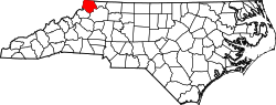
Husk
Location within the U.S. state of North Carolina
Coordinates: 36°34′N81°33′W / 36.57°N 81.55°W / 36.57; -81.55
Country Flag of the United States.svg  United States
State North Carolina
County Ashe
Time zone UTC-5 (EST)
  Summer (DST) UTC-4 (EDT)
ZIP Code
28643
Area code(s) 336, 743

Husk is an unincorporated community in Ashe County, North Carolina, United States. [1] [2]

Geography

Husk is located in northwestern Ashe County, north of Lansing. The community is bordered to the north by Virginia.

Big Horse Creek Road is the primary road within Husk. [1]

The ZIP Code for Husk is 28643. [2]

Related Research Articles

<span class="mw-page-title-main">Ashe County, North Carolina</span> County in North Carolina, United States

Ashe County is a county located in the U.S. state of North Carolina. As of the 2020 census, the population was 26,577. Its county seat is Jefferson.

New Hill is an unincorporated community located in southwestern Wake County, North Carolina, United States, at the crossroads of old U.S. 1, New Hill Olive Chapel Road and New Hill Holleman Road. New Hill is located along the original alignment of the New Hope Valley Railway between Durham and Bonsal. The ZIP Code for New Hill is 27562.

<span class="mw-page-title-main">Currituck, North Carolina</span> Unincorporated community in North Carolina, United States

Currituck is an unincorporated community in extreme northeastern North Carolina, United States. Situated along the Currituck Sound, it serves as the county seat for Currituck County. Currituck is part of the Inner Banks region and is one of the state's few unincorporated county seats. The community harbors the Knotts Island Ferry, which provides free shuttles across the sound to Knotts Island. North Carolina Highway 168 and Courthouse Road are the community's most prominent roads. The Currituck Beach Lighthouse is not located on mainland Currituck but is located across the sound on the Outer Banks.

Rocky Point is a census-designated place and unincorporated community in southern Pender County, North Carolina, United States. It is part of the Wilmington Metropolitan Statistical Area. Rocky Point is situated on North Carolina Highway 210, North Carolina Highway 133 and U.S. Route 117.

<span class="mw-page-title-main">Todd, North Carolina</span> Unincorporated community in North Carolina, United States

Todd is an unincorporated community straddling the county lines of Watauga and Ashe counties in northwestern North Carolina, United States on the South Fork of the New River. It lies at an elevation of 2,992 feet. The population was 2,141 at the 2010 United States Census. The ZIP Code for Todd is 28684.

Scottville is an unincorporated community in both Ashe and Alleghany counties, North Carolina, United States, on U.S. Route 221. It lies at an elevation of 2,854 feet. The ZIP Code for Scottville is 28672.

<span class="mw-page-title-main">Creston, North Carolina</span> Unincorporated community in North Carolina, US

Creston is an unincorporated community in Ashe County, North Carolina, United States, southwest of Grayson. It lies at an elevation of 2,861 feet. The ZIP Code for Creston is 28615.

Beaver Creek is an unincorporated community in Ashe County, North Carolina, United States, located off U.S. Route 221, south of West Jefferson.

Crumpler is an unincorporated community in Ashe County, North Carolina. It is located northeast of Jefferson, at an elevation of 2559 feet.

Comet is an unincorporated community in Ashe County, North Carolina, United States, located west of Warrensville.

Warrensville is an unincorporated community at the intersection of NC 88 and NC 194 in Ashe County, North Carolina, United States, east of Comet. It lies at an elevation of 2,707 feet. The ZIP Code for Warrensville is 28693.

Hubert is an unincorporated community located in Onslow County, North Carolina, United States. The community is located west of Swansboro. Hubert is part of the Jacksonville, NC Metropolitan Statistical Area.

Glendale Springs is an unincorporated community in Ashe County, North Carolina, United States. Glendale Springs is located on North Carolina Highway 16, 7.3 miles (11.7 km) southeast of Jefferson. Glendale Springs has a post office with ZIP code 28629.

<span class="mw-page-title-main">Laurel Springs, North Carolina</span> Unincorporated community in North Carolina, United States

Laurel Springs is an unincorporated community in Alleghany County, North Carolina, United States. Laurel Springs is located at the junction of North Carolina Highway 18 and North Carolina Highway 88 near the Ashe County line, 10.2 miles (16.4 km) southwest of Sparta. The Blue Ridge Parkway also crosses the center of the community. Laurel Springs has a post office with ZIP code 28644.

Fleetwood is an unincorporated community in Ashe County, North Carolina, United States. Fleetwood is located along Railroad Grade Road near U.S. Route 221, 8.2 miles (13.2 km) south-southwest of Jefferson. Fleetwood has a post office with ZIP code 28626, which opened on July 27, 1898.

Brandon is an unincorporated community in Ashe County, North Carolina, United States.

<span class="mw-page-title-main">Safe, North Carolina</span> Unincorporated community in North Carolina, U.S.

Safe is an unincorporated community in Duplin County, North Carolina, United States.

Williston is an unincorporated community in Carteret County, North Carolina, United States.

Ocean is an unincorporated community in Carteret County, North Carolina, United States.

<span class="mw-page-title-main">Lola, North Carolina</span> Unincorporated community in North Carolina, U.S.

Lola is an unincorporated community in Carteret County, North Carolina, United States. It is an enclave within the community of Cedar Island.

References

  1. 1 2 "Husk, North Carolina". Google Maps. Retrieved January 9, 2025.
  2. 1 2 "28643 ZIP Code Map". www.unitedstateszipcodes.org. Archived from the original on March 5, 2016. Retrieved January 9, 2025.