
The Iguazú National Park is a national park of Argentina, located in the Iguazú Department, in the north of the province of Misiones, Argentine Mesopotamia. It has an area of 677 km2 (261 sq mi).

Cangas del Narcea is the oldest municipality in the Principality of Asturias in Spain. It is also the largest municipality in Asturias. It is in the southwest of Asturias, on the Asturian border with León. Formerly, Cangas del Narcea was known as Cangas de Tineo . Cangas del Narcea is also the name of the municipality's capital, and one of the judicial districts in Asturias.
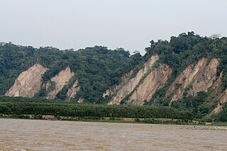
The Tuichi River is a river in the Madidi National Park in the north of Bolivia. The Tuichi River flows through the rainforest and joins the Beni River south of Rurrenabaque.

Cueva de los Guácharos National Natural Park is the oldest national park in Colombia. Located in the western face of the Colombian Eastern Andean Range in the departments of Huila and Caquetá, the park covers an area of 9,000 hectares. The caves formed from the karstic zones of the Magdalena and Caquetá rivers.

Bahía Portete – Kaurrele National Natural Park is a national natural park in Uribia, La Guajira, Colombia. The northernmost national park of mainland South America is located at the Caribbean coast of the La Guajira peninsula in Bahía Portete, between Cabo de la Vela and Punta Gallinas. Established on December 20, 2014, it is the most recently designated national park of the country. As of 2017, 59 nationally defined protected areas are incorporated in Colombia. The park hosts a high number of marine and terrestrial species.

Cotapata National Park and Integrated Management Natural Area is a protected area in the Yungas of La Paz Department, Bolivia. It is situated in the northwest of the department, in the Nor Yungas and Murillo provinces in the Coroico and La Paz Municipalities, about 50 km (31 mi) away from the city of La Paz.

Otuquis National Park and Integrated Management Natural Area,, is a national park in the Pantanal ecoregion of southeastern Bolivia.

Kaa-Iya del Gran Chaco National Park and Integrated Management Natural Area is the biggest national park in Bolivia and one of the largest in South America. It is a protected area in the region of the Gran Chaco and has a larger surface area than Belgium. It is situated in the south of Santa Cruz Department on the border with Paraguay in the Cordillera Province and Chiquitos Province.
Aguaragüe National Park and Integrated Management Natural Area is a protected area in Bolivia situated in the Tarija Department, Gran Chaco Province. The national park covers the whole of Serranía del Aguaragüe, the easternmost mayor Sub-Andean range.
Cuevas del Silvino is a limestone cave system in Guatemala. It is located at km 260 on the road connecting Guatemala City to Puerto Barrios, in the municipality of Morales in the department of Izabal.
The Rosario and San Bernardo Corals National Natural Park is a natural park located in the Sucre and Bolívar Departments on the coast of the Caribbean Region of Colombia, 45 km from the Bay of Cartagena. It was the most visited national park in Colombia in 2009, with 318,473 visitors.
The Tamá National Natural Park is a national park located in the Tamá Massif of the Andean Region of Colombia, between the municipalities Toledo and Herrán, in the department of Norte de Santander, in the northeastern part of the Eastern Ranges of the Colombian Andes. One of the main attractions of the park is a 820-metre-high (2,690 ft) waterfall, one of the world's highest.

The Special Administrative Unit of the Network of National Natural Parks of Colombia is Colombian central agency that manages all the national parks and protected areas.

The Serranía de Chiribiquete or Chiribiquete Mountains are a group of isolated table mountains in the Amazon Region of Colombia. The mountains are part of the western edge of the Guiana Shield. The area is protected as a national park. This area is habitat for the Chiribiquete emerald, an endemic hummingbird. The waterfall Caño Paujil originates from the Serranía de Chiribiquete.

Yacurí National Park is a 431-square-kilometre (166 sq mi) National Park in Ecuador located on the border between the provinces Loja and Zamora Chinchipe. It is part of a larger Protected Forest of 733 km2 (283 sq mi). It was founded in 2009. The headwaters for both the Chinchipe-Mayo (east) and Catamayo-Chira (west) water basins are in the park.
Chiribiquete National Natural Park is the largest national park in Colombia and the largest tropical rainforest national park in the world. It was established on 21 September 1989 and has been expanded twice, first in August 2013 and then in July 2018. The park occupies about 43,000 km2 (17,000 sq mi) and includes the Serranía de Chiribiquete mountains and the surrounding lowlands, which are covered by tropical moist forests, savannas and rivers.
The Ciénagas del Catatumbo National Park Also Catatumbo Marshes National Park or Ciénagas de Juan Manuel National Park Is a protected area. of Venezuela.

Bahía de Loreto National Park is a national park on the east coast of the Baja California Peninsula in Mexico, about 203 kilometres (126 mi) north of the city of La Paz in the state of Baja California Sur. The park protects 2,065.81 square kilometres (797.61 sq mi) of relatively pristine marine ecosystem in the central Sea of Cortez, including five large uninhabited islands and many smaller islets in Loreto Bay. It is known for its great variety of coastal environments, such as sandy beaches, sea cliffs, submarine canyons, and marine terraces, and is home to an exceptionally high biological diversity, especially of marine mammals.


