This article needs additional citations for verification .(May 2020) |
You can help expand this article with text translated from the corresponding article in Dutch. (May 2013)Click [show] for important translation instructions.
|
Overview | |
---|---|
Location | IJ |
Coordinates | 52°22′47″N4°54′39″E / 52.37972°N 4.91083°E |
Start | Centre of Amsterdam |
End | Amsterdam-Noord |
Operation | |
Opened | 30 October 1968 (built 1957-1968) |
Character | Submerged automobile tunnel |
Technical | |
Length | 1,682 m |
Route map | |
The IJtunnel, opened on 30 October 1968, is an automobile tunnel under the IJ that connects the centre of Amsterdam with Amsterdam-Noord. The tunnel is part of a route across Amsterdam that connects the Ringweg North with the Ringweg South near Duivendrecht, via Nieuwe Leeuwarderweg, Valkenburgerstraat, Weesperstraat, Wibautstraat and Gooiseweg (S112).
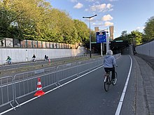
The total length of the tunnel, including on- and off-ramps, is 1682 metres. The covered part is 1039 metres long. The deepest point of the tunnel lies 20.32 metres below sea-level. The tunnel was built of sections of rectangular concrete constructions of 24.8 x 8.75 metres, subdivided into two tubes for automobile traffic and in between tubes for cables and pipes.
Ventilators, located in two ventilation buildings on the banks of the IJ, blow clean air into the traffic areas via tubes under the surface of the road and openings in the tunnel walls, and suck polluted air out. At the entrance on the north side there are sun-blocking lattices over the road. These lattices are missing on the south side, where the Nemobuilding is built on top of the tunnel. The traffic in the tunnel is monitored by 22 closed-circuit cameras. A heating system prevents the forming of ice on the surface of the road, and a computer regulates the intensity of light at the beginning and the end of the tunnel, so that a gradual transition from tunnel light to daylight takes place.
The route through the IJtunnel is an urban avenue, formed out of two divided tunnels, each with two lanes of traffic. This four-lane road continues to the A10 in the north and to the Prins Hendrikkade in the south, where it is reduced to two lanes, one in each direction.
The IJtunnel is a class D tunnel under the ADR treaty. The classification means that no one may use the tunnel to transport dangerous goods that may cause a large explosion, or a large toxic release, or a large fire. [1] The tunnel is also an entry point to Amsterdam's low emission zone, [2] and there is a height limit of 4 meters.
Pedestrians, agricultural vehicles, bicycles and mopeds are generally not allowed to use the IJtunnel. However, the ban on pedestrians, bicycles and mopeds may be temporarily lifted if public transport and ferry services across the IJ are suspended: such a situation occurred in 1993, 1997, 2005 and 28 May 2019. There was also a special open day on 26 October 1968, to mark the opening of the tunnel. The tunnel is also used by runners during the annual Dam tot Damloop.
The expressways of Singapore are special roads that allow motorists to travel quickly from one urban area to another. Construction of the system was authorized when construction of the Pan Island Expressway began in 1962. All of them are dual carriageways with grade-separated access. They usually have three to four lanes in each direction, although there are two-lane carriageways at many expressway intersections and five-lane carriageways in some places. There are ten expressways. Studies about the feasibility of additional expressways are ongoing.
Road signs in Sweden are regulated in Vägmärkesförordningen, VMF (2007:90), and are to be placed 2 metres from the road with the sign 1.6 m from the base for motorized roads. Except for route numbers, there are a maximum of three signs on a pole, with the most important sign at the top. All signs have a reflective layer added on selected parts of the sign as is custom in European countries; most larger signs also have their own illumination.
Cycling is the second-most common mode of transport in the Netherlands, with 36% of Dutch people listing the bicycle as their most frequent way of getting around on a typical day, as opposed to the car (45%) and public transport (11%). Cycling has a modal share of 27% of all trips nationwide. In cities this is even higher, such as Amsterdam which has 38%, and Zwolle 46%. This high frequency of bicycle travel is enabled by excellent cycling infrastructure such as cycle paths, cycle tracks, protected intersections, ample bicycle parking and by making cycling routes shorter and more direct than car routes.
Road signs in Norway are regulated by the Norwegian Public Roads Administration, Statens vegvesen.
Road signs in Iceland are visual communication devices placed along roads and highways throughout the country to provide information, warnings, and guidance to motorists and pedestrians. Iceland never ratified the Vienna Convention on Road Signs and Signals, but road signs in Iceland conform to the general pattern of those used in most other European countries, with certain design elements borrowed from Danish and Swedish practice. Signs tend to be more sparsely employed than in other European countries, especially in rural areas.
Western Scheldt Tunnel is a 6.6-kilometre (4.1 mi) tunnel in the Netherlands that carries highway N62 under the Western Scheldt estuary between Ellewoutsdijk and Terneuzen. It is the longest tunnel for highway traffic in the Netherlands.
The design of road signs in Poland is regulated by Regulation of the Ministers of Infrastructure and Interior Affairs and Administration on road signs and signals. The Annex 1 to the regulation describes conditions related to usage of the road signs – size, visibility, colors and light reflections, typeface and text, criteria of choosing the type of foil to signs faces, colorful specimens and schematics.
The road signs of the Kingdom of the Netherlands, as well as Suriname, are regulated in the Reglement verkeersregels en verkeerstekens 1990, commonly abbreviated as RVV 1990. While most previous signage, from the RVV 1966 (Dutch) remained legal and official, they have been updated / replaced. Some aren't official anymore and have lost legal validity, but most surviving old signs remained valid.
Road signs in Austria are regulated in Straßenverkehrsordnung (StVO).
Road signs in Switzerland and Liechtenstein generally conform to the 1968 Vienna Convention on Road Signs and Signals.
Road signs in Ukraine are governed by a combination of standards set out by the Vienna Convention on Road Signs and Signals, the European Union (EU), and Ukraine Transport and Roads Agency. Ukrainian signs are similar to the signs of other post-Soviet states and are set out in 7 separate categories based on meaning: Warning, priority, prohibitory, mandatory, information, guide, and additional plates.
Road signs in Hong Kong are standardised by the Transport Department. Due to being a former British territory, the road signage in Hong Kong is similar to road signs in the United Kingdom, with the addition of Traditional Chinese characters.
Terminology related to road transport—the transport of passengers or goods on paved routes between places—is diverse, with variation between dialects of English. There may also be regional differences within a single country, and some terms differ based on the side of the road traffic drives on. This glossary is an alphabetical listing of road transport terms.
These road signs are used in France, and can also be found in some overseas territories of France.
Road signs in Georgia are similar to the road sign system of other post-Soviet states that ensure that transport vehicles move safely and orderly, as well as to inform the participants of traffic built-in graphic icons. However, some road signs look a bit different from Soviet ones and closer to the European ones. These icons are governed by the Vienna Convention on Road Traffic and Vienna Convention on Road Signs and Signals.
Road signs in Lithuania ensure that transport vehicles move safely and orderly, as well as to inform the participants of traffic built-in graphic icons. These icons are governed by the Vienna Convention on Road Traffic and Vienna Convention on Road Signs and Signals.
This page lists the traffic signs used in Belgium, as included in the traffic code.
Road signs in Portugal are governed by the "Regulamento de Sinalização do Trânsito" of the Republic of Portugal.
Road signs in Latvia ensure that transport vehicles move safely and orderly, as well as to inform the participants of traffic built-in graphic icons. These icons are governed by the Vienna Convention on Road Traffic and Vienna Convention on Road Signs and Signals. The system is covered in Ceļu satiksmes noteikumi and the standards documents LVS 77–1:2016 "Ceļa zīmes. 1. daļa: Ceļa zīmes", LVS 77-2:2016 "Ceļa zīmes. 2. daļa: Uzstādīšanas noteikumi" and LVS 77-3:2016 "Ceļa zīmes. 3. daļa: Tehniskās prasības".
Road signs in South Africa are based on the SADC-Road Traffic Sign Manual, a document designed to harmonise traffic signs in member states of the Southern Africa Development Community. Most of these signs were in the preceding South African RTSM.