Washington County is a county in the southwestern corner of Utah, United States. As of the 2020 United States Census, the population was 180,279, making it the fifth-most populous county in Utah. Its county seat and largest city is St. George. The county was created in 1852 and organized in 1856. It was named after the first President of the United States, George Washington. A portion of the Paiute Indian Reservation is in western Washington County. Washington County comprises the St. George, UT Metropolitan Statistical Area.

Inyo County is a county in the eastern central part of the U.S. state of California, located between the Sierra Nevada and the state of Nevada. In the 2020 census, the population was 19,016. The county seat is Independence. Inyo County is on the east side of the Sierra Nevada and southeast of Yosemite National Park in Central California. It contains the Owens River Valley; it is flanked to the west by the Sierra Nevada and to the east by the White Mountains and the Inyo Mountains. With an area of 10,192 square miles (26,400 km2), Inyo is the second-largest county by area in California, after San Bernardino County. Almost half of that area is within Death Valley National Park. However, with a population density of 1.8 people per square mile, it also has the second-lowest population density in California, after Alpine County.

San Bernardino County, officially the County of San Bernardino and sometimes abbreviated as S.B. County, is a county located in the southern portion of the U.S. state of California, and is located within the Inland Empire area. As of the 2020 U.S. Census, the population was 2,181,654, making it the fifth-most populous county in California and the 14th-most populous in the United States. The county seat is San Bernardino.

Mohave County occupies the northwestern corner of the U.S. state of Arizona. As of the 2020 census, its population was 213,267. The county seat is Kingman, and the largest city is Lake Havasu City. It is the fifth largest county in the United States.

Huerfano County is a county located in the U.S. state of Colorado. As of the 2020 census, the population was 6,820. The county seat is Walsenburg. The county, whose name comes from the Spanish huérfano meaning "orphan", was named for the Huerfano Butte, a local landmark. The area of Huerfano County boomed early in the 1900s with the discovery of large coal deposits. After large scale World War II coal demand ended in the 1940s Walsenburg and Huerfano saw a steady economic decline through 2015.

Grand County is a county located in the U.S. state of Colorado. As of the 2020 census, the population was 15,717. The county seat is Hot Sulphur Springs.

The Humboldt–Toiyabe National Forest (HTNF) is the principal U.S. National Forest in the U.S. state of Nevada, and has a smaller portion further west in Eastern California in the state of California. With an area of 6,289,821 acres (25,454.00 km2), it is the largest U.S. National Forest reservation outside of Alaska, further northwest on the North American continent.

Mojave National Preserve is a United States National Preserve located in the Mojave Desert of San Bernardino County, California, US, between Interstate 15 and Interstate 40. The preserve was established October 31, 1994, with the enactment of the California Desert Protection Act by the United States Congress, which also established Joshua Tree National Park and Death Valley National Park as National Parks. Previously, some lands contained within the Preserve were the East Mojave National Scenic Area, under the jurisdiction of the Bureau of Land Management. At 1,542,776 acres (6,243 km2), within the contiguous United States it is the third largest unit of the National Park System and the first largest National Preserve. The preserve was created within the Pacific West Region of the National Park Service and remains within that jurisdiction today.

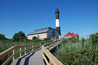
Fire Island National Seashore (FINS) is a United States National Seashore that protects a 26-mile (42 km) section of Fire Island, an approximately 30-mile (48 km) long and 0.5-mile (0.80 km) wide barrier island separated from Long Island by the Great South Bay. The island is part of New York State's Suffolk County and the Outer Barrier.

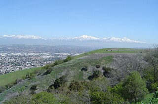
The Puente Hills are a chain of hills, one of the lower Transverse Ranges, in an unincorporated area in eastern Los Angeles County, California, in the United States. The western end of the range is often referred to locally as the Whittier Hills. The eastern end is in the city of Chino Hills in San Bernardino County.

Arapaho National Forest is a National Forest located in north-central Colorado, United States. The region is managed jointly with the Roosevelt National Forest and the Pawnee National Grassland from the United States Forest Service office in Fort Collins, Colorado. It has a wildlife refuge which manages a protection for all birds and mammals. The combined facility of 1,730,603 acres (7,004 km2) is denoted as ARP by the Forest Service. Separately, Arapaho National Forest consists of 723,744 acres (2,929 km2).

Caribou–Targhee National Forest is located in the states of Idaho and Wyoming, with a small section in Utah in the United States. The forest is broken into several separate sections and extends over 2.63 million acres (10,600 km2). To the east the forest borders Yellowstone National Park, Grand Teton National Park and Bridger–Teton National Forest. Most of the forest is a part of the 20-million-acre (81,000 km2) Greater Yellowstone Ecosystem.

Inyo National Forest is a United States National Forest covering parts of the eastern Sierra Nevada of California and the White Mountains of California and Nevada. The forest hosts several superlatives, including Mount Whitney, the highest point in the contiguous United States; Boundary Peak, the highest point in Nevada; and the Ancient Bristlecone Pine Forest, which protects the oldest living trees in the world. The forest, encompassing much of the Owens Valley, was established by Theodore Roosevelt as a way of sectioning off land to accommodate the Los Angeles Aqueduct project in 1907, making the Inyo National Forest one of the least wooded forests in the U.S. National Forest system.

Black Hills National Forest is located in southwestern South Dakota and northeastern Wyoming, United States. The forest has an area of over 1.25 million acres (5,066 km2) and is managed by the Forest Service. Forest headquarters are located in Custer, South Dakota. There are local ranger district offices in Custer, Rapid City, and Spearfish in South Dakota, and in Sundance, Wyoming.

The Ottawa National Forest is a national forest that covers 993,010 acres (401,860 ha) in the Upper Peninsula of the U.S. state of Michigan. It includes much of Gogebic and Ontonagon counties, as well as slices of Iron, Houghton, Baraga, and Marquette counties. The forest is under the jurisdiction of the U.S. Forest Service.

San Isabel National Forest is located in central Colorado. The forest contains 19 of the state's 53 fourteeners, peaks over 14,000 feet (4,267 m) high, including Mount Elbert, the highest point in Colorado.

Riverside County is a county located in the southern portion of the U.S. state of California. As of the 2020 census, the population was 2,418,185, making it the fourth-most populous county in California and the 10th-most populous in the United States. The name was derived from the city of Riverside, which is the county seat.

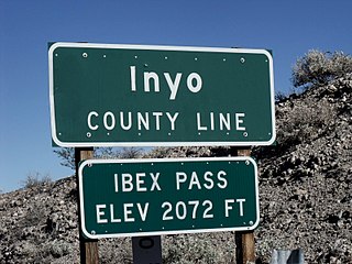
Ibex Pass [el. 2,072 ft (632 m)] is a mountain pass in the Sperry Hills of Central-Southern California in the United States.

Badger Mountain is a mountain summit in the South Park Hills of the Rocky Mountains of North America. The 11,295-foot (3,443 m) peak is located in Pike National Forest, 9.6 miles (15.5 km) northwest by west of the community of Lake George in Park County, Colorado, United States.


