Ifẹ̀ is an ancient Yoruba city in south-western Nigeria, recent in-depth archeologically estimates suggest Ife's founding to be between the 10th century BC and 6th century BC and is widely agreed upon by historians to be the oldest amongst the classical and post-classical Yoruba city-states. The city is located in present-day Osun State. Ifẹ̀ is about 218 kilometers northeast of Lagos with a population of over 500,000 people, which is the highest in Osun State according to population census of 2006.

Akure is a city in south-western Nigeria. It is the capital and largest city of Ondo State. The city had a population of 403,000 as of the 2006 population census. It currently hosts a population of 774,000.
Ado Ekiti is the capital city of Ekiti State, Nigeria. It is the headquarter of the Ekiti central senatorial district, southwest, Nigeria.
Ogoja is a Local Government Area in Cross River State, Nigeria. Its headquarters is Ogoja town in the northeast of the area near the A4 highway at 6°39′17″N8°47′51″E.

Ikirun is a town in Osun State, Nigeria. It is the headquarters of the Ifelodun Local Government Area. The population of the town is estimated to be 100,000.

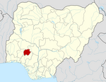
Birnin Kebbi is a city located in Northwestern Nigeria It is the capital city of Kebbi State and headquarter of the Gwandu Emirate. As at 2007 the city had an estimated population of 125,594 people. Kebbi is mostly a Hausa and Fulani state, with Islam as the major religion. Formerly it was the capital of the Kebbi Emirate, which relocated to Argungu after the conquest by Gwandu in 1831. The town remained the capital of Kebbi until 1805, when it was burned in the Fulani jihad by Abdullahi dan Fodio, a brother of the jihad leader and later Emir of Gwandu. After Birnin Kebbi was incorporated into the Fulani Emirate of Gwandu, it was eclipsed in political importance by Gwandu (Gando) town, 30 miles east, and as a caravan and riverside market centre by Jega, 20 miles southeast, which lay at the head of navigation on the Zamfara River, a tributary of the Sokoto. Ironically, while Argungu became the traditional seat of the king of Kebbi in 1827, Birnin Kebbi served as the Gwandu emirate headquarters after Emir Haliru was inaugurated there in 1906. Birnin Kebbi became the capital of the newly created Nigerian state of Kebbi in 1991.
Suleja is a city in Niger State, Nigeria, pop. (2016) local government area, 260,240, just north of Abuja, capital of the Suleja Emirate. It is sometimes confused with the nearby city of Abuja, due to its proximity, and the fact that it was originally called Abuja before the Nigerian government adopted the name from the then Emir Sulayman Bal for its new federal capital in 1976.
Bida is a Local Government Area in Niger State, Nigeria and a city on the A124 highway which occupies most of the area.
Ikere-Ekiti, also known as Ikere or Ikerre, is a city in Ekiti State of Nigeria.In Ikere Local Government. It is an agricultural and mine centre. According to the 1963 and 1991 census, the population was 114,780 and 60,257 respectively, but the 2006 census recorded it to be 147,355.
Agaie is a Local Government Area in Niger State, Nigeria. Its headquarters are in the town of Agaie on the A124 highway.
Oye is a town and headquarter of Oye Local Government Area in Ekiti State, Nigeria. Oye Local Government Area was carved out from the defunct Ekiti North Local Government on 17 May 1989.
Ankpa is a Local Government Area in Kogi State, Nigeria. Its headquarters are in the town of Ankpa on the A233 highway in the west of the area at7°22′14″N7°37′31″E.
Emure is a town in the Ekiti State of Nigeria. It is also called Emure Ekiti. It became much better known in the US after the king of Emure's grandson Adewale Ogunleye made it into the NFL for the Chicago Bears.
Efon is a Local Government Area of Ekiti State, Nigeria. Its headquarters are in the town of Efon-Alaaye.
Ise/Orun is a Local Government Area of Ekiti State, Nigeria. Its headquarters are in the town of Ise Ekiti.

Kaiama is a Local Government Area and town in northwestern Kwara State, Nigeria. Its headquarters are in the town of Kaiama.
Karu is a Local Government Area in Nasarawa State, central Nigeria. It is close in proximity to the Federal Capital Territory of Nigeria. It has an area of 2,640 km2. Karu local government has its headquarters in New Karu town. It was originally built to house the capital's civil servants and lower income families, but had no running water or good sanitation system. Karu has grown in population beyond its original planned capacity. Ensure Administrative convenience and bring government closer to the grass root people, Karshi Development Area was created with its administrative secretariat at Uke.
Agwara is a Local Government Area in Niger State, Nigeria. Its headquarters are in the town of Agwara.
Osu is a town in Osun State, Nigeria.
Apomu is a medium-sized town in the Osun state. It has a population of about 71,656 people.