Gboko is a Local Government Area in Benue state, North-central Nigeria. It is headquartered in the town of Gboko.
Ikere-Ekiti, also known as Ikere or Ikerre, is a city in Ekiti State of Nigeria. It is an agricultural and mine centre. According to the 1963 and 1991 census, the population was 114,780 and 60,257 respectively, but the 2006 census recorded it to be 147,355.
Oye is a town and headquarter of Oye Local Government Area in Ekiti State, Nigeria. Oye Local Government Area was carved out from the defunct Ekiti North Local Government on 17 May 1989.
Emure is a town in the Ekiti State of Nigeria. It is also called Emure Ekiti. It became much better known in the US after the king of Emure's grandson Adewale Ogunleye made it into the NFL for the Chicago Bears.
Ido-Osi is a town located in Ekiti State, Nigeria.
Dambam is a Local Government Area of Bauchi State, Nigeria. Its administrative headquarter is located in the town of Dambam. It has two district Dagauda and Jalam
Guma is a Local Government Area of Benue State, North Central Nigeria. Its headquarters are in the town of Gbajimba.
Guzamala is a Local Government Area of Borno State, Nigeria. Its headquarters are in the town of Gudumbali. It's located approximately 125 kilometres north of the state capital, Maiduguri. It has an area of 2,517 km2 and a population of 95,648 at the 2006 census.
Ekiti South-West is a Local Government Area (LGA) of Ekiti State, Nigeria. Its headquarters are in the town of Ilawe Ekiti. It has an area of 346 km2 and a population of 165,277 at the 2006 census. There are 3 towns under Ekiti South-West LGA.
Ekiti West is a Local Government Area of Ekiti State, Nigeria. Its headquarters is in the town of Aramoko.
Ilejemeje is a Local Government Area of Ekiti State, Nigeria, consisting of seven towns. Its present headquarters are in the town of Eda Oniyo, Which was formerly In Iye town before the relocation.
Ise/Orun is a Local Government Area of Ekiti State, Nigeria. Its headquarters are in the town of Ise Ekiti.

Akko is a local government area of Gombe, Gombe State, Nigeria. Its headquarters is in Kumo town on the A345 highway south of the state capital Gombe, about 40 km away. Kumo (headquarter) is a cosmopolitan communities of more than 30 differents tribes, ranging from the dominant Fulani tribe to Tangale, Tera, Hausa and other minorities.

Gezawa is a Local Government Area in Kano State, Nigeria. Gezawa Local Government Area administrative headquarters is in the town of Gezawa with its area council made up of Jogana, Gawo, Zango, Tumbau, Wangara, Sarain-Gezawa, Babawa, Ketatwa and Tsamiya-Dabba. It has an area of 340 km2 and a population of 282,069 at the 2006 census. Hausa and Fulani ethnic groups make up the majority of the local population. The majority religion practiced in the region is Islam, and the languages spoken there are Fufulde and Hausa.
Chikun is a Local Government Area in central Kaduna State, Nigeria. It has an area of about 4,466 km2, and had a population of 372,272 as at the 2006 census. Its headquarters is located in the town of Kujama. The postal code of the area is 2438000.
Kagarko is a Local Government Area in southern Kaduna State of Nigeria. Its headquarters are in the town of Kagarko. It has an area of 2,356 km2 and a population of 239,058 at the 2006 census. The Local Government Council is chaired by Nasara Rabo. The postal code is 802.
Kauru is a Local Government Area in southern Kaduna State, Nigeria. The area is 3,186 km2. Its headquarters are in the town of Kauru. The postal code of the area is 811.
Giwa Local Government Area, is a Local Government Area at Kaduna State, Nigeria. Its headquarters are in the town of Giwa. The Government Council is chaired by Abubakar Lawal.
Nangere is a Local Government Area in Yobe State, Nigeria. It has its headquarters in the town of Sabon Garin Nangere.
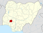
Aiyekire is a Local Government Area of Ekiti State, Nigeria.