Related Research Articles
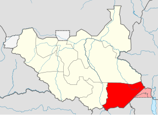
Eastern Equatoria is a state in South Sudan. It has an area of 73,472 km2. The capital City is Torit. On October 1, 1972, the state was divided into Imatong and Namorunyang states and was re-established by a peace agreement signed on 22 February 2020.
The Pari are an ethnic group in South Sudan. They also call themselves Jo-Pari.

The wildlife of Uganda is composed of its flora and fauna. Uganda has a wide variety of different habitats, including mountains, hills, tropical rainforest, woodland, freshwater lakes, swamps and savanna with scattered clumps of trees. The country has a biodiverse flora and fauna reflecting this range of habitats and is known for its primates, including gorillas and chimpanzees. There are ten national parks and thirteen wildlife reserves; some 345 species of mammal and 1020 species of bird have been recorded in the country.

The equatorial akalat is a species of bird in the family Muscicapidae. Its natural habitat is subtropical or tropical moist montane forests.

The foxy cisticola is a species of bird in the family Cisticolidae.
Imatong refers to:

The Imatong Mountains are mainly located in Eastern Equatoria in southeastern South Sudan, and extend into the Northern Region of Uganda. Mount Kinyeti is the highest mountain of the range at 3,187 metres (10,456 ft), and the highest point of South Sudan.

Torit County is an administrative region in Eastern Equatoria of South Sudan, with headquarters in the town of Torit, which is also the state capital.
The Koss River is a river that flows in a north of northwest direction through the erstwhile Eastern Equatoria state of South Sudan, fed by streams from the Imatong Mountains to the west.
Ikwoto County was an administrative area in the Eastern Equatoria state of South Sudan with headquarters in the town of Ikwoto. The people, who live in the former county's area by subsistence agriculture and cattle herding, are poverty-stricken. Years of civil war have made violence commonplace: most people have experienced the murder of a close family member. In 2009, AK-47 rifles were used in 42 per cent of killings.
Ikotos is a town in Eastern Equatoria of South Sudan, headquarters of Ikotos County. The town is home to the Lango people, who have a total population of 25,000 - 30,000 people in Ikotos county and elsewhere, and speak dialects of the Lotuko language.
Lafon is located in Eastern Equatoria State of South Sudan, the headquarters of Lafon County. The people belong to the Pari ethnic group. Lafon Hill is a small, rocky elevation that rises abruptly from the surrounding plain. It is covered with terraced, Pari villages. Traditionally the people made their living primarily from cattle herding.
The Veveno River is a river in eastern South Sudan by the Imatong Mountains. It is a tributary of the Lotilla River, which it joins southwest of Pibor.
The Kinyeti River flows northward from the Imatong Mountains in the Imatong State of South Sudan, eventually dispersing into the Badigeru swamp.
Otuho, also known as Lotuko (Lotuxo), is the language of the Otuho people. It is an Eastern Nilotic language, and has several other Otuho speaking dialectic groups.

Imatong State was a state in South Sudan that existed between 2 October 2015 and 22 February 2020. It was located in the Equatoria region and it bordered Yei River to the southwest, Jubek to the west, Terekeka and Jonglei to the northwest, Boma to the northeast, Namorunyang to the east, and Uganda to the south.

Kapoeta State was a state in South Sudan that existed between 2 October 2015 and 22 February 2020. It was located in the Equatoria region and it bordered Imatong to the west, Boma to the north, Ethiopia to the east, and Kenya and Uganda to the south.

Terekeka State was a state in South Sudan that existed between 2 October 2015 and 22 February 2020. It was located in the Equatoria region and it bordered Amadi, Eastern Lakes, Imatong, Jonglei, and Jubek. It has an estimated population of 176,030 in 2014, and the capital and largest city of the state is Terekeka, South Sudan.

Boma State was a state in South Sudan that existed between 2 October 2015 and 22 February 2020. It was located in the Greater Upper Nile region and was formerly part of the state of Jonglei. The state bordered Akobo State, Imatong State, Jonglei State, Kapoeta State, Bieh State, Terekeka State and the country of Ethiopia to the east.
References
- ↑ "Imatong". gurtong. Archived from the original on July 13, 2014. Retrieved June 16, 2014.
| | This article about South Sudanese ethnicity is a stub. You can help Wikipedia by expanding it. |