The Qikiqtaaluk Region, Qikiqtani Region or Baffin Region is the easternmost administrative region of Nunavut, Canada. Qikiqtaaluk is the traditional Inuktitut name for Baffin Island. Although the Qikiqtaaluk Region is the most commonly used name in official contexts, several notable public organisations, including Statistics Canada prefer the older term Baffin Region.

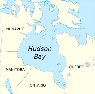
The Kivalliq Region is an administrative region of Nunavut, Canada. It consists of the portion of the mainland to the west of Hudson Bay together with Southampton Island and Coats Island. The regional seat is Rankin Inlet. The population was 10,413 in the 2016 Census, an increase of 16.3% from the 2011 Census.

Qiajivik Mountain is a mountain in Qikiqtaaluk, Nunavut, Canada. Located in northeastern Baffin Island, it is part of the Baffin Mountains. At 1,965 m (6,447 ft) Qiajivik is the highest mountain in northern Baffin Island and with a topographic prominence of 1,787 m (5,863 ft) it is one of Canada's 142 ultra prominent peaks.
Lock Island is a member of the Canadian Arctic Archipelago in the territory of Nunavut. It lies in Peel Sound across the mouth of Browne Bay, between northeastern Prince of Wales Island and northwestern Somerset Island. Vivian Island lies to the southeast, and Binstead Island to the northeast.
Opingivik Island is an uninhabited Baffin Island offshore island located in the Canadian Arctic Archipelago in Nunavut's Qikiqtaaluk Region. It lies in Cumberland Sound between Ikpit Bay to the north and Robert Peel Inlet approximately 18.6 km (11.6 mi) to the south.
Maktaktujanak Island is an uninhabited Baffin Island offshore island located east of Shakshukuk Island in the Canadian Arctic Archipelago in Nunavut's Qikiqtaaluk Region. It lies in Cumberland Sound, approximately 15.4 km (9.6 mi) from Robert Peel Inlet
Nimigen Island is an uninhabited Baffin Island offshore island located in the Canadian Arctic Archipelago in Nunavut's Qikiqtaaluk Region. It lies in Cumberland Sound, approximately 10.5 km (6.5 mi) east of Robert Peel Inlet To its east is Utsusivik Island; south is Chidliak Bay.

Airartuuq Island is one of several uninhabited Canadian arctic islands in Kivalliq Region, Nunavut, Canada. It is located within western Hudson Bay, 32.7 km (20.3 mi) from the abandoned trading post of Tavani.

Sakkiak Island is one of the uninhabited Canadian arctic islands located in Hudson Strait, Nunavut, Canada. It is a Baffin Island offshore island in Qikiqtaaluk Region, separated by deep water from Cape Dorset, Nunavut, 1.5 mi (2.4 km) to the south-southwest. The island is approximately 6 km2 (2.3 sq mi) in size, 2.25 mi (3.62 km) long, and 1 mi (1.6 km) wide. The elevation is approximately 65 m (213 ft) above sea level.

Okolli Island is one of the Canadian arctic islands located in Hudson Strait, Nunavut, Canada. It is a Baffin Island offshore island in Qikiqtaaluk Region. The island is 4.5 miles (7.2 km) long and 1.5 miles (2.4 km) wide. The elevation is 351 feet (107 m) above sea level.
The Sheer Islands are Canadian arctic islands that are located in Qikiqtaaluk Region, Nunavut, Canada. They are a Baffin Island offshore island group in Hudson Strait. The islands are situated approximately 1 mi (1.6 km) north of Cape Tanfield and form part of the north side of Itivirk Bay.
Glencoe Island is a Canadian Arctic island located in Hudson Strait. It is a Baffin Island offshore island in Nunavut's Qikiqtaaluk Region.

Blaze Island is an island located within western Coronation Gulf's Richardson Bay, south of Victoria Island, in the Kitikmeot Region, Nunavut, Canada.
Hat Island is an uninhabited island located in the Qikiqtaaluk Region of Nunavut, Canada. It is situated in Eureka Sound at the confluence of Bay Fjord, east of Ellesmere Island's Raanes Peninsula, and 19.6 km (12.2 mi) west of Stor Island. It is a member of the Sverdrup Islands group and the Canadian Arctic Archipelago. It is also a member of the Queen Elizabeth Islands and the Canadian Arctic Archipelago.
Round Island is an uninhabited island in the Qikiqtaaluk Region of Nunavut, Canada. It is located across the mouth of Coutts Inlet in Baffin Bay off the northeastern coast of Baffin Island. Nova Zembla Island is 7.4 km (4.6 mi) to the northwest.

Scott Island is an uninhabited island in the Qikiqtaaluk Region of Nunavut, Canada. It is located in Baffin Bay, off the eastern coast of Baffin Island, in the middle of Scott Inlet, north of the confluence of Clark Fiord and Gibbs Fiord which embrace Sillem Island.
Low Island is one of the many uninhabited Canadian arctic islands in Qikiqtaaluk Region, Nunavut. It is a Baffin Island offshore island located in Frobisher Bay just off the Bartlett Narrows, southeast of the capital city of Iqaluit. Other islands in the immediate vicinity include Culbertson Island, Mark Island, McAllister Island, Mitchell Island, and Precipice Island.


