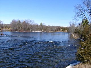
The Ganaraska River is a river in Northumberland County and the Regional Municipality of Durham in Southern Ontario, Canada. It is part of the Great Lakes Basin, and is a tributary of Lake Ontario, which it reaches at the central community of the municipality of Port Hope. The river's name is thought to originate from Ganaraske, the name for the Cayuga village which was located at the current site of Port Hope.

Mississippi Mills is a town in eastern Ontario, Canada, in Lanark County on the Mississippi River. It is partly located within Canada's National Capital Region.

Renfrew County is a county in the Canadian province of Ontario. It stands on the west bank of the Ottawa River. There are 17 municipalities in the county.

The Mississippi River is a tributary of the Ottawa River in Eastern Ontario, Canada which has no relation with the Mississippi River in the United States. It is 200 kilometres (120 mi) in length from its source at Mackavoy Lake, has a drainage area of 4,450 square kilometres (1,720 sq mi), and has a mean discharge of 40 cubic metres per second (1,400 cu ft/s). There are more than 250 lakes in the watershed.

The York River is a river in Renfrew County, Hastings County and Haliburton County in Ontario, Canada. The river is in the Saint Lawrence River drainage basin, and flows from the southern extension of Algonquin Provincial Park to the Madawaska River.

Lanark County is a county located in the Canadian province of Ontario. Its county seat is Perth, which was first settled in 1816. Most European settlements of the county began in 1816, when Drummond, Beckwith and Bathurst townships were named and initially surveyed. The first farm north of the Rideau was cleared and settled somewhat earlier, in 1790. The county took its name from the town of Lanark in Scotland. Nearly all the townships were named after British public and military figures from the era of early settlement.

The Indian River is a river in Renfrew County and Nipissing District in Eastern and Northeastern Ontario, Canada. It is in the Saint Lawrence River drainage basin, and is a left tributary of the Muskrat River.

Almonte is a former mill town located in Lanark County, in the eastern portion of Ontario, Canada. Formerly a separate municipality, Almonte is now a ward of the town of Mississippi Mills, which was created on January 1, 1998, by the merging of Almonte with Ramsay and Pakenham townships. Almonte is located 46 kilometres (29 mi) south-west of downtown Ottawa. Its population as of 2013 is about 5,000.

The Maitland River is a river in Huron County, Perth County and Wellington County in Southwestern Ontario, Canada. The river is in the Great Lakes Basin and empties into Lake Huron at the town of Goderich. It is 150 kilometres (93 mi) long, and is named after Sir Peregrine Maitland, Lieutenant-Governor of Upper Canada from 1818 to 1828. It was formerly known as the Menesetung River.

The Pottawatomi River is a river in the municipalities of Owen Sound and Georgian Bluffs, Grey County in Southwestern Ontario, Canada. It is in the Great Lakes Basin and empties into Georgian Bay on Lake Huron at Owen Sound Harbour.

The Crowe River is a river in the counties of Haliburton, Hastings, Northumberland and Peterborough in southern Ontario, Canada. It is in the Lake Ontario drainage basin and is a tributary of the Trent River.

The Jock River, known locally as the Mighty Jock, is a river in Ottawa and Lanark County in Eastern Ontario, Canada. It is in the Saint Lawrence River drainage basin and is a left tributary of the Rideau River. The river is named after Jacques, a French man who drowned in it in the early 19th century, and it was once known as the Goodwood River. The River is supported by a community-volunteer organization known as the Friends of the Jock River.

The Tay River is a river in Lanark County in Eastern Ontario, Canada. It is in the Saint Lawrence River drainage basin and is a left tributary of the Rideau River.

The Clyde River is a river in Lanark County in Eastern Ontario, Canada. It is in the Saint Lawrence River drainage basin, is a left tributary of the Mississippi River, and was named after the River Clyde in Scotland.

The Indian River is a river in Peterborough County in Central Ontario, Canada. It is in the Great Lakes Basin, and is a tributary of Rice Lake.

Bobs Lake is a lake in Frontenac County and Lanark County in Eastern Ontario, Canada. It is in the St. Lawrence River drainage basin and is the source of the Tay River.

The Mill of Kintail Conservation Area is a 152 acres (62 ha) preserve operated by the Mississippi Valley Conservation Authority, in Mississippi Mills, Ontario, Canada.

The Little Clyde River is a river in the municipality of Lanark Highlands, Lanark County in Eastern Ontario, Canada. It is in the Saint Lawrence River drainage basin, is a right tributary of the Clyde River, and was named after the River Clyde in Scotland.

The South Greenhill River is a river in Algoma District and Sudbury District in northeastern Ontario, Canada. It is in the James Bay drainage basin, and is a right tributary of the Greenhill River.

Irvine Creek is a creek in the municipality of Centre Wellington, Wellington County in southwestern Ontario, Canada. It is in the Great Lakes Basin and is a right tributary of the Grand River.


