International Commission for the piercing of the isthmus of Suez

Last updated

The International Commission for the piercing of the isthmus of Suez (Commission Internationale pour le percement de l'isthme de Suez) was the commission consisting of various European experts convened in 1855 by Ferdinand de Lesseps as instructed by the viceroy of Egypt Muhammad Sa'id in order to ascertain the feasibility of a canal between the Mediterranean and the Red Sea and to evaluate the best alternative for such a canal.

Contents

The commission was solely composed of Europeans. There were no Egyptians on the commission. [1]

Preliminary events

The idea of digging a canal through the isthmus of Suez was attracting widespread interest throughout Europe in the early 19th century. Interest grew amid European imperial expansion into Asia in the 19th century. [1]

Napoleon's surveyors in his Campaign in Egypt had found a difference of some 9 m between the levels of the two seas. The surveys made by Paul-Adrien Bourdaloue in 1847 during an expedition of the Société d'Études du Canal de Suez were the first generally accepted evidence that there was in fact no such difference. During the same expedition, Alois Negrelli, the Austrian railroad pioneer, explored the bay of Pelusium at the northern end of the anticipated canal. However, due to the political disturbances of 1848, the ideas were not pursued any further. On 30 November 1854, De Lesseps obtained from Muhammad Sa'id the first concession for a Suez Canal and on De Lesseps' request, a first draft of the canal was made by Linant-Bey and Mougel-Bey (Linant de Bellefonds and Eugène Mougel), two high level French engineers in the Egyptian canal administration. From the outset, De Lesseps' main concern was to put the canal project on a political basis as wide as possible. Thus, in his second, more detailed firman of 19 May 1855, the viceroy ordered to further elaborate the initial draft and to submit it to an international commission of experts for discussion and evaluation.

Commission

Map of the Nile delta and the designed canal (from the book of Conrad) Reizen naar de landengte van Suez, Egypte, het Heilige Land (1859), page 186.jpg
Map of the Nile delta and the designed canal (from the book of Conrad)

The Commission first convened in Paris on 30 October 1855. [2] It consisted of Messrs.

The members had already viewed the initial draft of Linant-Bey and Mougel-Bey and decided to investigate the circumstances on the spot in Egypt. In addition, a map of the bay of Pelusium was to be drawn up in order to complete the soundings made by Negrelli in 1847.

Investigations in Egypt

Five of the thirteen members met on 18 November 1855 in Alexandria, namely Messrs. Conrad, Renaud, Negrelli, McClean and Lieussou. Negrelli provided the soundings and the alignment of the canal which he had drawn up during his visit of 1847 and which corresponded to a large extent to the draft made by Linant and Mougel. During the next two days, the group examined the harbour and roads of Alexandria, and then went on to explore the bay of Suez during four days.

Subsequently, they went north to Lake Timsah and the Wadi Tumilat to make boreholes and subsoil investigations and to examine the line of a canal across the Nile delta to Alexandria proposed by Jacques-Marie Le Père and by Paulin Talabot. The members of the group did not take long to consent that this proposition was not acceptable because of various technical and economical reasons. They then proceeded towards the Mediterranean, making further boreholes and investigations. On 31 December 1855, the group was taken on board the Egyptian frigate Le Nil and arrived in Alexandria on 2 January 1856. The discussion on further soundings made in the meantime by Mr. Larousse, a French navy hydrologist seconded to the commission, came to the conclusion that the entrance to the canal should be moved further to the west (to the place of the present Port Said) because of the deeper waters, even if this added 6 km to the length of the canal. In addition, the entrance should be protected by a 3.5 km long northern jetty and a 2.5 km long southern jetty and a lighthouse should be built.

On 2 January 1856, a preliminary report was submitted to the Viceroy stating that a direct canal across the isthmus was the only reasonable alternative but that the details thereof would have to be set out in a final report yet to be elaborated on the basis of certain further investigations. The viceroy then issued the second concession to De Lesseps.

The commission's deliberations

The complete commission convened again on 23 June 1856 in Paris (Rendel was excused, Negrelli and Montesino arrived the following day). [2] During three days, the members discussed the result of the investigations in Egypt and all details of the future canal. The unanimous vote was for a canal as suggested by Negrelli from the outset, i.e. a canal without locks, passing the lower level Bitter Lakes (to be flooded by the canal) without any dams or dikes. The canal should have a depth of 8 m and its width should be 100 metres at water level and 64 metres at the bottom, however, in a certain section only 80 m at water level and 44 m at the bottom.

Options Proposed by John Robinson McClean and Charles Manby

In his 1864 presidential address to the Institution of Civil Engineers, John Robinson McClean detailed his view of the two contrasting systems proposed for the construction of the Canal. Both McClean and Manby dissented from the conclusions of the majority of the commissioners on the nature of the project, instead proposing a canal elevated twenty-five feet above sea level, utilising locks similar to those in the Caledonian Canal. This was in contrast to the majority conclusion which favoured a sea-level canal without locks. The comparison of these systems was part of an appendix in McClean's 1864 address and detailed his opinions on both proposals, as summarised below. [4]

First System (Adopted by Majority of Commissioners)

  • The level of the canal would align with the low water level of the Mediterranean Sea at Said.
  • The total excavation required was estimated at 130 million cubic metres, half of which would need dredging.
  • Considerable difficulty was anticipated in forming the harbour of Suez due to the potential presence of coral reefs and indurated sands.
  • A significant cost and dredging effort were required to establish a port in Lake Timsah.

Second System (Proposed by McClean and Manby)

  • The canal's water level would be 7 metres above the low water level of the Mediterranean Sea.
  • The total embankment required would not exceed 70 million cubic metres, significantly reduced by judicious selection of the canal line.
  • The excavation would be entirely above natural drainage, facilitating rapid construction using railways and locomotive engines.
  • The formation of the Suez Harbour would circumvent the need for dredging, employing locks in deep water instead.
  • The higher canal level at Port Timsah negates the need for locks at this point, reducing construction costs.
  • An innovative irrigation approach proposed using the canal to draw water directly from the Nile, avoiding the need for a separate conduit and enabling its use as a reservoir during Nile inundations.
  • The high-level system would avoid water supply issues like salt deposits and tidal dependencies, inherent in the low-level system.

British opposition to the canal

British proposals continued to insist that there was a difference in water level between the Red and Mediterranean Seas of some 7 metres, despite the fact that survey work as early as 1847 had shown this not to be the case. [5] [6] Opposition to the canal from British engineers including McClean, Manby, and Robert Stephenson appeared in various engineering publications in Britain and further afield. [4] [3] [7] Stephenson spoke in Parliament against possible involvement in a Suez canal scheme in 1857 and 1858. [8] [9]

In addition to opposition from British engineers, the wider British establishment, including notably Lord Palmerston, had ruthlessly opposed the construction of the canal, fearing it's accessibility to seagoing vessels of all nations would threaten Britain's commercial interests (such as control of the Cape Route along with overland routes to India and the Far East), and British naval supremacy. [10] [11] [12] [13] [14] [15] The British Government would later publicise and object to the use of forced labour in the construction of the canal, despite the fact that the British themselves had used forced labour in the construction of a railway between Alexandria and Cairo, which opened in 1854, being extended to Suez in 1858. [6] [8]

Final report

Design of the breakwaters of Port Said CONRAD(1859) p251 PROFIL VAN DE HAVEN VAN SAID.jpg
Design of the breakwaters of Port Said

The final report contained 195 pages plus plans, technical tables etc., was published in December 1856 and accepted by the Khedive. The report contains the reasoning for the direct connection between the two seas and all technical details of the canal, including ports to be built, telegraph lines to be installed along the canal, ferries to be introduced and finally the lighting of the Mediterranean coast and of the whole of the Red Sea to be provided, complete with lighthouses, buoys and so on. As already mentioned in the preliminary report, the name of Port Said was suggested as the name for the port on the northern entrance. [16]

Key resolutions included the decision against continuous embankments in areas where the canal traversed the Bitter Lakes, deeming them unnecessary. The report also determined that locks at the canal's extremities were not required, as the lakes would mitigate tidal currents. It specified the canal's dimensions, recommending a depth of 8 metres (approximately 26.4 feet), with a width sufficient to accommodate two passing vessels and a third stationary line. [17]

The proposed width was approximately 64 metres (210 feet) at the bottom and 97.5 metres (320 feet) at the top between the Red Sea and the Bitter Lakes, and approximately 43.9 metres (144 feet) at the bottom and 79.9 metres (262 feet) at the top between the Bitter Lakes and the Mediterranean.

The Commission favoured constructing jetties directly seaward of Port Said, over an earlier proposal near the Gulf of Pelusium. This decision, influenced by the recommendations of Mr. Larousse, a French Navy hydrographer, was based on finding an adequate depth of 8 metres closer to Port Said than the initially proposed eastern entrance. Considering the cost implications of jetty construction and the advantageous steep sea-bed slope, the choice of Port Said was deemed prudent. [16]

At Port Said, the jetties' design, including their length and construction method, was later adopted based on the advice of Mr. Pascal, Inspector-General of Roads and Bridges. At Port Tewfik, the construction of a single jetty was deemed sufficient. There was consensus on the arrangement of necessary inner harbour works at both canal ends. The western and eastern jetties at Port Said were recommended to be approximately 2987 metres (9,800 feet) and 1829 metres (6,000 feet) respectively, with a starting width of approximately 1280 metres (4,200 feet) and an ending separation of approximately 701 metres (2,300 feet). The channel alongside the western jetty was to be approximately 100.6 metres (330 feet) wide and 9.1 metres (30 feet) deep, oriented northeast by 2 degrees north. [17] [18]

In the report, the commission expressly declared to have fulfilled their duties and to have finalised all their activities. They expressed their desire to have the canal be built in the near future, but have not in any way commented on the execution of the future works or on their management.

Notes

  1. He is often confused with his nephew Jan Frederik Willem Conrad, who in 1888 became member of the supervision committee of the Convention of Constantinople to oversee the free access to the Suez Canal

Sources

The comprehensive final report together with the journal of the investigation group and the minutes of the deliberations of the complete commission have been published by Lesseps in. [19]

Negrelli informed the K.K. Geographische Gesellschaft (Imperial Royal Geographic Society) in Vienna about the intended canal and presented them with a copy of the commission's final report. The society published the information in their own papers: [20]

The illustrations are not available in the scans of the books mentioned below. However, in the (Dutch) report by Conrad [21]

Related Research Articles

<span class="mw-page-title-main">Suez Canal</span> Artificial sea-level waterway in Egypt

The Suez Canal is an artificial sea-level waterway in Egypt, connecting the Mediterranean Sea to the Red Sea through the Isthmus of Suez and dividing Africa and Asia. The 193.30-kilometre-long (120.11 mi) canal is a key trade route between Europe and Asia.

<span class="mw-page-title-main">Port Said</span> Egyptian city on the northern end of the Suez Canal

Port Said is a city that lies in northeast Egypt extending about 30 km (19 mi) along the coast of the Mediterranean Sea, straddling the west bank of the northern mouth of the Suez Canal. It forms the majority of the Port Said governorate, where its seven districts comprise seven of the governorate's eight regions. The city was established in 1859 during the building of the Suez Canal, and at the beginning of 2023 had a population of 680,375 people.

<span class="mw-page-title-main">Barthélemy-Prosper Enfantin</span> French social reformer

Barthélemy-Prosper Enfantin was a French social reformer, one of the founders of Saint-Simonianism. He was also a proponent of a Suez canal.

<span class="mw-page-title-main">Ferdinand de Lesseps</span> French diplomat (1805–1894)

Ferdinand Marie, Comte de Lesseps was a French diplomat and later developer of the Suez Canal, which in 1869 joined the Mediterranean and Red Seas, substantially reducing sailing distances and times between Europe and East Asia.

<span class="mw-page-title-main">Port Said Governorate</span> Governorate of Egypt

Port Said Governorate is a subdivision located at the northeast end of the Nile Delta, on the coast of the Mediterranean Sea at the northern mouth of the Suez Canal. It is wholly urban, comprising the original Port Said city on the west bank of the Suez Canal, and the town of Port Fuad on the eastern bank.

<span class="mw-page-title-main">Alois Negrelli</span> Tyrolean civil engineer and railroad pioneer

Nikolaus Alois Maria Vinzenz Negrelli, Ritter von Moldelbe was a Tyrolean civil engineer and railroad pioneer mostly active in parts of the Austrian Empire, Switzerland, Germany and Italy.

<span class="mw-page-title-main">John Hawkshaw</span> Civil engineer from Leeds, Yorkshire, England

Sir John Hawkshaw FRS FRSE FRSA MICE, was an English civil engineer. He served as President of the Institution of Civil Engineers 1862-63. His most noteworthy work is the Severn Tunnel.

<span class="mw-page-title-main">Suez Company (1858–1997)</span> Transport company

The Suez Company or Suez Canal Company, full initial name Compagnie universelle du canal maritime de Suez, sometimes colloquially referred to in French as Le Suez, was a company formed by Ferdinand de Lesseps in 1858 to operate the Egyptian granted concession of the Suez Canal, which the company built between 1859 and 1869. Initially, French investors held half of the Company's stock, with Egypt's ruler Sa'id Pasha holding most of the balance. In 1875, financial distress forced Sa'id's successor Isma'il Pasha to sell the country's shares to the government of the United Kingdom. The Suez Company operated the canal until Egypt's new president Gamal Abdel Nasser revoked its concession in 1956 and transferred canal operation to the state-owned Suez Canal Authority, precipitating the Suez Crisis.

<span class="mw-page-title-main">Louis Maurice Adolphe Linant de Bellefonds</span>

Louis Maurice Adolphe Linant de Bellefonds better known as Linant Pasha was an explorer of Egypt and, as the chief engineer of Egypt's public works, 1831–1869, an influential engineer of the Suez Canal. He is listed as a founder of the Suez Canal Company.

<span class="mw-page-title-main">History of the Panama Canal</span>

The idea of the Panama Canal dates back to 1513, when Vasco Núñez de Balboa first crossed the Isthmus of Panama. This narrow land bridge between North and South America was a fine location to dig a water passage between the Atlantic and Pacific Oceans. The earliest European colonists recognized this, and several proposals for the construction of a canal were made.

<span class="mw-page-title-main">Canal of the Pharaohs</span> Forerunner of the Suez Canal, Egypt

The Canal of the Pharaohs, also called the Ancient Suez Canal or Necho's Canal, is the forerunner of the Suez Canal, constructed in ancient times and kept in use, with intermissions, until being closed in 767 AD for strategic reasons during a rebellion. It followed a different course from its modern counterpart, by linking the Nile to the Red Sea via the Wadi Tumilat. Work began under the pharaohs. According to Darius the Great's Suez Inscriptions and Herodotus, the first opening of the canal was under Persian king Darius the Great, but later ancient authors like Aristotle, Strabo, and Pliny the Elder claim that he failed to complete the work. Another possibility is that it was finished in the Ptolemaic period under Ptolemy II, when engineers solved the problem of overcoming the difference in height through canal locks.

<span class="mw-page-title-main">John Robinson McClean</span> British engineer and politician

John Robinson McClean CB FRS FRSA FRAS, was a British civil engineer and Liberal Party politician. He carried out many important works, and for a time was the sole owner of a main line railway, the first individual to do so. He carried out philanthropic works including securing a fresh water supply to overcome persistent outbreaks of cholera, taking no salary for his work.

<span class="mw-page-title-main">Lake Timsah</span> Lake in Egypt

Lake Timsah, also known as Crocodile Lake ; is a lake in Egypt on the Nile delta. It lies in a basin developed along a fault extending from the Mediterranean Sea to the Gulf of Suez through the Bitter Lakes region. In 1800, a flood filled the Wadi Tumilat, which caused Timsah's banks to overflow and moved water south into the Bitter Lakes about nine miles (14 km) away. In 1862, the lake was filled with waters from the Red Sea, and became part of the Suez Canal.

<span class="mw-page-title-main">Egyptian Public Works</span>

The Egyptian Department of Public Works was established in the early 19th century, and concentrates mainly on public works relating to irrigation and hydraulic engineering. These irrigation projects have constituted the bulk of work performed by this entity in Egypt. During its almost 200-year history, the Egyptian Department of Public Works employed many notable engineers and constructed massive public works projects throughout the country. It became the most respected engineering entity and was regarded as the 'best school' for civil engineers in modern Egypt. Its history can be broken into three periods:

  1. The Classic Period (1818–1882).
  2. The Occupation Period (1882–1952).
  3. The Modern Period.
<span class="mw-page-title-main">Paul-Adrien Bourdaloue</span>

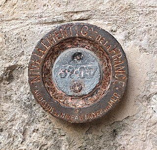
Paul Adrien Bourdaloue was a French civil engineer and topographer, who proposed the first orthometric levelling of France.

The Société d'études du Canal de Suez was a society set up in 1846 by the Saint-Simonist Prosper Enfantin in Paris to study the Isthmus of Suez and the possibility of a Suez Canal.

Dieudonné Eugène Mougel aka Eugène Mougel Bey was a French engineer graduated from the École Polytechnique and later working for the Egyptian administration. He built the Nile Barrage near Cairo, a project initially started by Louis Maurice Adolphe Linant de Bellefonds, and contributed as general supervisor to the initial phases of the Suez Canal works. Mougel was chief engineer for the Suez Canal Company from 1859 to 1861, where he worked with superintendent Alphonse Hardon to plan the mobilization infrastructure to build the Suez Canal: the freshwater access canals, freshwater distilleries, and early hand-digging operations. He was listed by Ferdinand de Lesseps as a founder of the Suez Canal Company.

<span class="mw-page-title-main">Charles Joseph Lambert (engineer)</span> French explorer and engineer

Charles Joseph Lambert, also known as Lambert Bey was a French explorer and engineer.

<span class="mw-page-title-main">Cipriano Segundo Montesino</span> Spanish engineer and politician

Cipriano Segundo Montesino y Estrada was a Spanish civil engineer and politician. He was a founding committee member of the Royal Academy of Exact, Physical, and Natural Sciences, serving as vice-president and president, and also as a Senator appointed by the academy. He also served as the vice-president of the Senate of Spain.

References

  1. 1 2 Eijking, Jan (14 June 2023). "Historical Claims to the International: The Case of the Suez Canal Experts". International Studies Quarterly. 67 (3). doi: 10.1093/isq/sqad041 .
  2. 1 2 3 "Obituary. John Robinson Mcclean, Former President and Vice-President, M.p., F.r.s., 1813-1873". Minutes of the Proceedings of the Institution of Civil Engineers. 38 (1874): 287–291. January 1874. doi: 10.1680/imotp.1874.22770 .
  3. 1 2 Segundo Montesino, C. (1858). "Canal del istmo de Suez" [Isthmus of Suez Canal]. Revista de Obras Públicas (in Spanish). 6, tomo I (21): 249–250. Retrieved 14 December 2023.
  4. 1 2 Mcclean, J R (January 1864). "Presidential Address of John Robinson M'clean, January 12, 1864 (Including Appendix)". Minutes of the Proceedings of the Institution of Civil Engineers. 23 (1864): 151–167. doi:10.1680/imotp.1864.23280.
  5. Bradshaw, Dan F (1973). A decade of British opposition to the Suez Canal project, 1854–1864 (Thesis). hdl: 11244/3693 . ProQuest   287954768 OCLC   24708427, 1035380473.[ page needed ]
  6. 1 2 Bell, K. (December 1965). "British Policy Towards the Construction of the Suez Canal". Transactions of the Royal Historical Society. 15: 121–143. doi:10.2307/3678819. JSTOR   3678819. S2CID   154157309.
  7. Stephenson, R. (1858). "Canal del Istmo de Suez" [Isthmus of Suez Canal]. Revista de Obras Públicas (in Spanish). 6, tomo I (20): 237–241.
  8. 1 2 Rolt, L.T.C. (1978). George and Robert Stephenson: The Railway Revolution. Pelican biographies. Harmondsworth, Middlesex: Penguin Books. ISBN   978-0-14-007646-2.[ page needed ]
  9. Robert Stephenson (1 June 1858). "Resolution". Parliamentary Debates (Hansard) . Vol. 150. Parliament of the United Kingdom: Commons.
  10. Kyle, Keith (2011). Suez: Britain's End of Empire in the Middle East. Bloomsbury Publishing. ISBN   978-0-85771-967-6.[ page needed ]
  11. Bissett, Alice M. (1927). Lord Palmerston's policy of opposition to the project and to the construction of the Suez Canal (Thesis). OCLC   957343681, 964513065.[ page needed ]
  12. Fletcher, Max E. (December 1958). "The Suez Canal and World Shipping, 1869-1914". The Journal of Economic History. 18 (4): 556–573. doi:10.1017/S0022050700107740. S2CID   153427820.
  13. O'Connor, Damian (June 2006). "The Suez Crisis 1876–82". The RUSI Journal. 151 (3): 74–78. doi:10.1080/03071840609442023. S2CID   153827725.
  14. Hoskins, Halford L. (November 1957). "The Suez Canal". Current History. 33 (195): 257–262. doi:10.1525/curh.1957.33.195.257.
  15. Kinross, Patrick Balfour Baron (1969). Between Two Seas: The Creation of the Suez Canal. Morrow. ISBN   978-0-7195-1813-3.[ page needed ]
  16. 1 2 Hartley, Sir C (January 1900). "A short history of the engineering works of the Suez Canal". Minutes of the Proceedings of the Institution of Civil Engineers. 141 (1900): 157–194. doi:10.1680/imotp.1900.18688.
  17. 1 2 Fox, D; Barry, J W; Harcourt, L F V; Dawes, E; Appleby, C J; Bell, J R; Corthell, E L; Wells, L B; Hartley, C (January 1900). "Discussion: A short history of the engineering works of the Suez Canal". Minutes of the Proceedings of the Institution of Civil Engineers. 141 (1900): 195–212. doi:10.1680/imotp.1900.18689.
  18. Denison, Sir W T (January 1867). "THE SUEZ CANAL". Minutes of the Proceedings of the Institution of Civil Engineers. 26 (1867): 442–448. doi:10.1680/imotp.1867.23168.
  19. Lesseps, Ferdinand de (1856). Percement de l'isthme de Suez (in French). H. Plon. p. 37.
  20. Kaiserlich-Königliche Geographische Gesellschaft in Wien (1857). Mittheilungen der Kaiserlich-Königlichen Geographischen Gesellschaft in Wien (in German). Lechner. p. 71.
  21. Conrad, Frederik Willem (1859). Reizen naar de landengte van Suez, Egypte, het Heilige Land (in Dutch). Martinus Nijhoff.[ page needed ]