Iquira

Last updated
Iquira
Municipality and town
Flag of Iquira (Huila).svg
Colombia - Huila - Iquira.svg
Location of the municipality and town of Iquira in the Huila Department of Colombia.
CountryFlag of Colombia.svg  Colombia
Department Huila Department
Area
[1]
  Total521 km2 (201 sq mi)
Population
 (Census 2018 [2] )
  Total9,064
  Density17/km2 (45/sq mi)
Time zone UTC-5 (Colombia Standard Time)

Iquira is a town and municipality in the Huila Department, Colombia.

Climate

Climate data for Iquira, elevation 1,095 m (3,593 ft), (1981–2010)
MonthJanFebMarAprMayJunJulAugSepOctNovDecYear
Mean daily maximum °C (°F)27.4
(81.3)
27.4
(81.3)
27.6
(81.7)
27.4
(81.3)
27.3
(81.1)
27.5
(81.5)
28.0
(82.4)
28.2
(82.8)
28.8
(83.8)
28.1
(82.6)
27.1
(80.8)
27.1
(80.8)
27.6
(81.7)
Daily mean °C (°F)23.1
(73.6)
23.2
(73.8)
23.1
(73.6)
23.1
(73.6)
23.1
(73.6)
23.2
(73.8)
23.1
(73.6)
23.6
(74.5)
24.0
(75.2)
23.5
(74.3)
22.8
(73.0)
23.0
(73.4)
23.2
(73.8)
Mean daily minimum °C (°F)19.3
(66.7)
19.3
(66.7)
19.3
(66.7)
19.3
(66.7)
19.2
(66.6)
19.1
(66.4)
19.0
(66.2)
19.0
(66.2)
19.2
(66.6)
19.1
(66.4)
19.1
(66.4)
19.1
(66.4)
19.2
(66.6)
Average precipitation mm (inches)191.2
(7.53)
183.6
(7.23)
203.3
(8.00)
213.7
(8.41)
168.3
(6.63)
60.3
(2.37)
43.6
(1.72)
37.6
(1.48)
84.0
(3.31)
197.5
(7.78)
278.9
(10.98)
256.2
(10.09)
1,918.2
(75.52)
Average precipitation days151418181613121111172018183
Mean monthly sunshine hours 164.3135.5120.9132.0139.5147.0136.4155.0147.0148.8126.0145.71,698.1
Mean daily sunshine hours 5.34.83.94.44.54.94.45.04.94.84.24.74.6
Source: Instituto de Hidrologia Meteorologia y Estudios Ambientales [3]
Climate data for Iquira (Terpeya Colombia), elevation 1,650 m (5,410 ft), (1981–2010)
MonthJanFebMarAprMayJunJulAugSepOctNovDecYear
Mean daily maximum °C (°F)22.9
(73.2)
23.1
(73.6)
23.0
(73.4)
23.1
(73.6)
23.2
(73.8)
23.2
(73.8)
23.2
(73.8)
24.0
(75.2)
24.6
(76.3)
23.5
(74.3)
22.0
(71.6)
22.1
(71.8)
23.2
(73.8)
Daily mean °C (°F)18.7
(65.7)
18.9
(66.0)
18.9
(66.0)
18.9
(66.0)
19.0
(66.2)
18.8
(65.8)
18.6
(65.5)
19.0
(66.2)
19.4
(66.9)
19.1
(66.4)
18.5
(65.3)
18.4
(65.1)
18.9
(66.0)
Mean daily minimum °C (°F)15.5
(59.9)
15.7
(60.3)
15.9
(60.6)
16.1
(61.0)
16.1
(61.0)
15.6
(60.1)
15.3
(59.5)
15.4
(59.7)
15.4
(59.7)
15.5
(59.9)
15.7
(60.3)
15.7
(60.3)
15.6
(60.1)
Average precipitation mm (inches)223.2
(8.79)
211.7
(8.33)
255.5
(10.06)
221.2
(8.71)
187.5
(7.38)
89.5
(3.52)
74.4
(2.93)
46.1
(1.81)
99.1
(3.90)
176.5
(6.95)
265.4
(10.45)
228.0
(8.98)
2,077.9
(81.81)
Average precipitation days191821212018191616202322232
Average relative humidity (%)87868686858179757582888883
Source: Instituto de Hidrologia Meteorologia y Estudios Ambientales [3]

Related Research Articles

<span class="mw-page-title-main">Ebéjico</span> Municipality and town in Antioquia Department, Colombia

Ebéjico is a town and municipality in the West of Antioquia Department, Colombia. The population was 10,338 at the 2018 census.
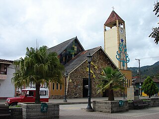
<span class="mw-page-title-main">Gómez Plata</span> Municipality and town in Antioquia Department, Colombia

Gómez Plata is a town and municipality in the Colombian department of Antioquia. It is part of the subregion of Northern Antioquia. The population was 8,235 at the 2018 census.

<span class="mw-page-title-main">Venecia, Antioquia</span> Municipality and town in Antioquia Department, Colombia

Venecia is a town and municipality in Antioquia Department, Colombia. According to the 2018 census, the population comprised 10,280 people.

<span class="mw-page-title-main">Puerto Triunfo</span> Municipality and town in Antioquia Department, Colombia

Puerto Triunfo is a town and municipality in Antioquia Department, Colombia. It is part of the Magdalena Medio Antioquia sub-region.

<span class="mw-page-title-main">San Rafael, Antioquia</span> Municipality and town in Antioquia Department, Colombia

San Rafael is a town and municipality in Antioquia Department, Colombia. Part of the subregion of Eastern Antioquia.

<span class="mw-page-title-main">Condoto</span> Municipality and town in Chocó Department, Colombia

Condoto is the third most important municipality in the Chocó Department, after Quibdó and Istmina. It is situated in the south of the department and its main economical activity is mining and agriculture. Condoto is also known as the "Platinum Capital of Colombia".
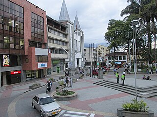
<span class="mw-page-title-main">Calarcá</span> Municipality and town in Quindío Department, Colombia

Calarcá is a municipality in the eastern part of the department of Quindío, Colombia. It is located 4 km east of the departmental capital Armenia. Its nickname is La Villa del Cacique in homage of its writers. The city was founded in 1886 by Segundo Henao during the time of colonization by people from Antioquia. It is the second most populated city in Quindío, after Armenia.

<span class="mw-page-title-main">Ponedera</span> Municipality and town in Caribbean, Colombia

Ponedera is a municipality and town in the Colombian department of Atlántico.

<span class="mw-page-title-main">Cicuco</span> Municipality and town in Bolívar Department, Colombia

Cicuco is a town and municipality located in the Bolívar Department, northern Colombia.
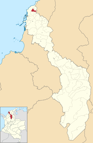
<span class="mw-page-title-main">Clemencia, Bolívar</span> Municipality and town in Bolívar Department, Colombia

Clemencia is a town and municipality located in the Bolívar Department, northern Colombia.

<span class="mw-page-title-main">Caimito, Sucre</span> Municipality and town in Sucre Department, Colombia

San Juan de Caimito, also known as Caimito. Is a town and municipality located in the Sucre Department, northern Colombia.

<span class="mw-page-title-main">La Unión, Sucre</span> Municipality and town in Sucre Department, Colombia

La Unión is a town and municipality located in the Sucre Department, northern Colombia.

<span class="mw-page-title-main">San Juan Betulia</span> Municipality and town in Sucre Department, Colombia

San Juan Betulia is a town and municipality located in the Sucre Department, northern Colombia.
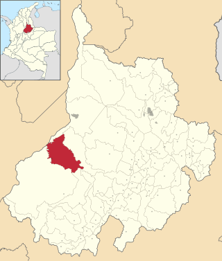
<span class="mw-page-title-main">Puerto Parra</span> Municipality and town in Santander Department, Colombia

Puerto Parra is a town and municipality in the Santander Department in northeastern Colombia.

<span class="mw-page-title-main">Supía, Caldas</span> Municipality and town in Caldas Department, Colombia

Supía is a town and municipality in the Colombian Department of Caldas. Located along the Colombian coffee growing axis, it was part of the "Coffee Cultural Landscape" UNESCO World Heritage Site in 2011.

<span class="mw-page-title-main">Pupiales</span> Municipality and town in Nariño Department, Colombia

Pupiales is a town and municipality in the Nariño Department, Colombia.

<span class="mw-page-title-main">Palestina, Huila</span> Municipality and town in Huila Department, Colombia

Palestina is a town and municipality in the Huila Department, Colombia.

<span class="mw-page-title-main">Santa María, Huila</span> Municipality and town in Huila Department, Colombia

Santa María is a town and municipality in the Huila Department, Colombia.
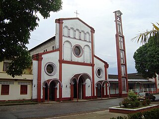
<span class="mw-page-title-main">Belén de Andaquies, Colombia</span> Municipality and town in Caquetá Department, Colombia

Belén de los Andaquíes is a town and municipality in Caquetá Department, Colombia.

<span class="mw-page-title-main">Valparaíso, Caquetá</span> Municipality and town in Caquetá Department, Colombia

Valparaíso is a town and municipality in Caquetá Department, Colombia.

References

  1. "Municipalities of Colombia". statoids. Retrieved 30 April 2020.
  2. "Censo Nacional de Población y Vivienda 2018" (in Spanish). DANE . Retrieved 30 April 2020.
  3. 1 2 "Promedios Climatológicos 1981–2010" (in Spanish). Instituto de Hidrologia Meteorologia y Estudios Ambientales. Archived from the original on 15 August 2016. Retrieved 17 June 2024.

2°39′N75°39′W / 2.650°N 75.650°W / 2.650; -75.650